Back
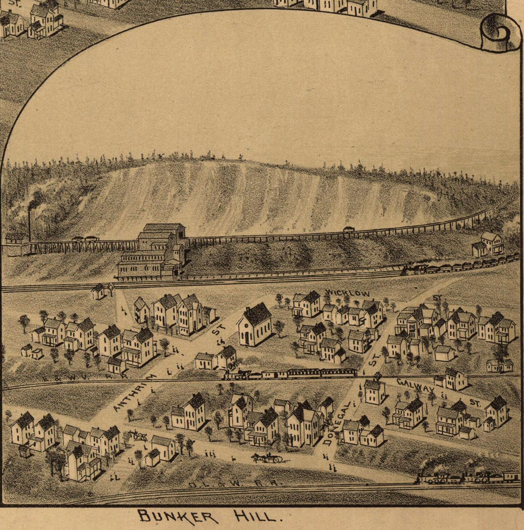
Bunker Hill
Area & Railroad Maps
1885 Bunker Hill Dunmore
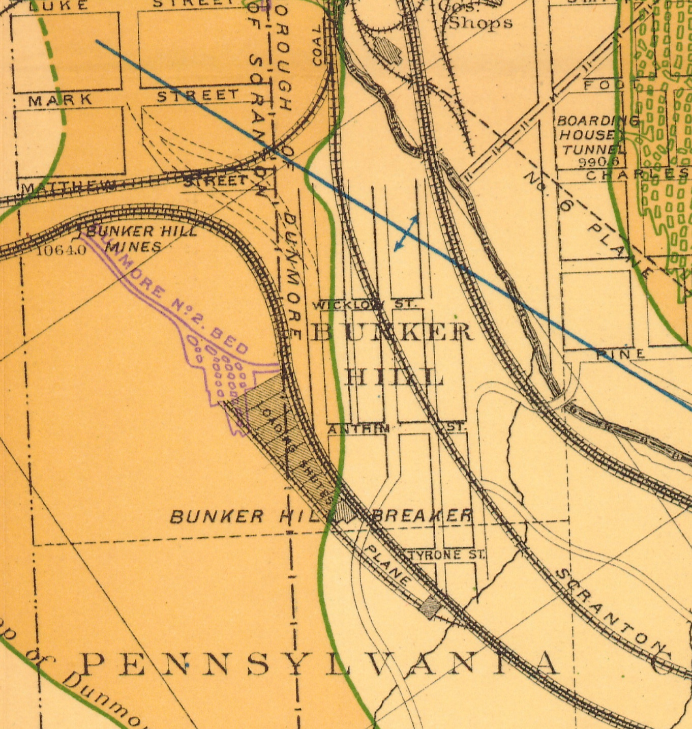
1888 2nd Pa Geo Survey sheet XVI close-up
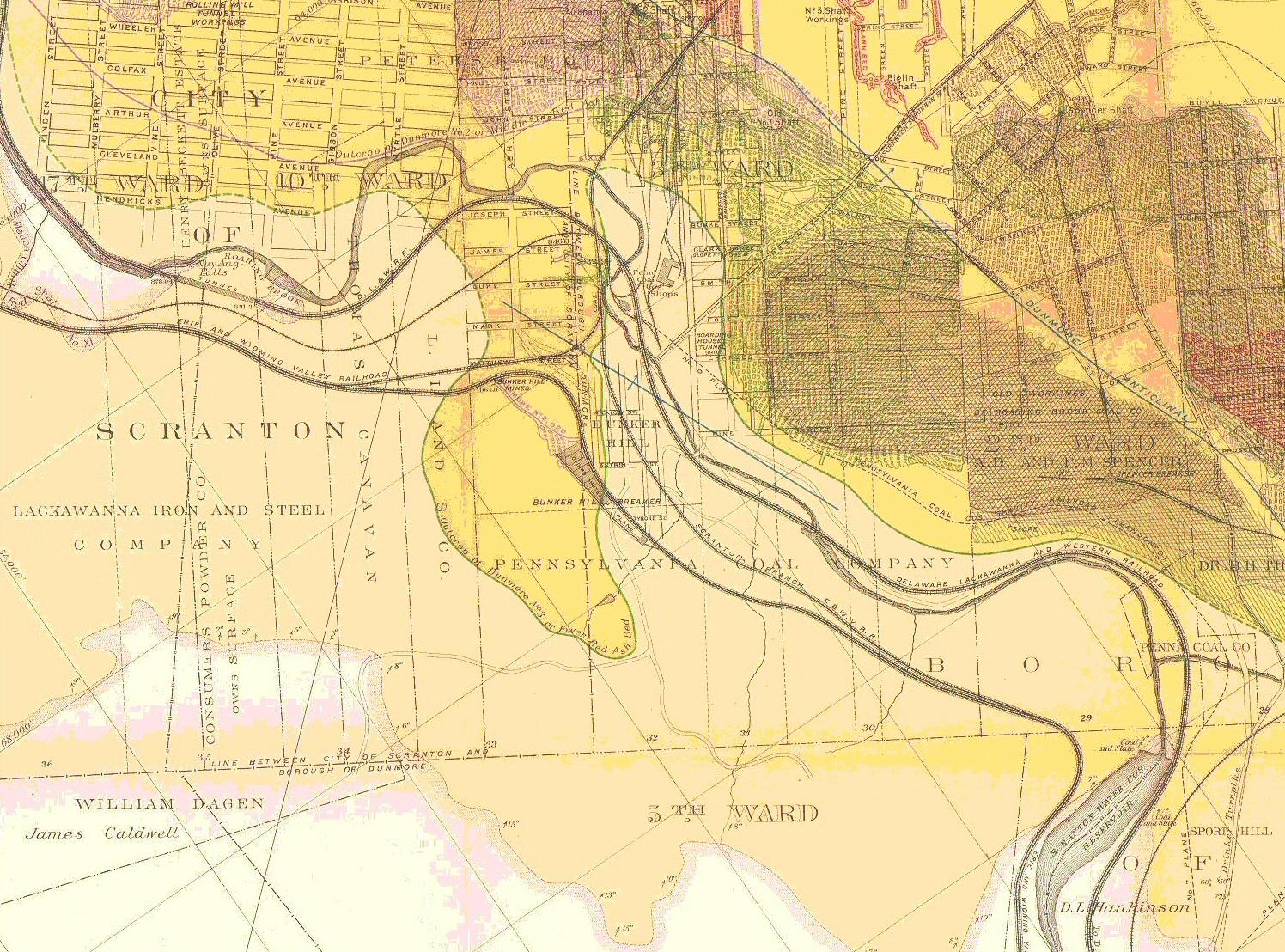
1888 2nd Pa Geo Survey sheet XVI
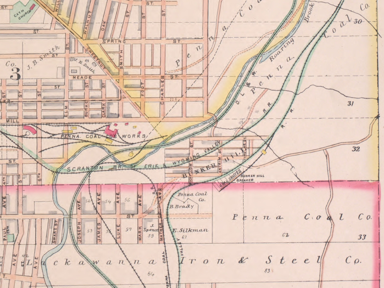
1894 Baist Atlas Wyoming and Lackawanna Valley Plate 9
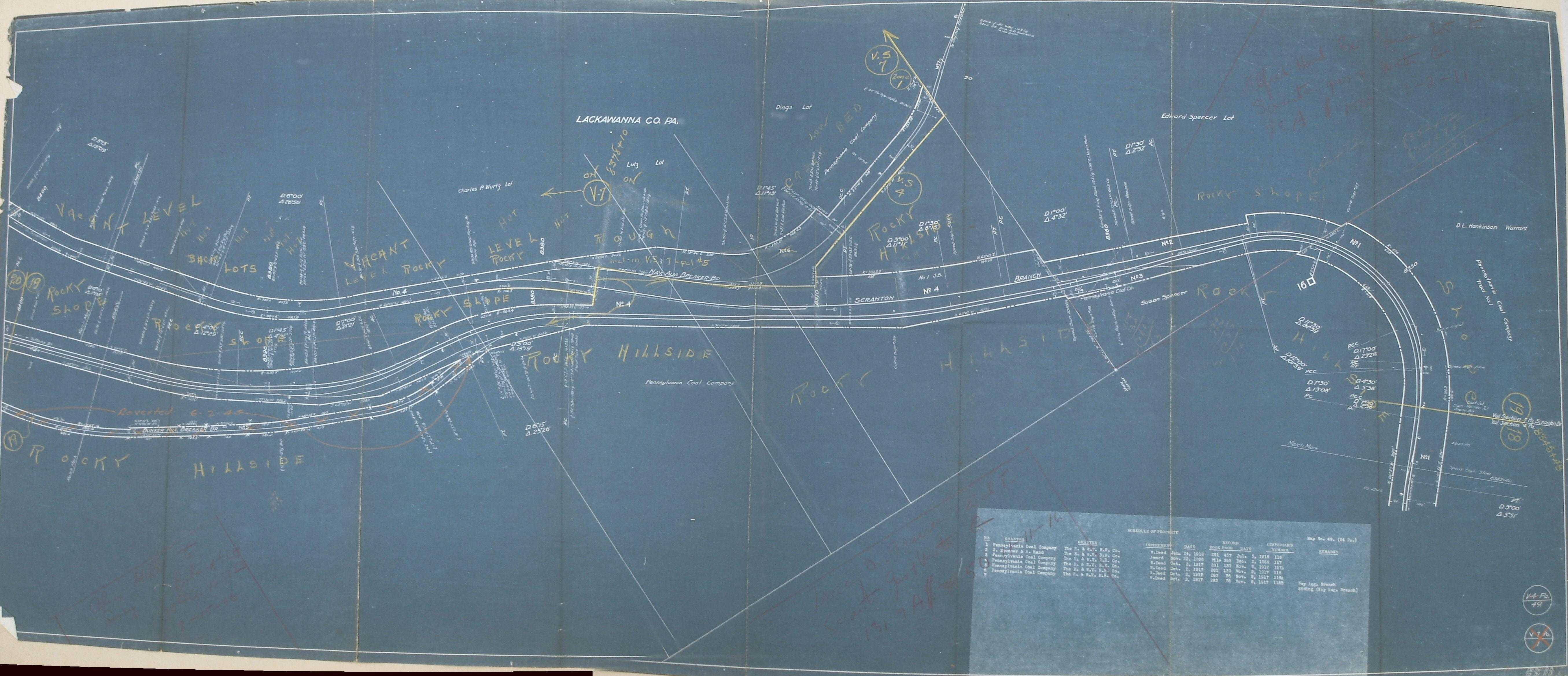
1918 Erie v4 Pa m49
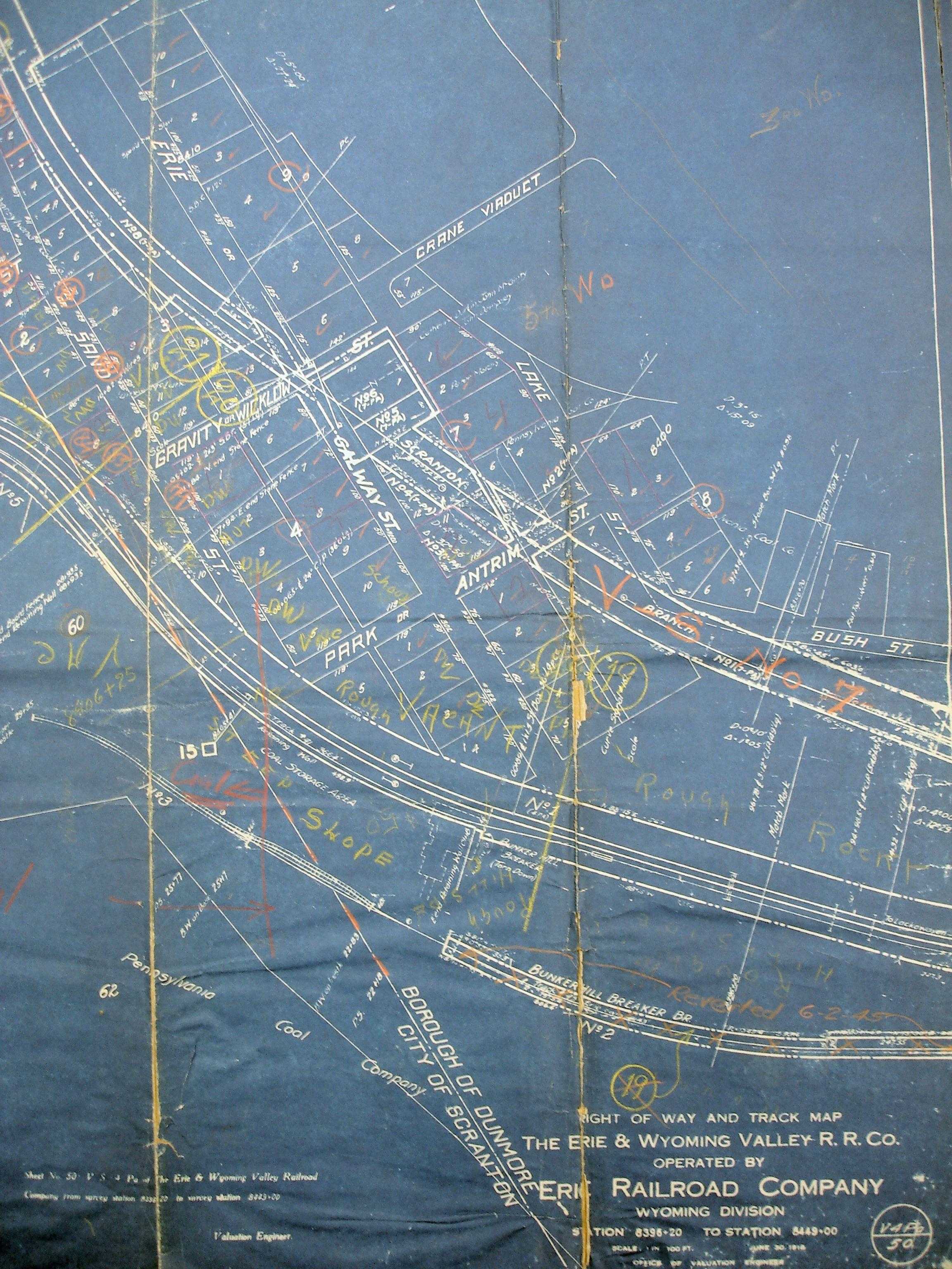
1918 Erie v4 Pa m50
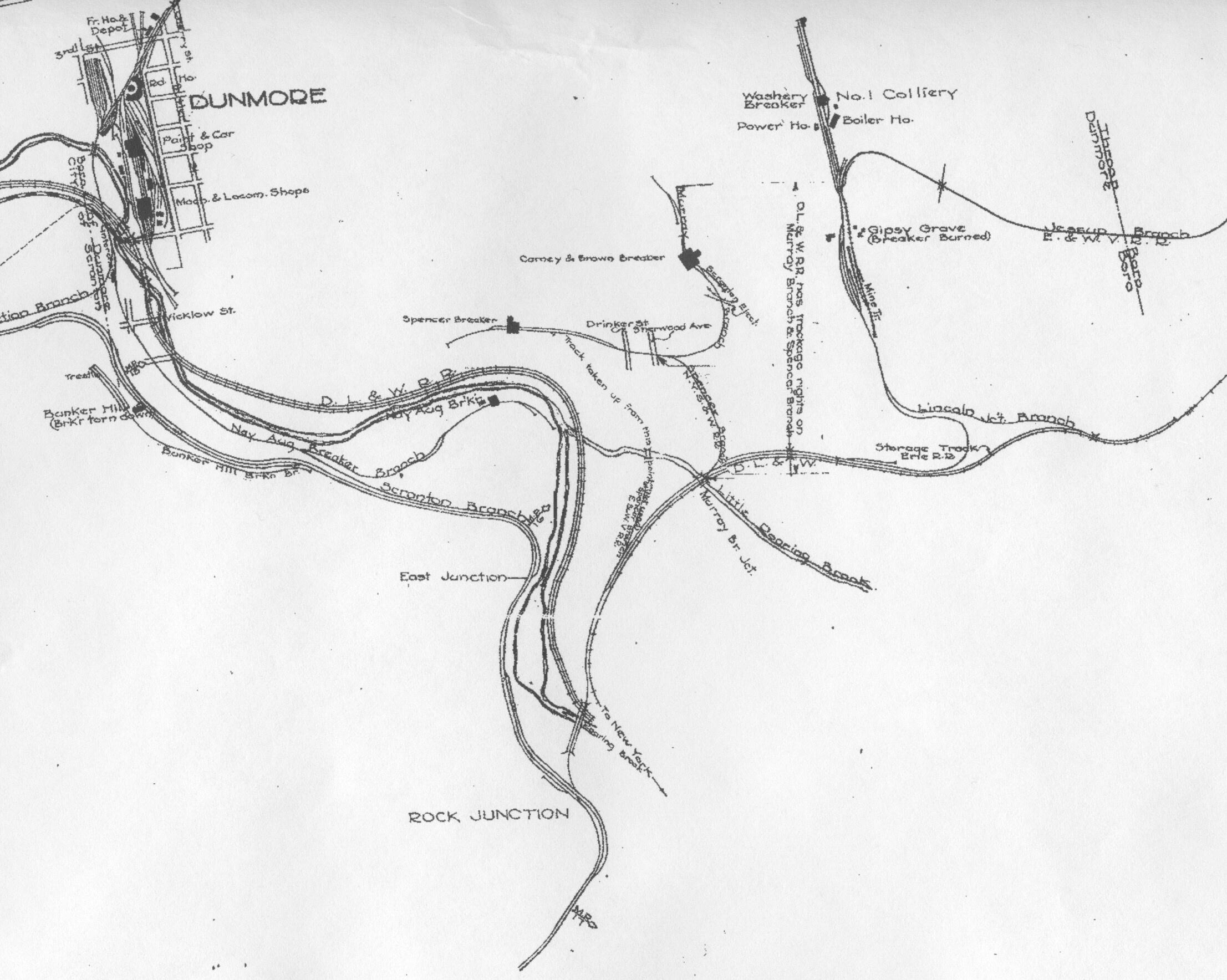
1920 version Shepherd Map Dunmore
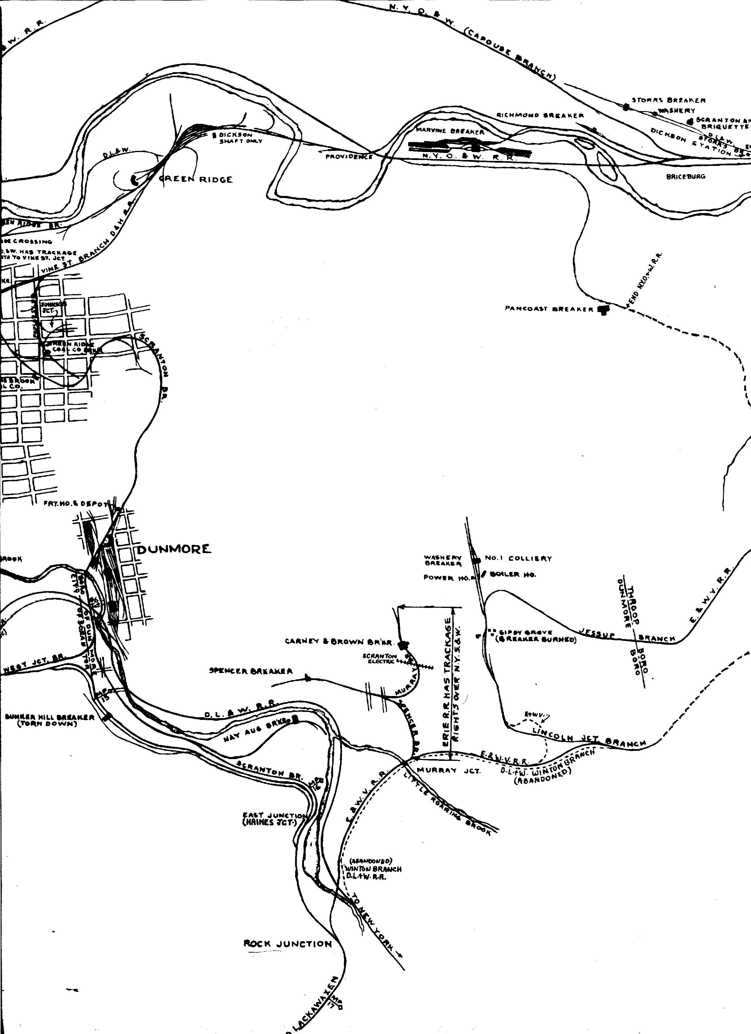
1939 Shepherd Map
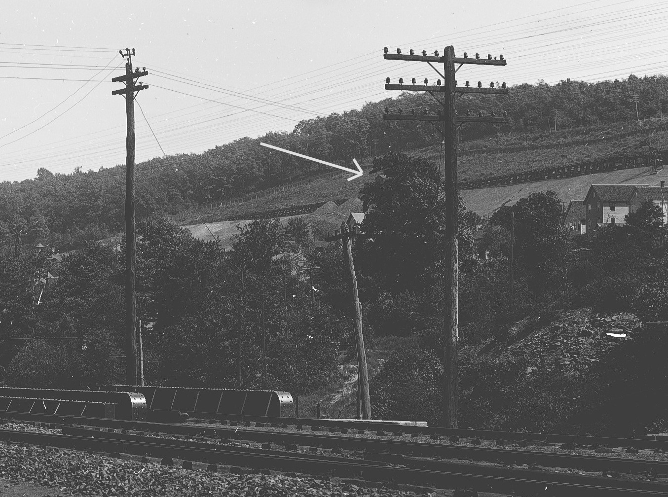
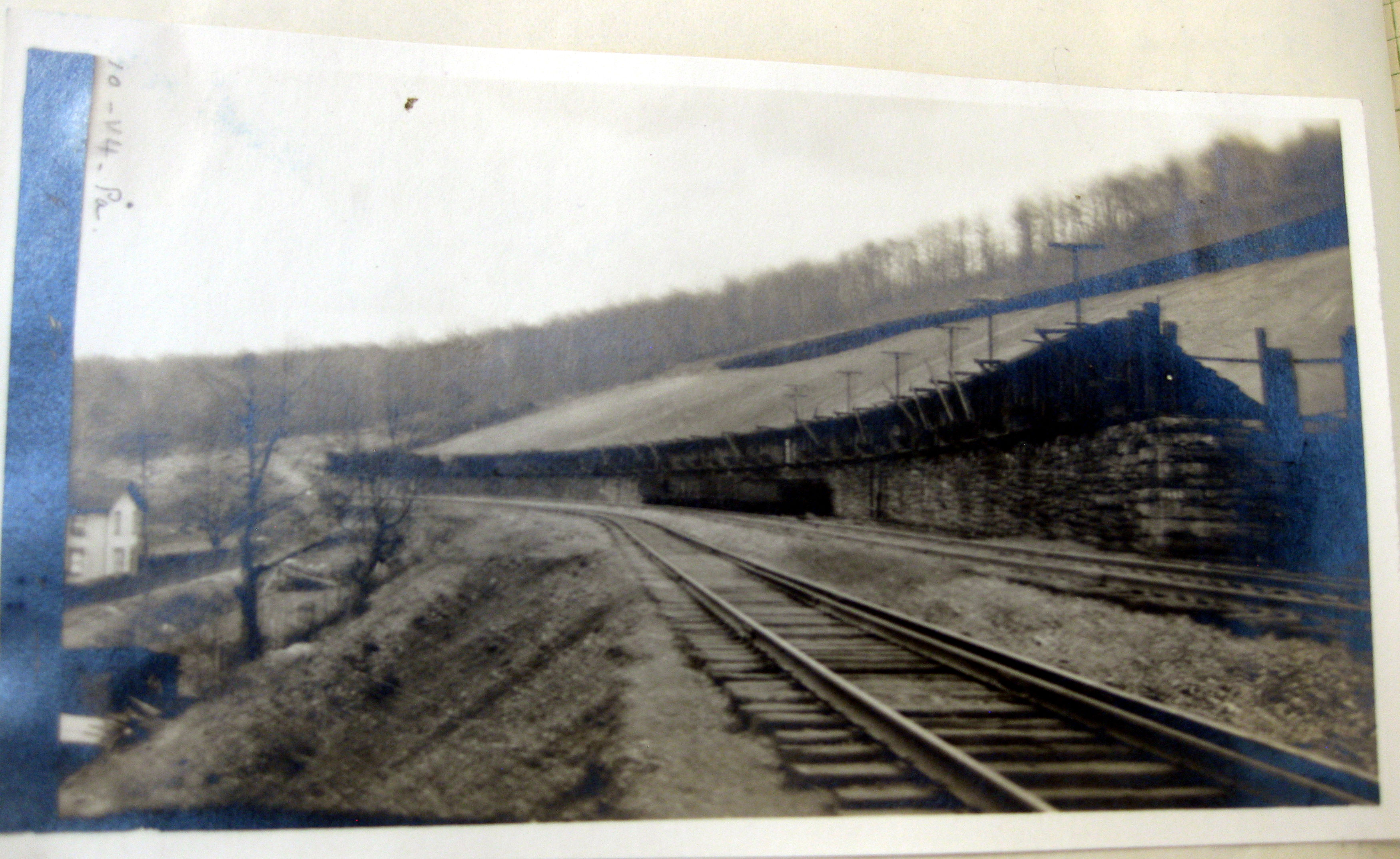
Period Photos
3 photos
3 photos
3 photos
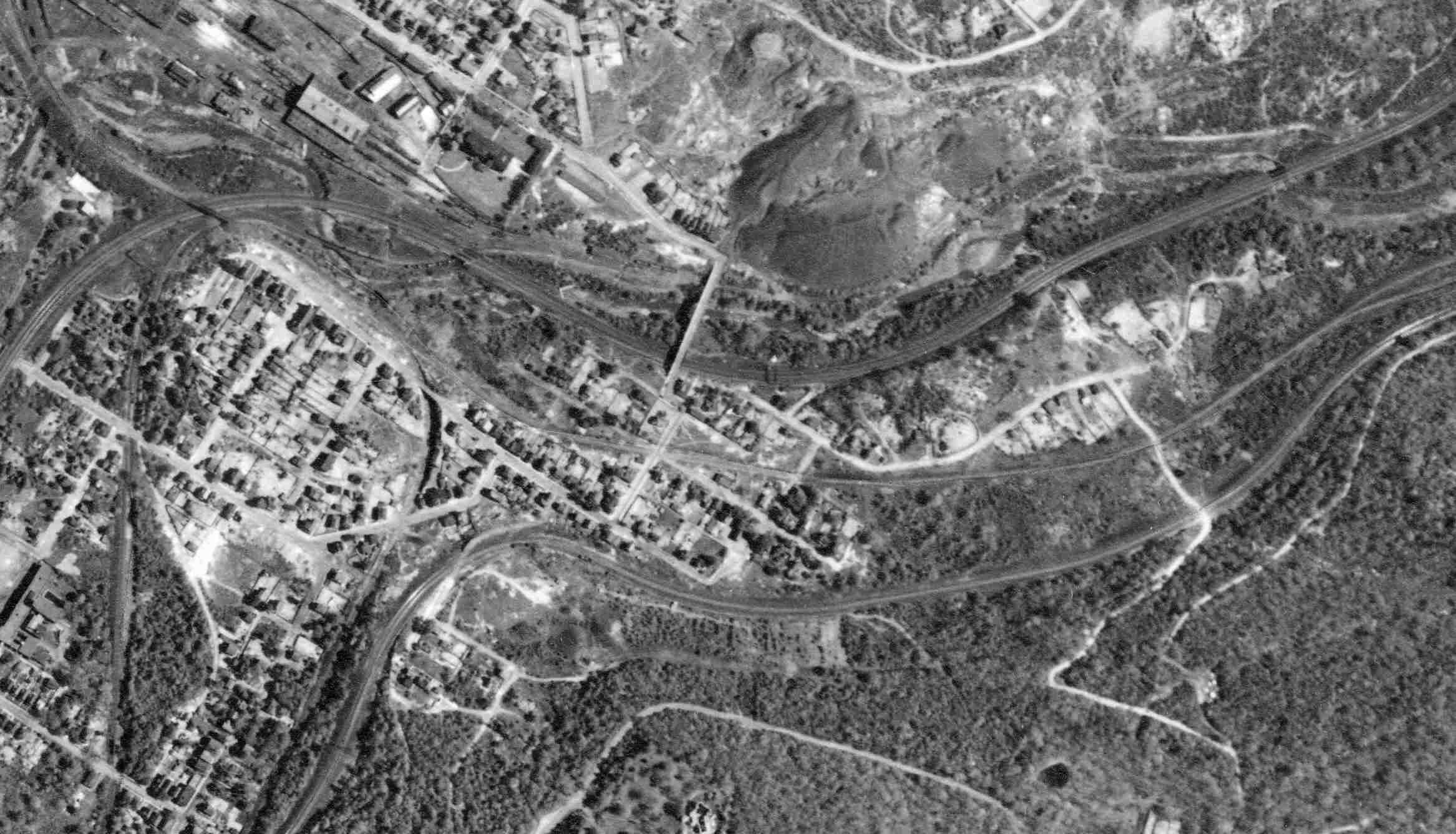
Penn Pilot and Aerial Photos
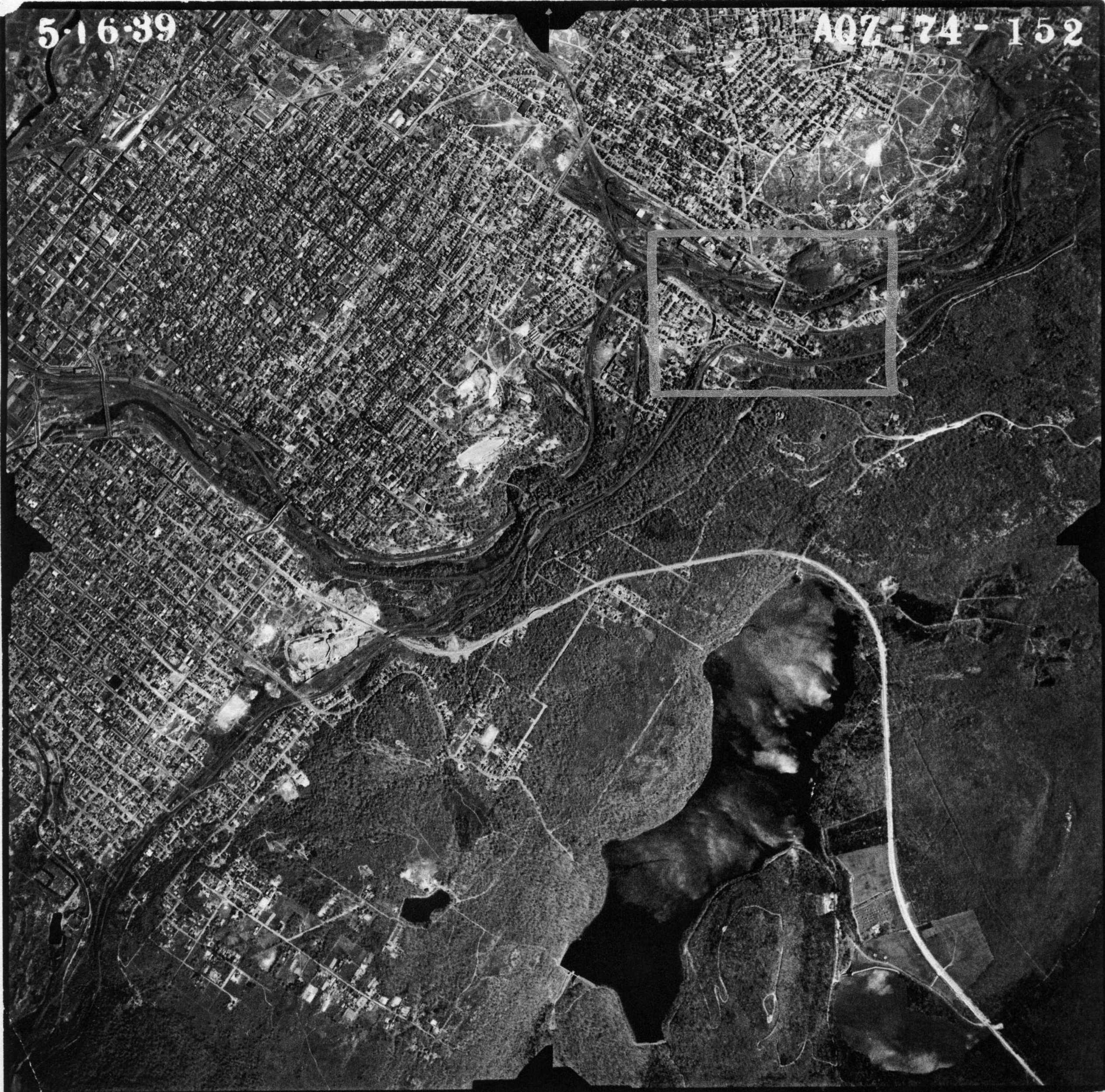
1939-05-16 74_152 close-up
1939-05-16 74_152
Mine Inspections
Inspector Narratives
City & Sanborn Maps
News, History & Articles
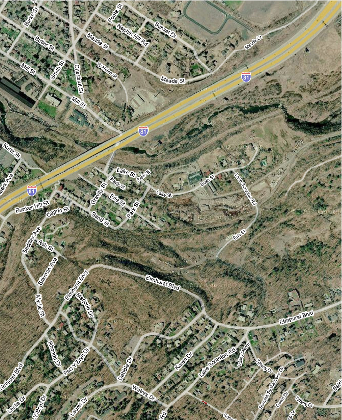
Modern Photos & Google Earth
Google Earth
Other Materials
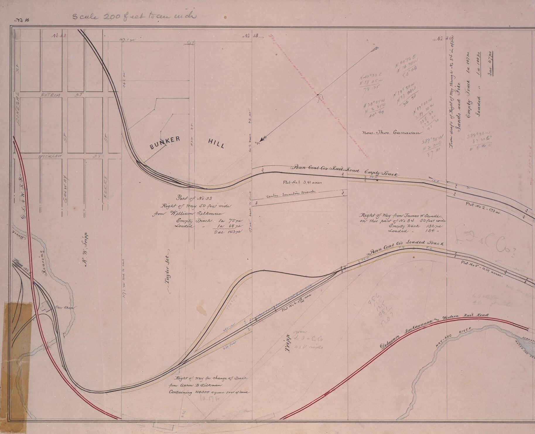
1894-1904 PaCC Field Survey Notebook No 137 Bunker Hill
Comments and Feedback