Back
Additional information specific to Motley is not available.
Displaying information for the correlated Erie operation instead.
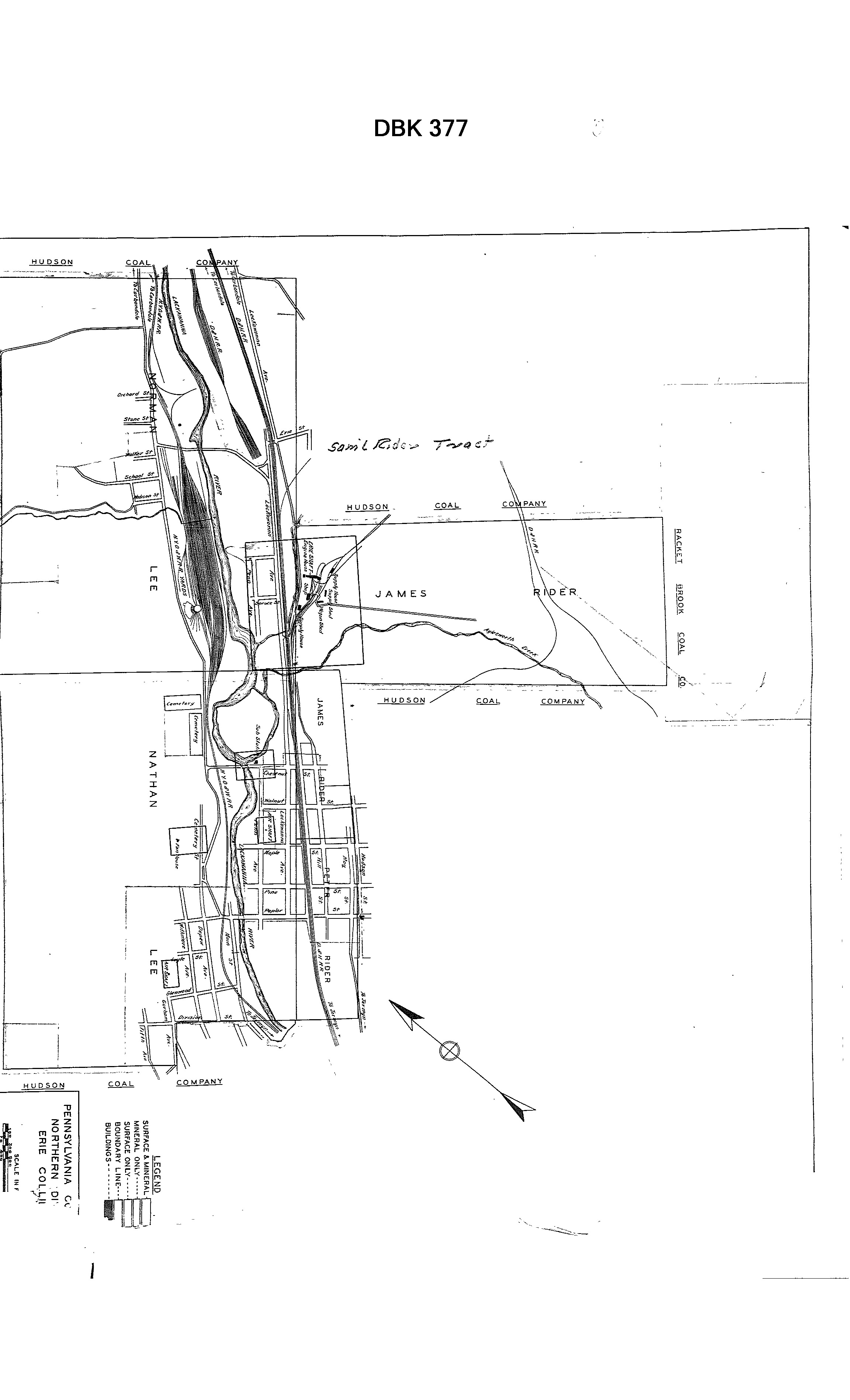
Area & Railroad Maps
1878 Mine Inspector Map
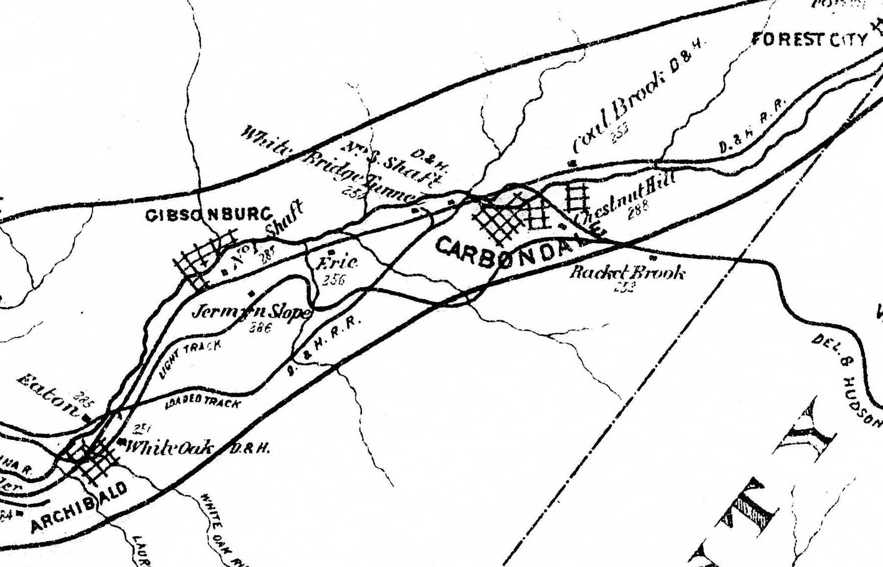
1879 Mine Inspector Map
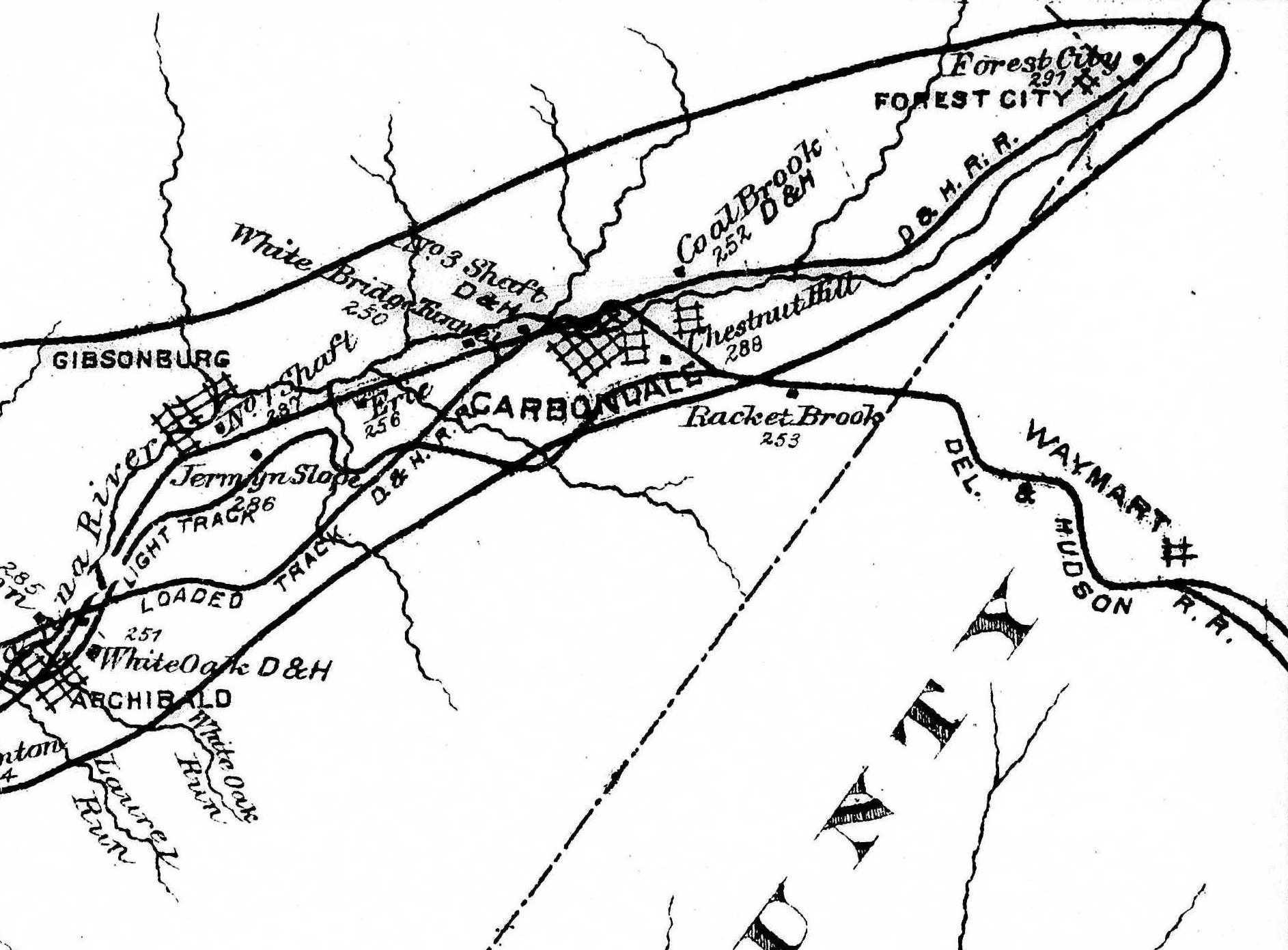
1880 Mine Inspector Map
1888 2nd Pa Geo Survey sheet XIX
1890 Northern Field Map (15) PSU
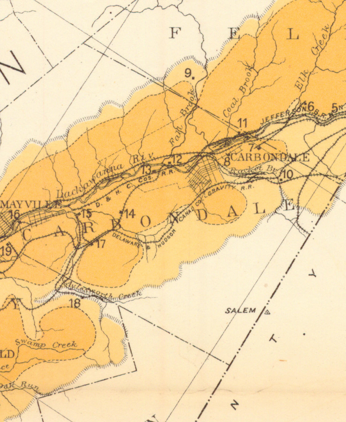
1894 Baist Atlas Wyoming and Lackawanna Valley Plate 11
1930 PCC-Pittston Lease
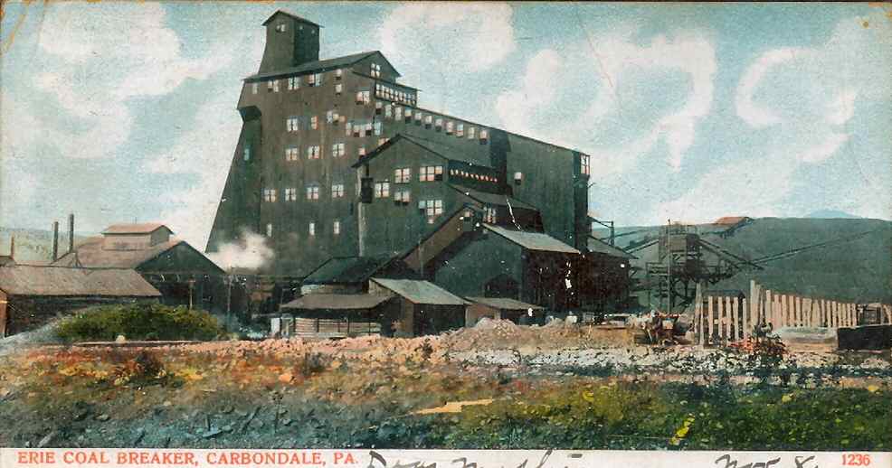
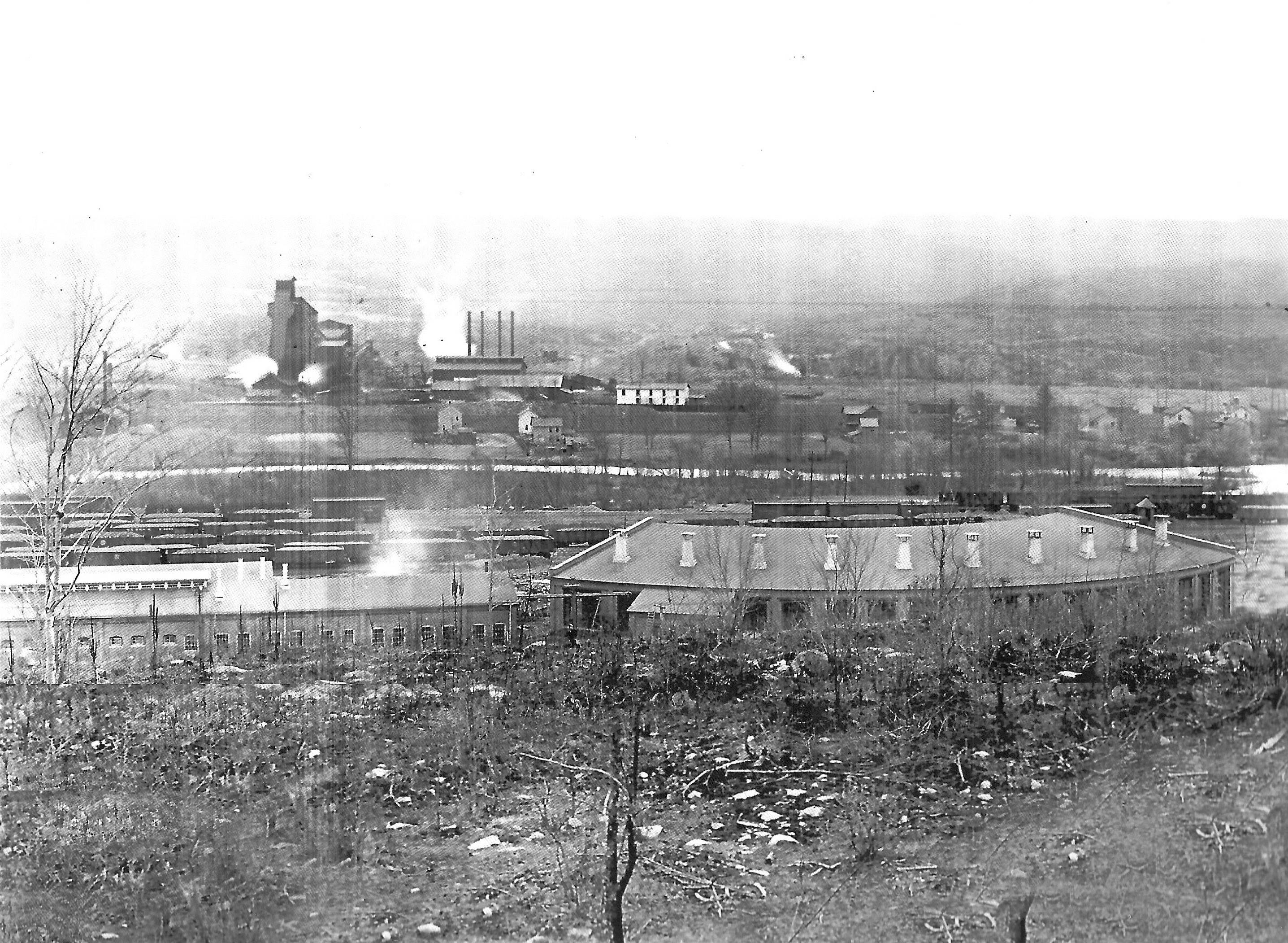
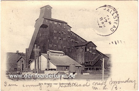
Period Photos
Healey Mining eBook
3 photos
3 photos
3 photos
Penn Pilot and Aerial Photos
Mine Inspections
Inspector Narratives
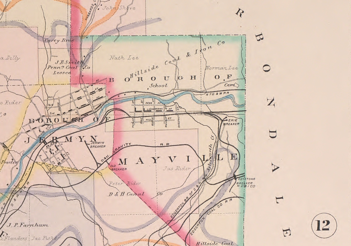
City & Sanborn Maps
News, History & Articles
Modern Photos & Google Earth
Other Materials
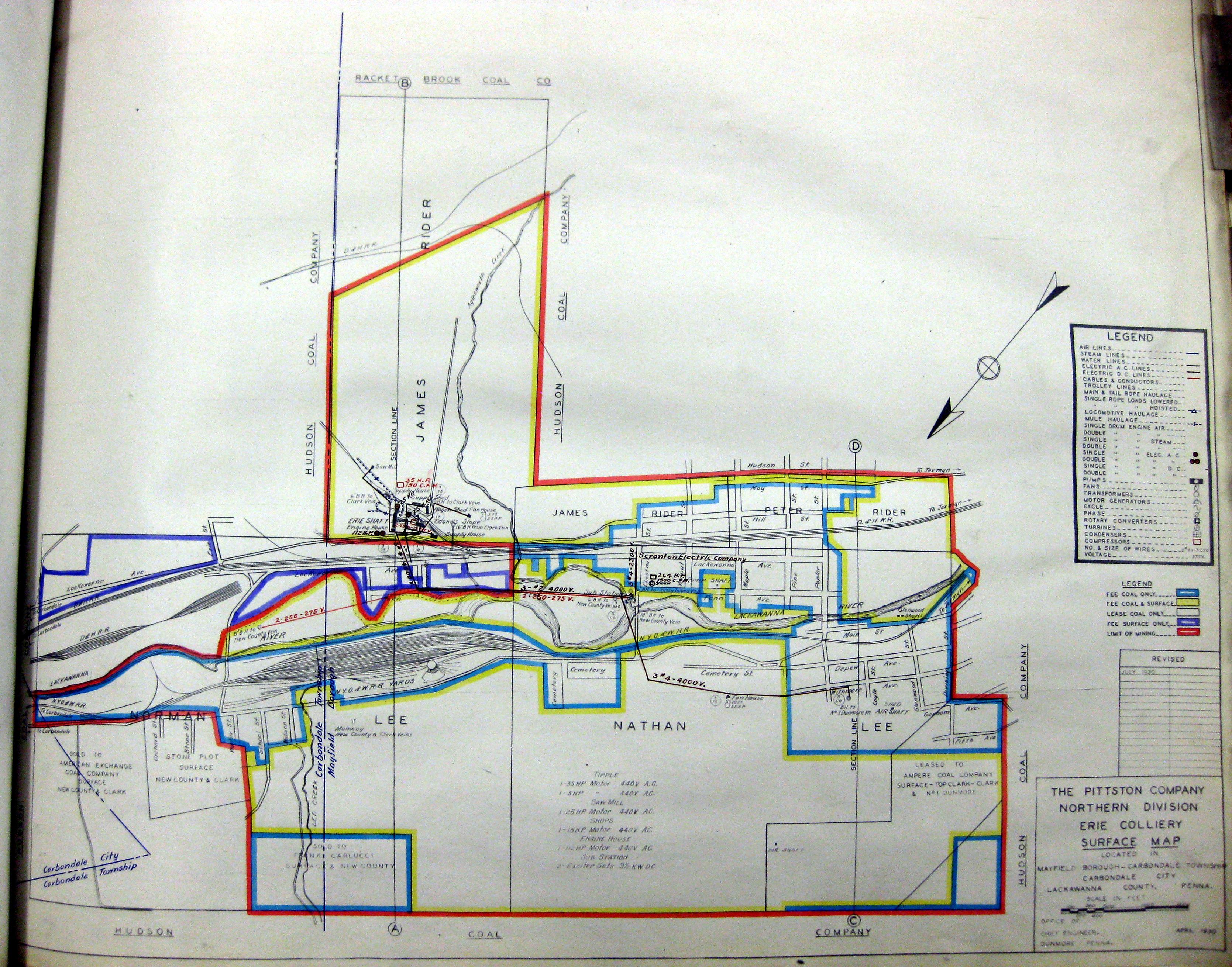
1930-04 Erie Colliery 1 Surface
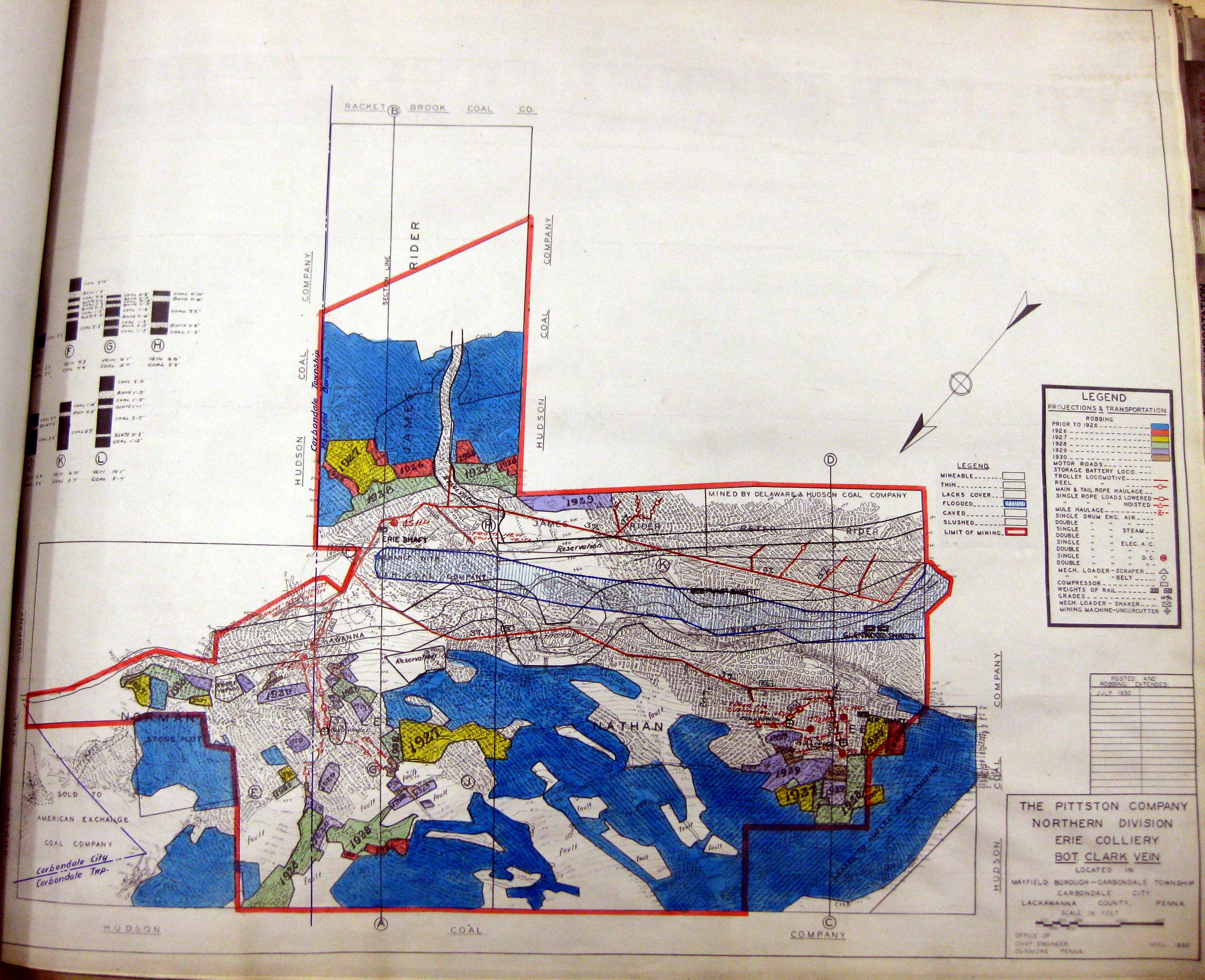
1930-04 Erie Colliery Clark Vein Bottom 1
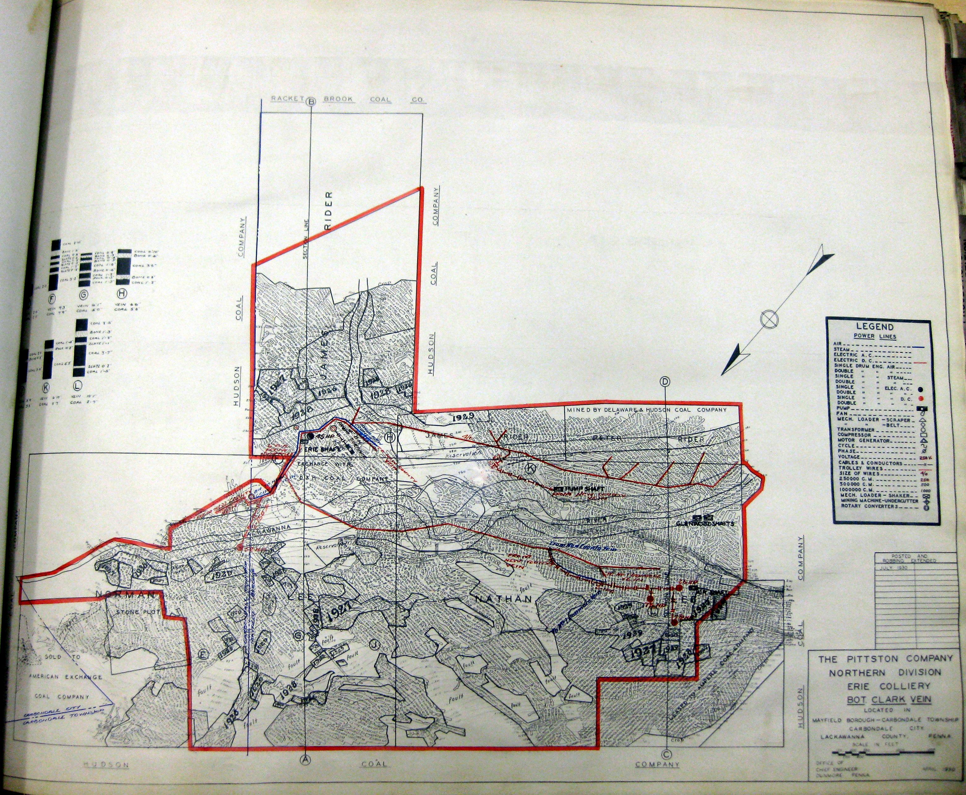
1930-04 Erie Colliery Clark Vein Bottom 2
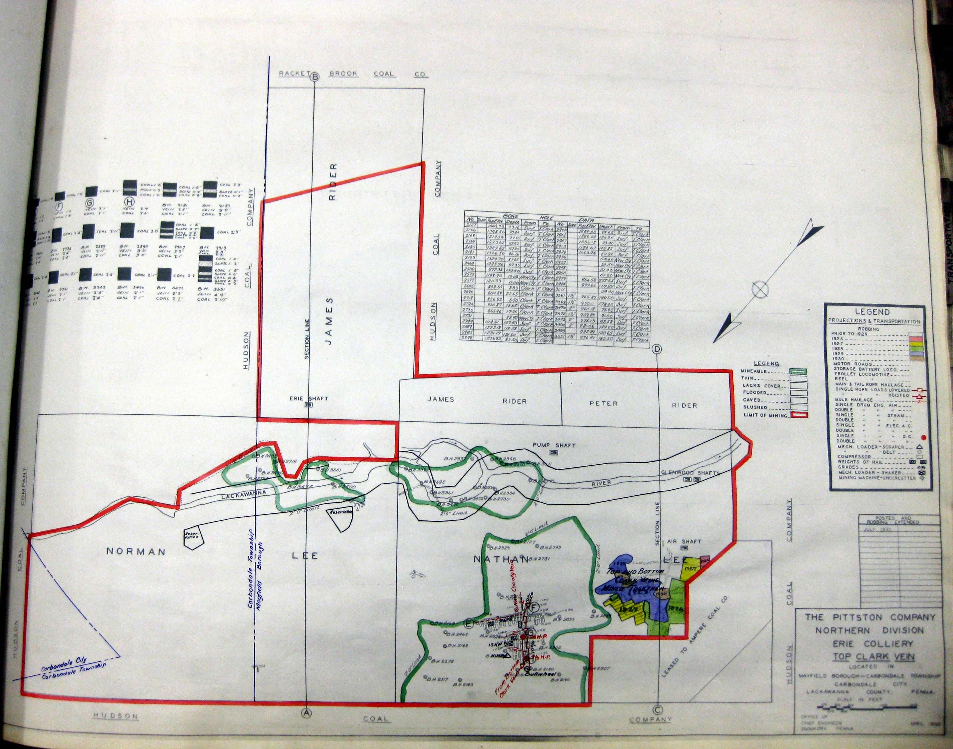
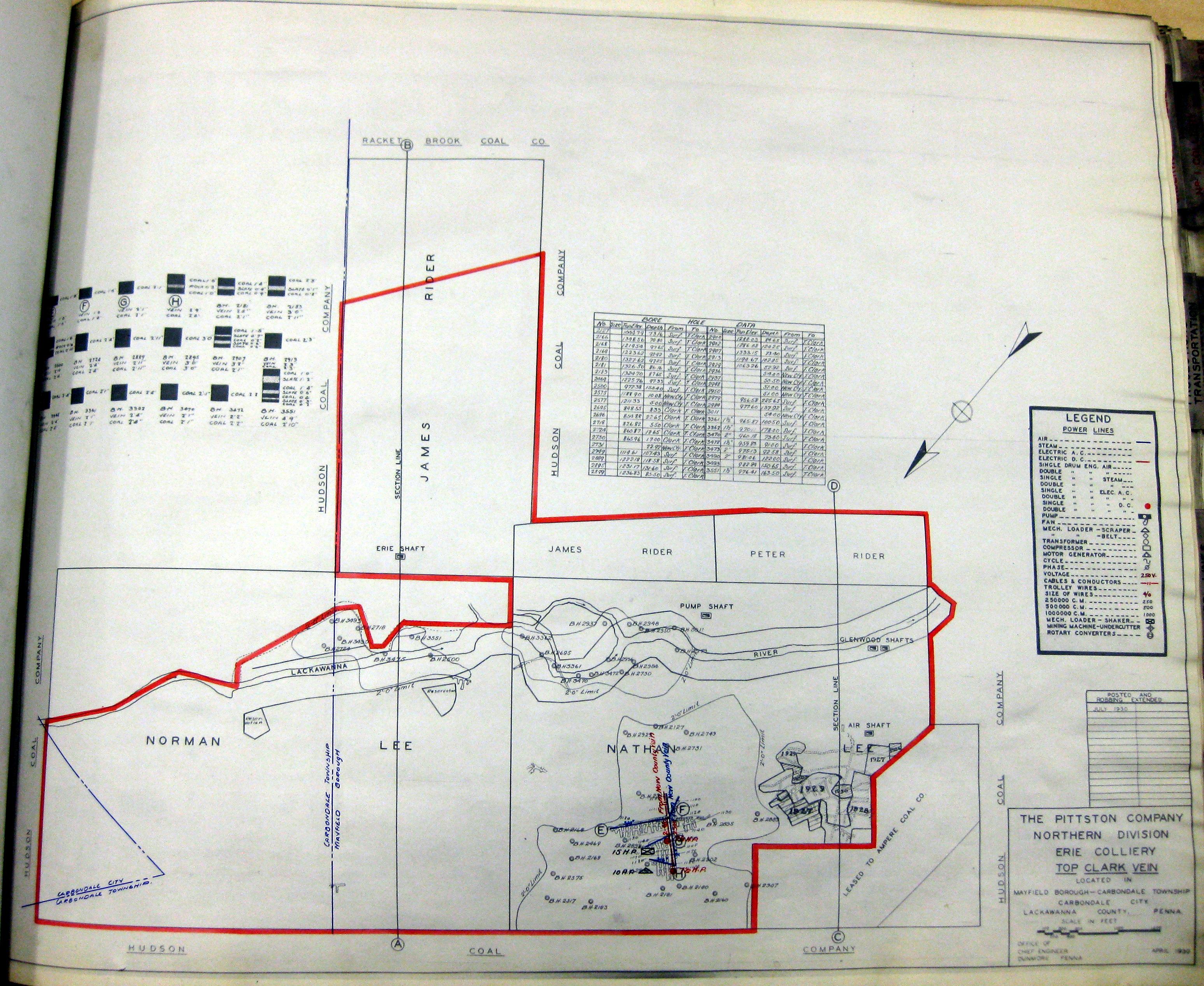
1930-04 Erie Colliery Clark Vein Top 1
1930-04 Erie Colliery Clark Vein Top 2
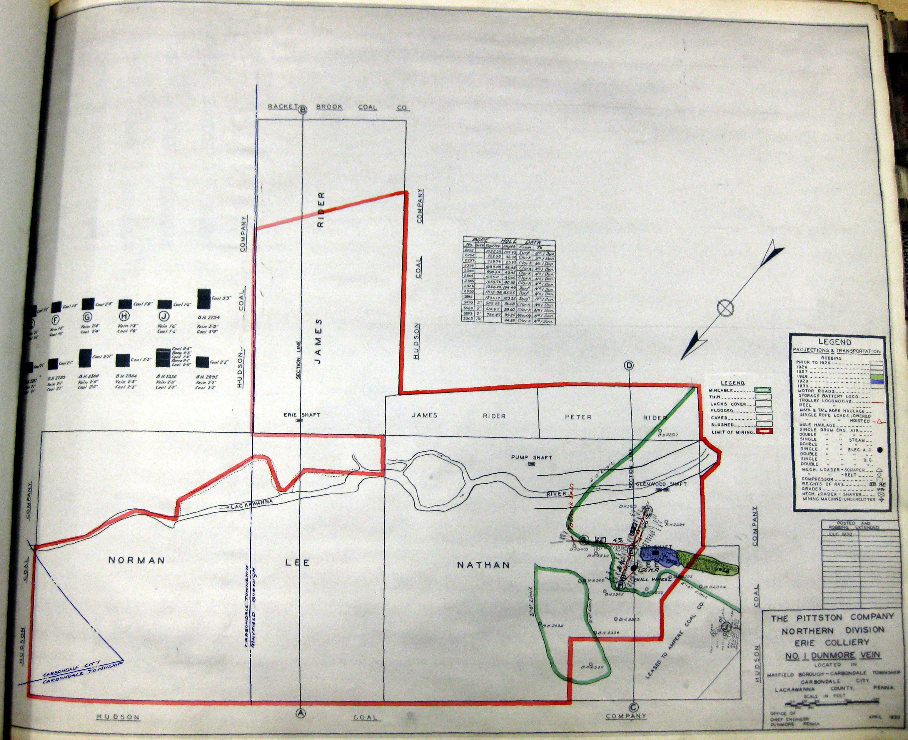
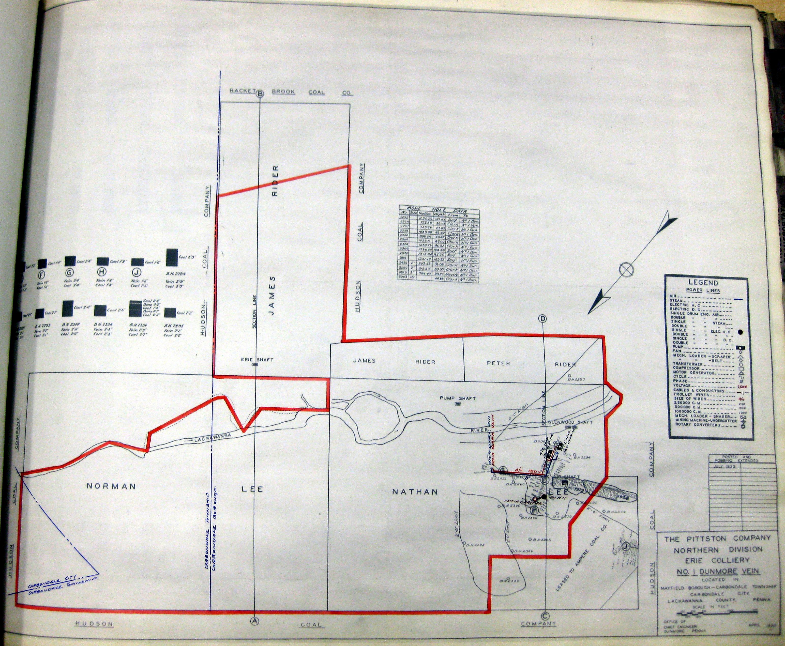
1930-04 Erie Colliery Dunmore No 1 Vein 1
1930-04 Erie Colliery Dunmore No 1 Vein 2
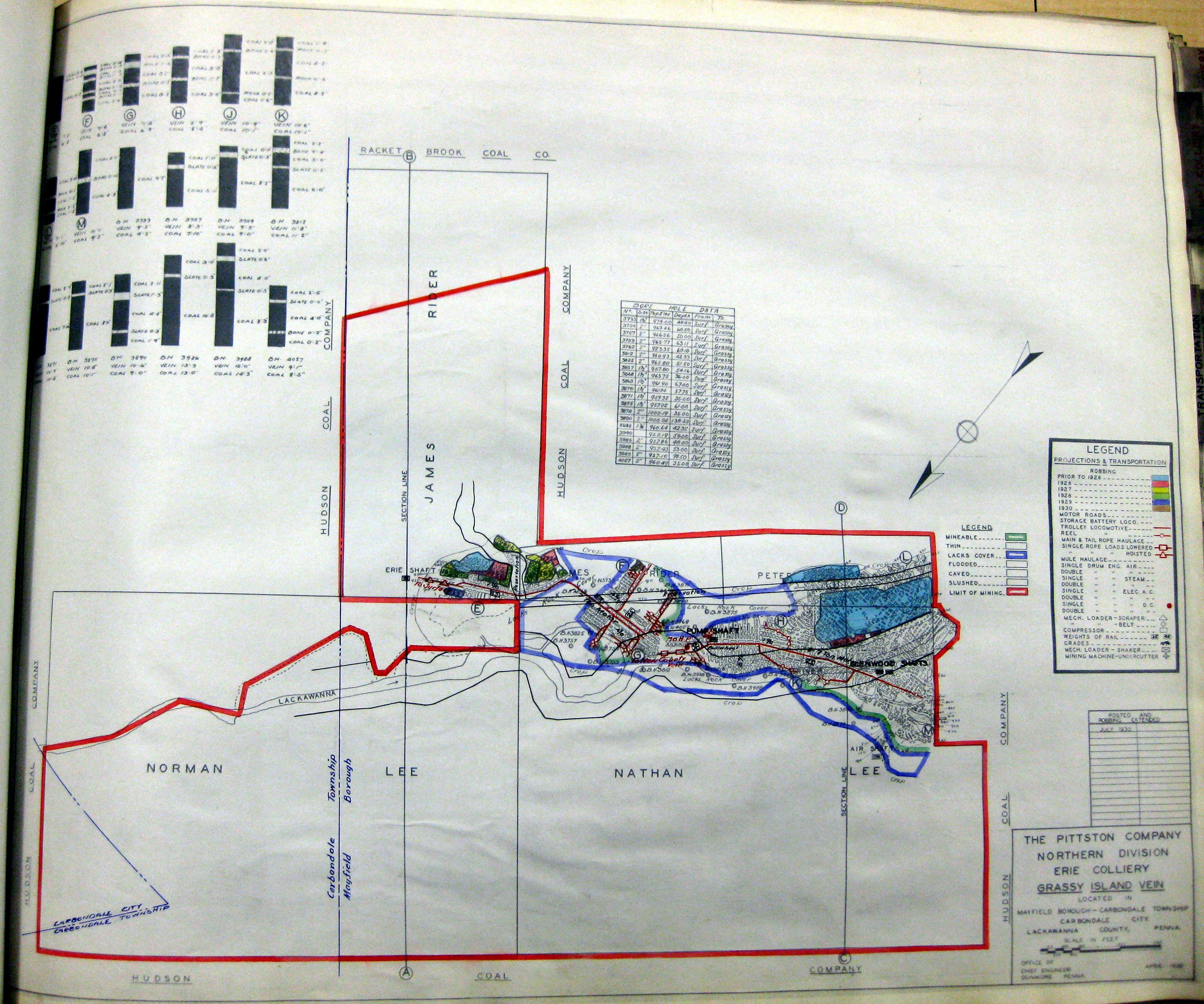
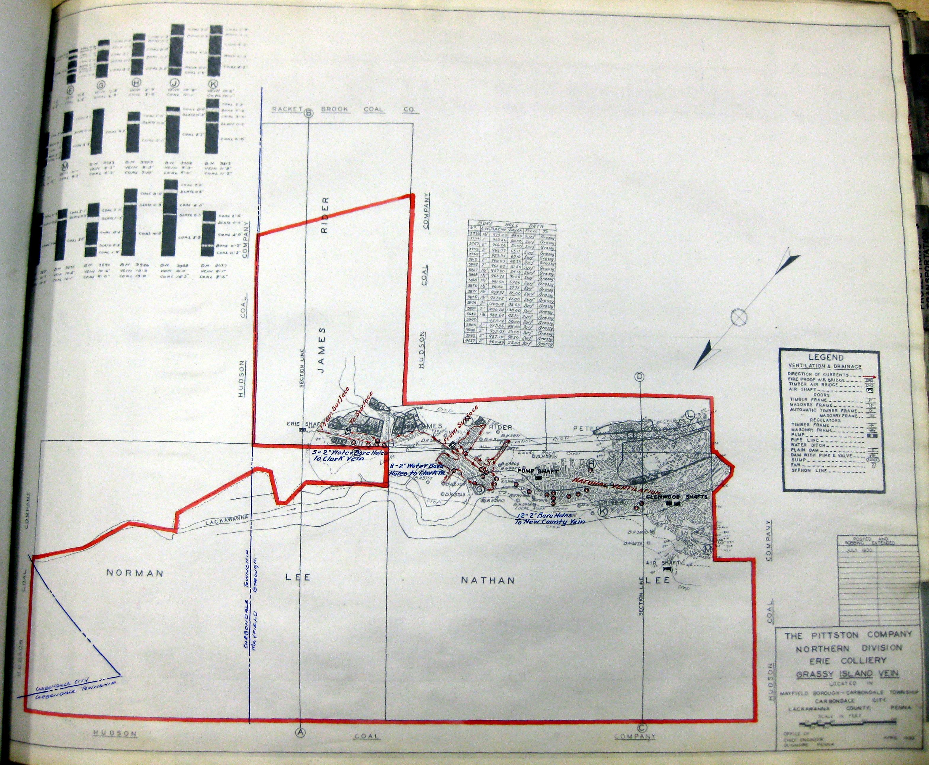
1930-04 Erie Colliery Grassy Island Vein 1
1930-04 Erie Colliery Grassy Island Vein 2
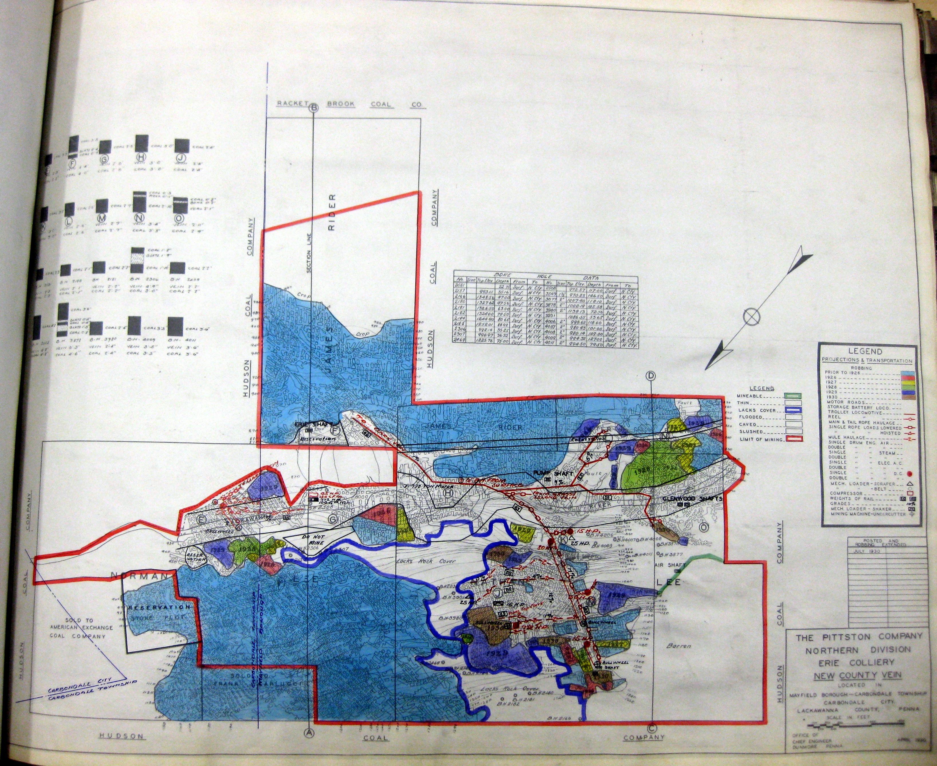
1930-04 Erie Colliery New Country Vein 1
1930-04 Erie Colliery New Country Vein 2
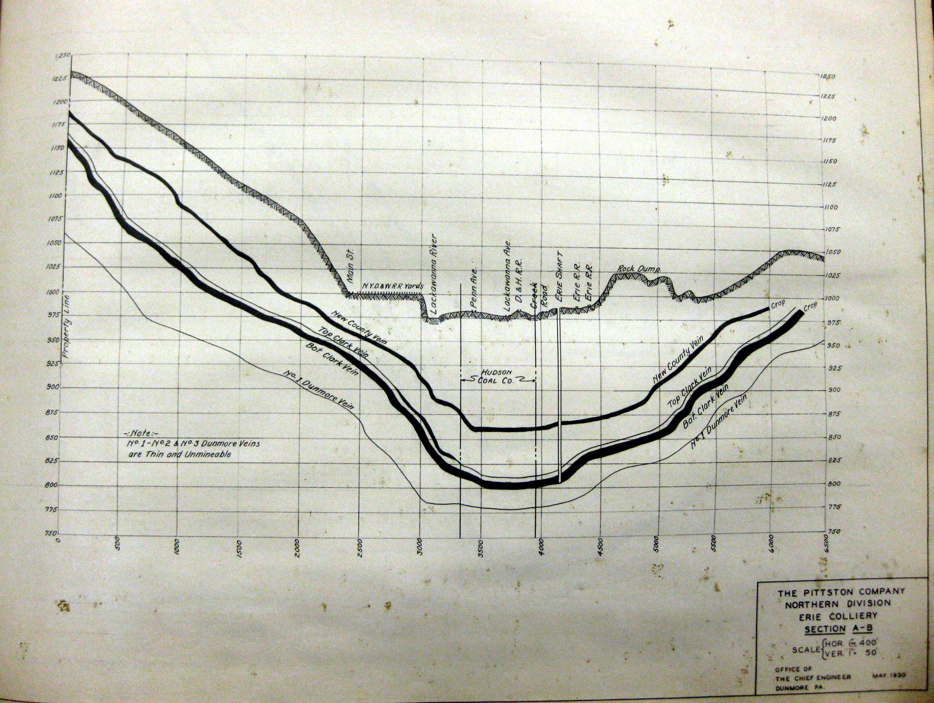
1930-04 Erie Colliery Section A-B
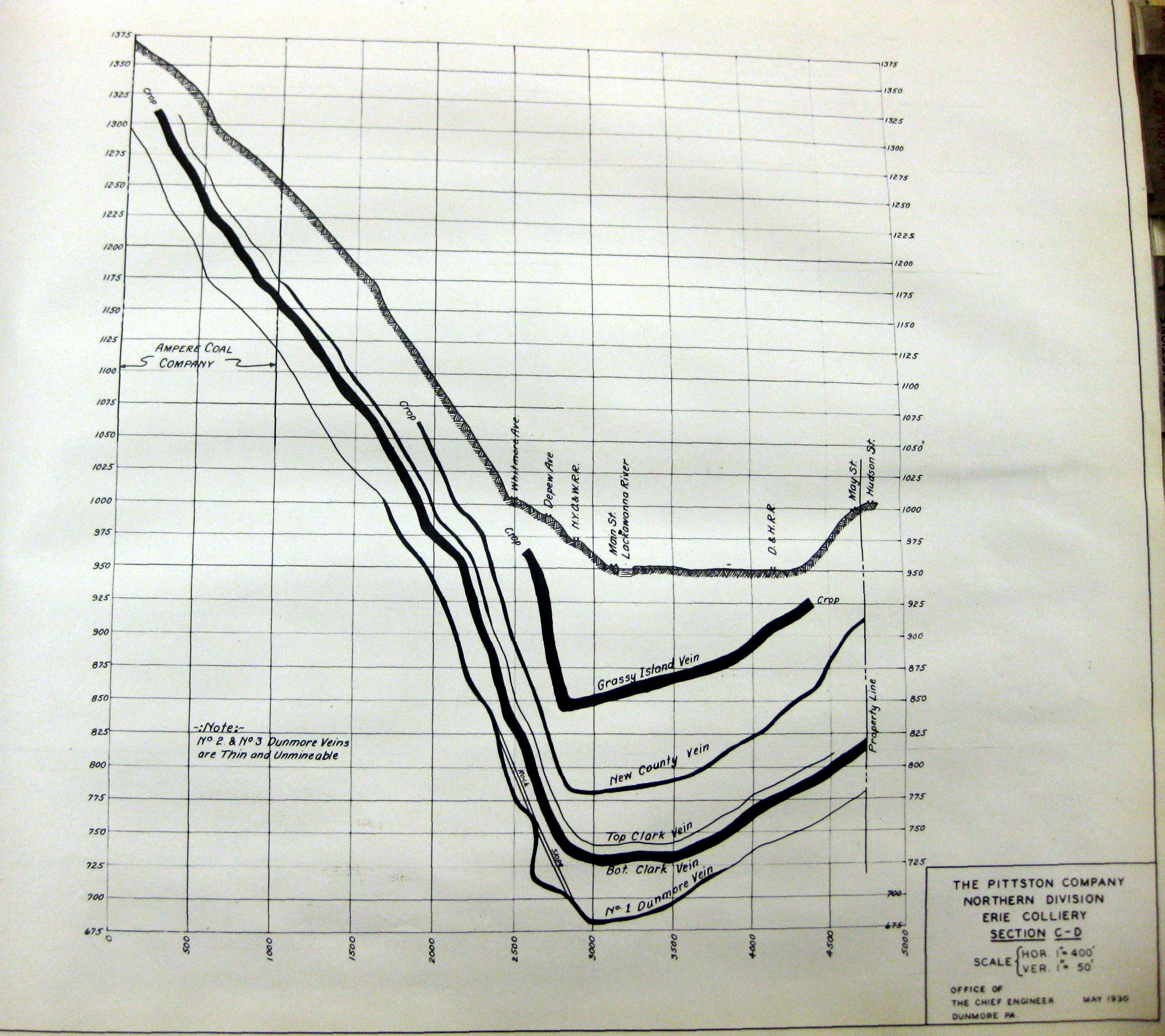
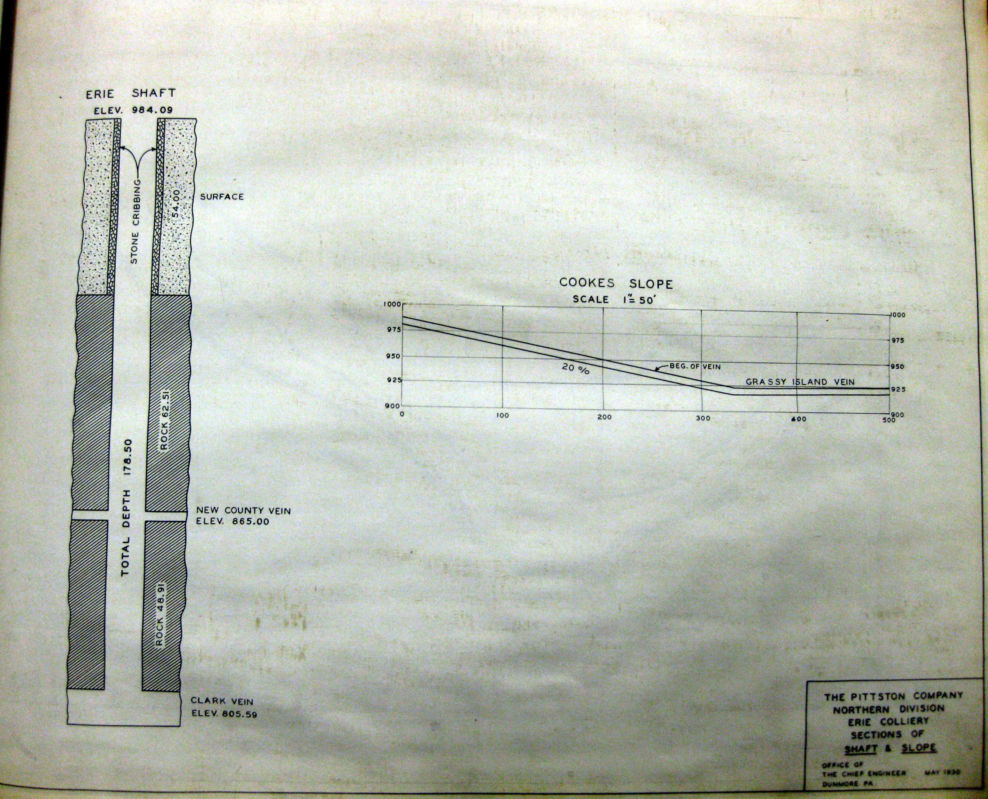
1930-04 Erie Colliery Section C-D
1930-04 Erie Colliery Sections
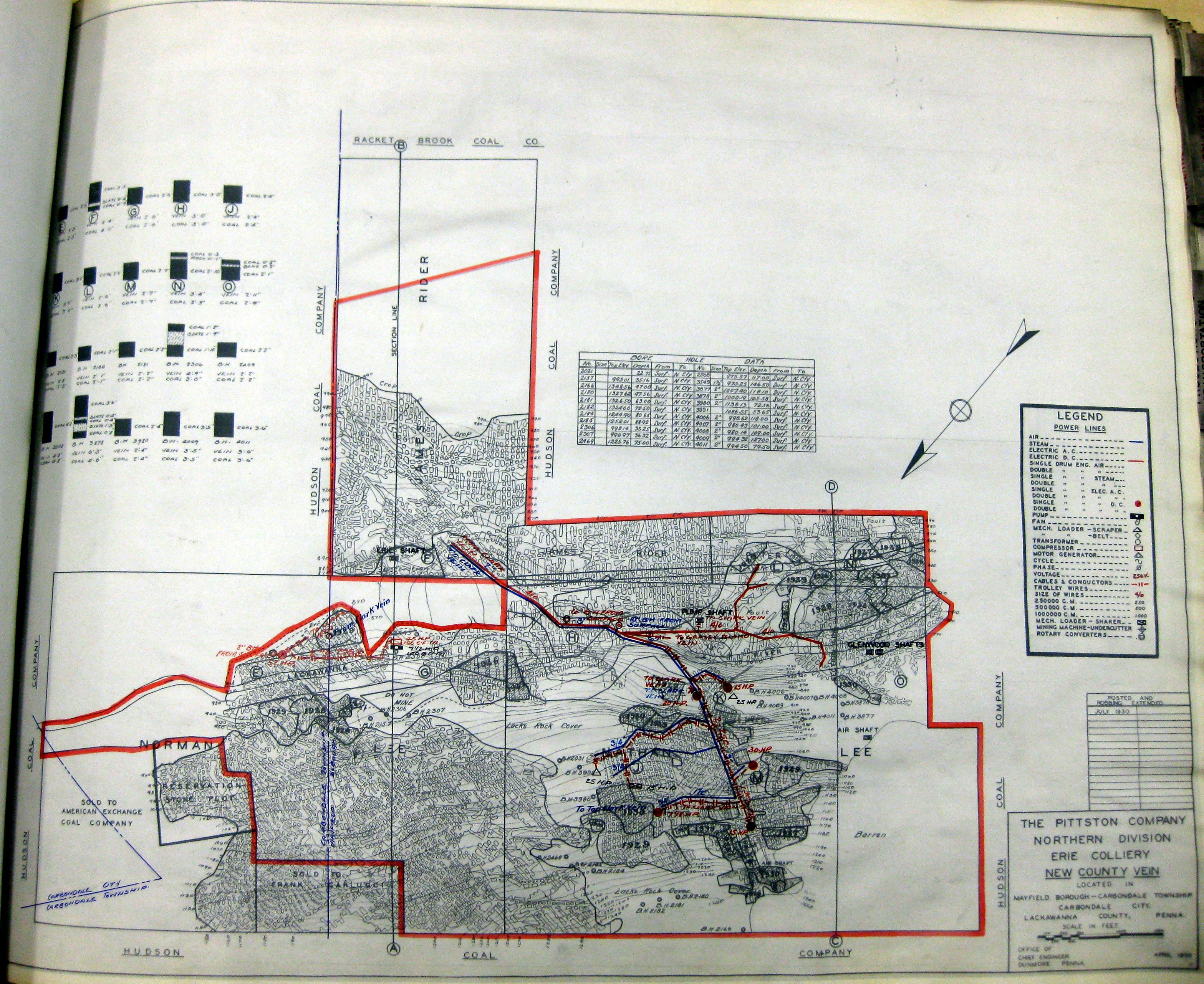
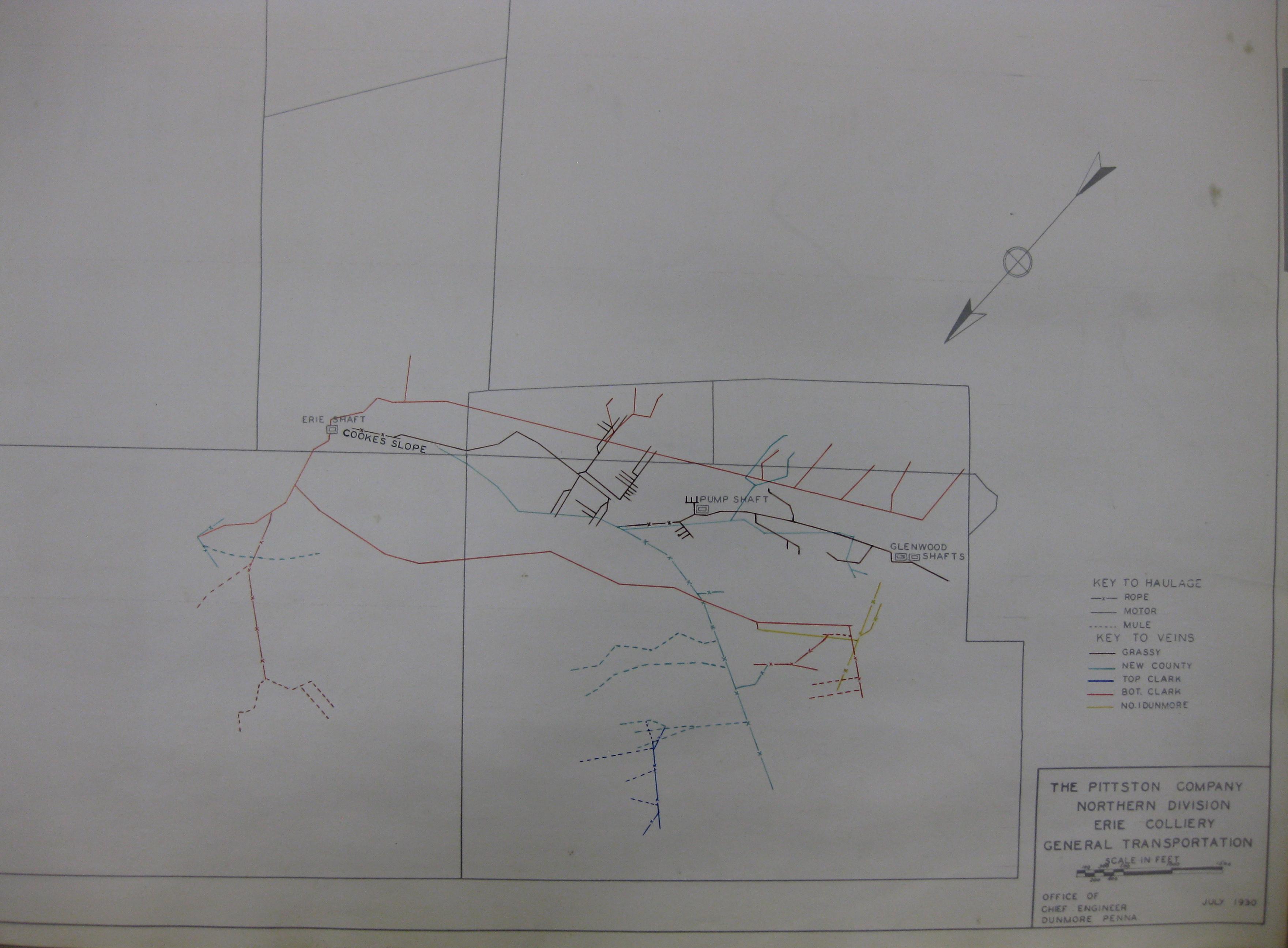
1930-04 Erie Colliery Transportation
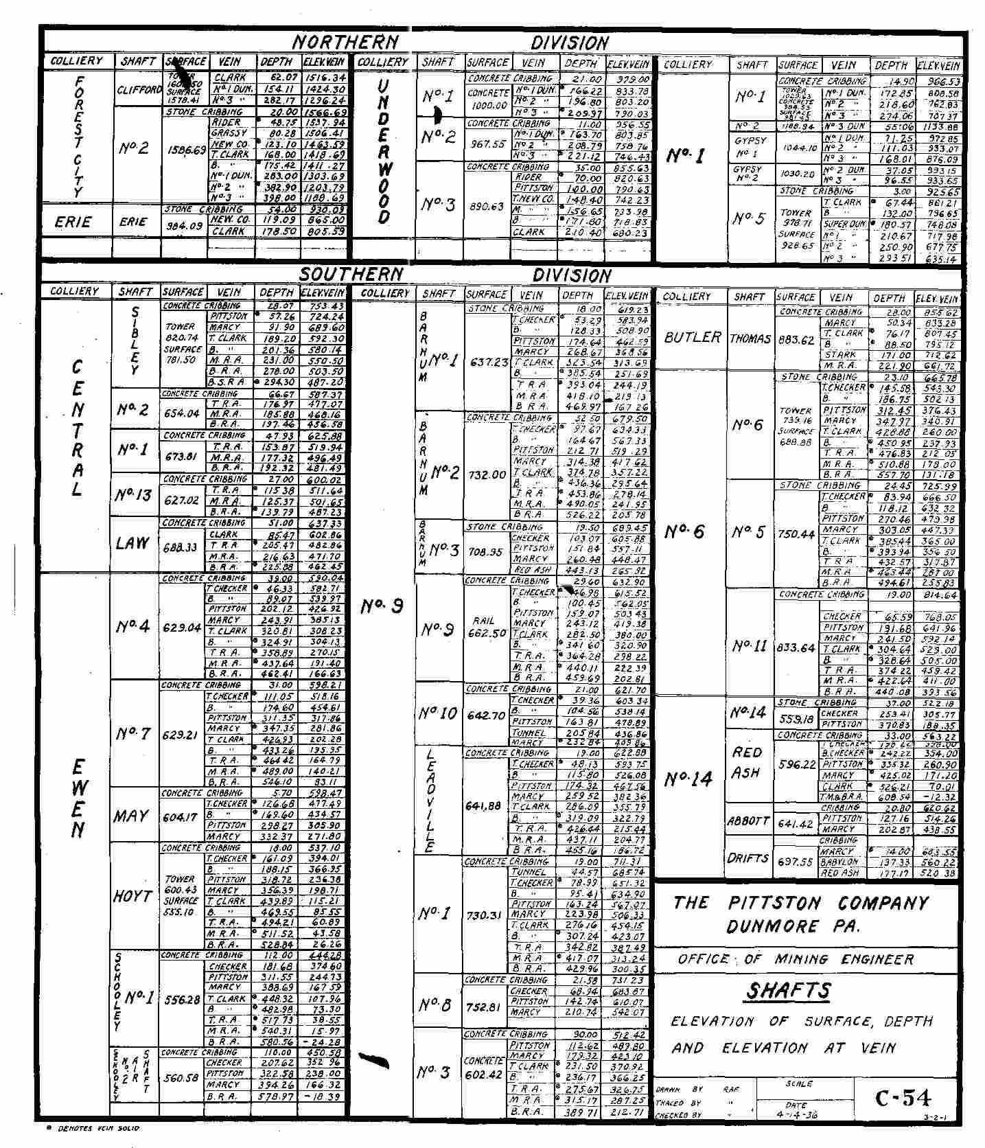
1936 PCC_Veins
Comments and Feedback