Back
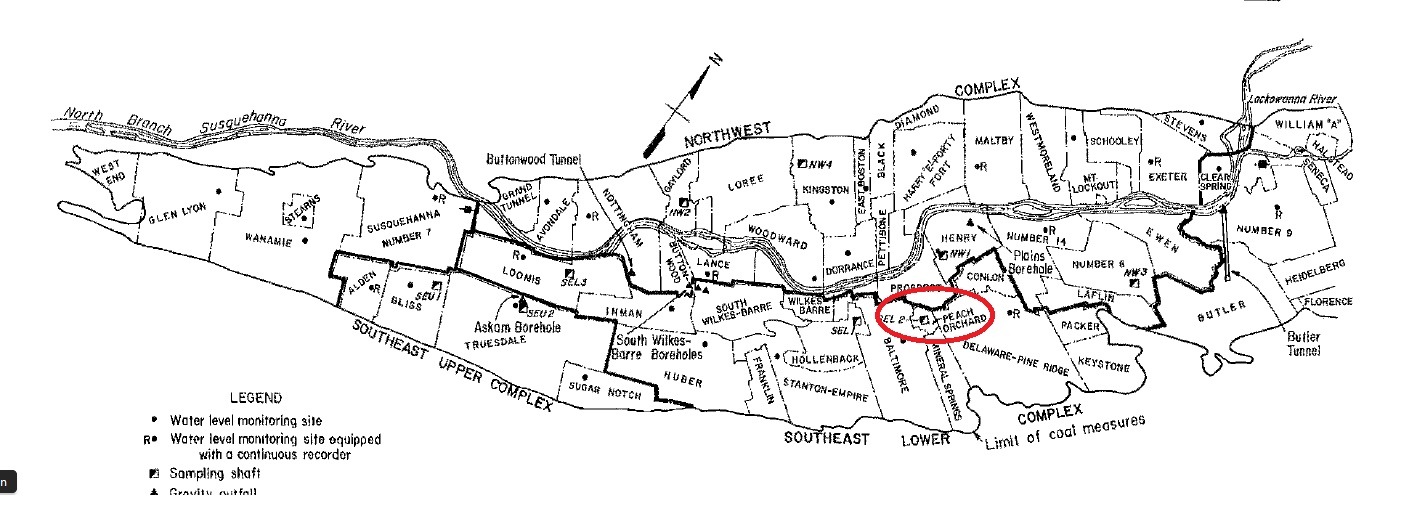
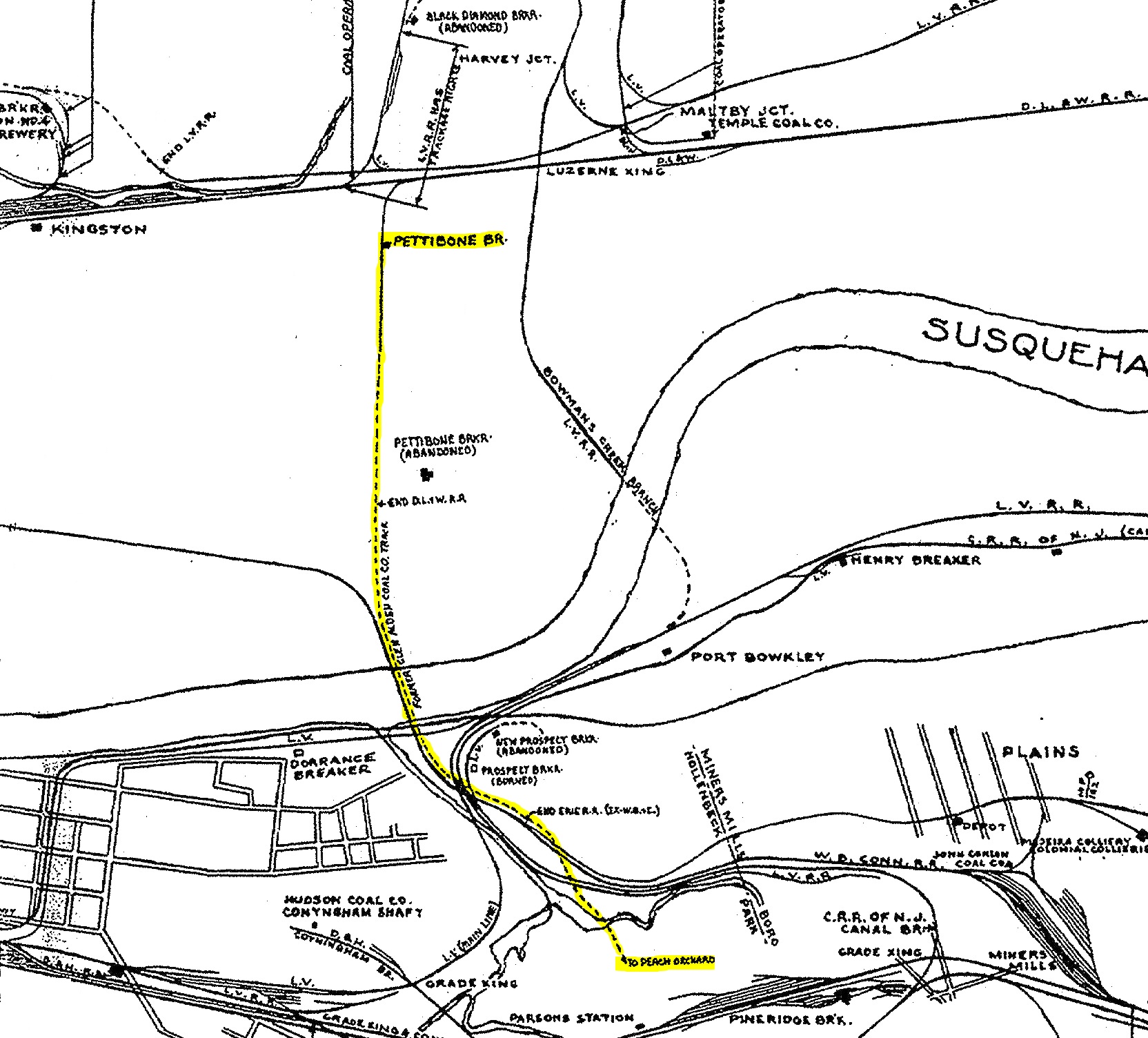
Pettebone (Peach Orchard)
Area & Railroad Maps
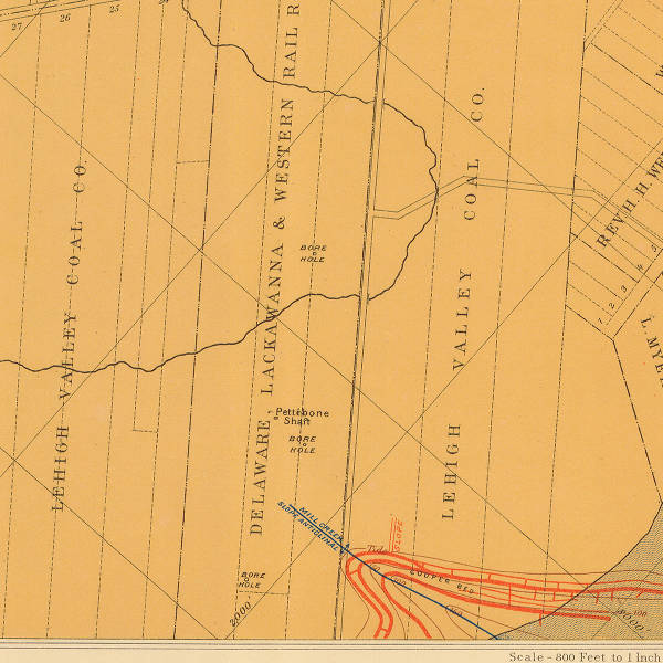
1888 2nd Pa Geo Survey
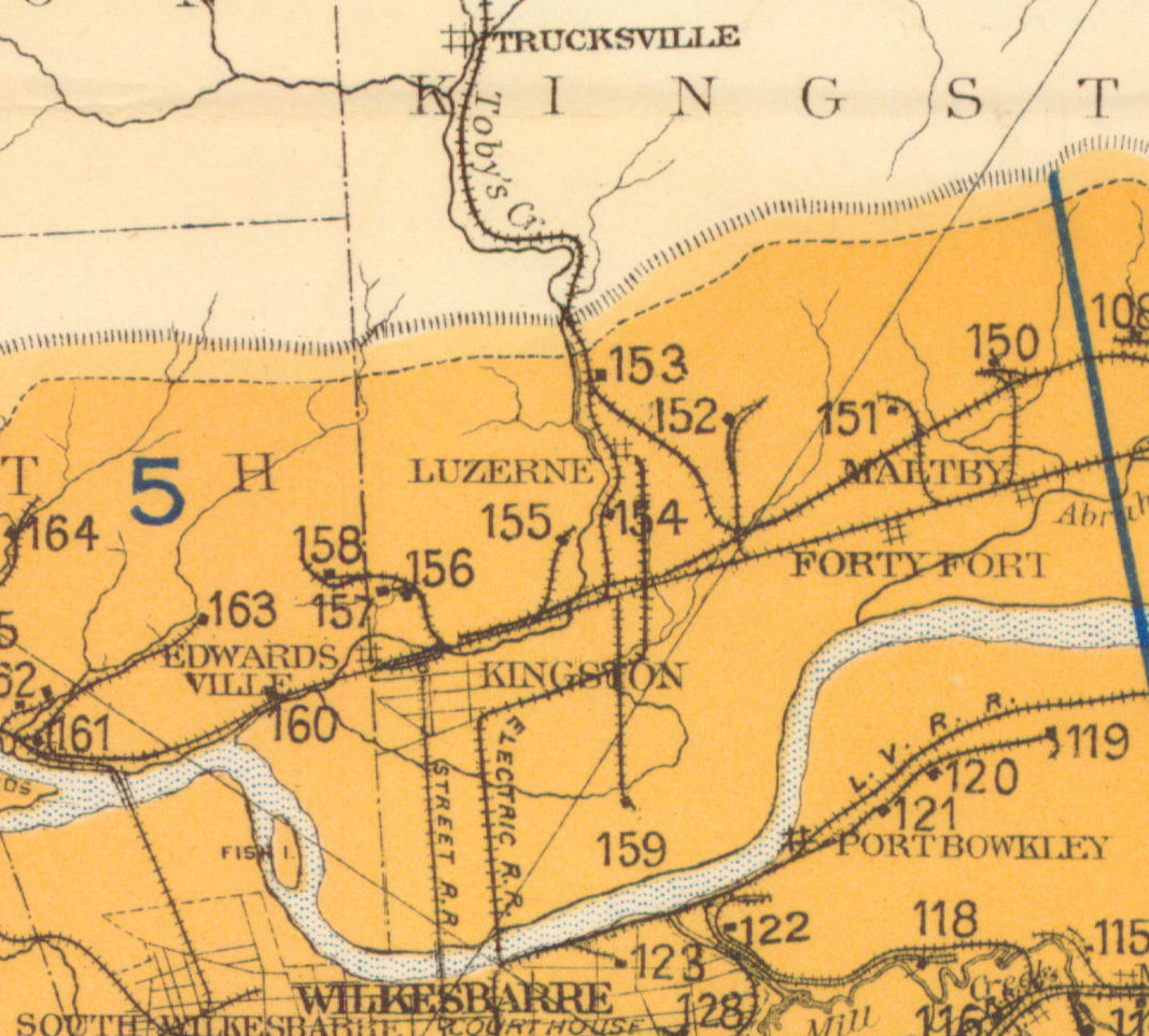
1890 Northern Field (159) PSU
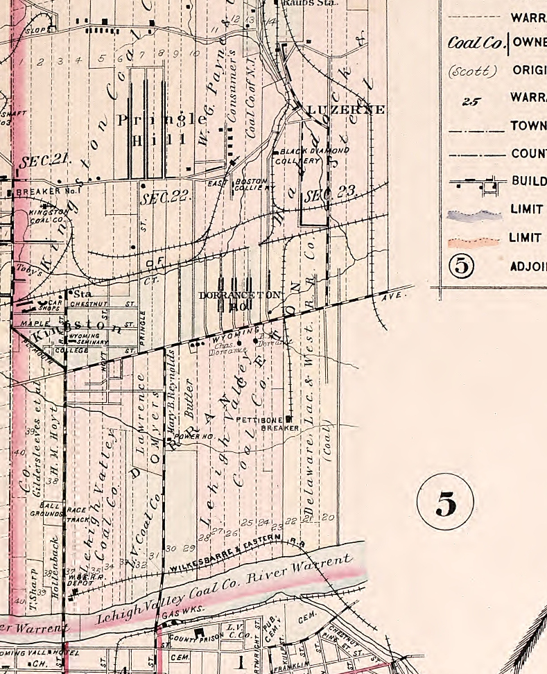
1894 Baist Atlas Wyoming and Lackawanna Valley Plate 3
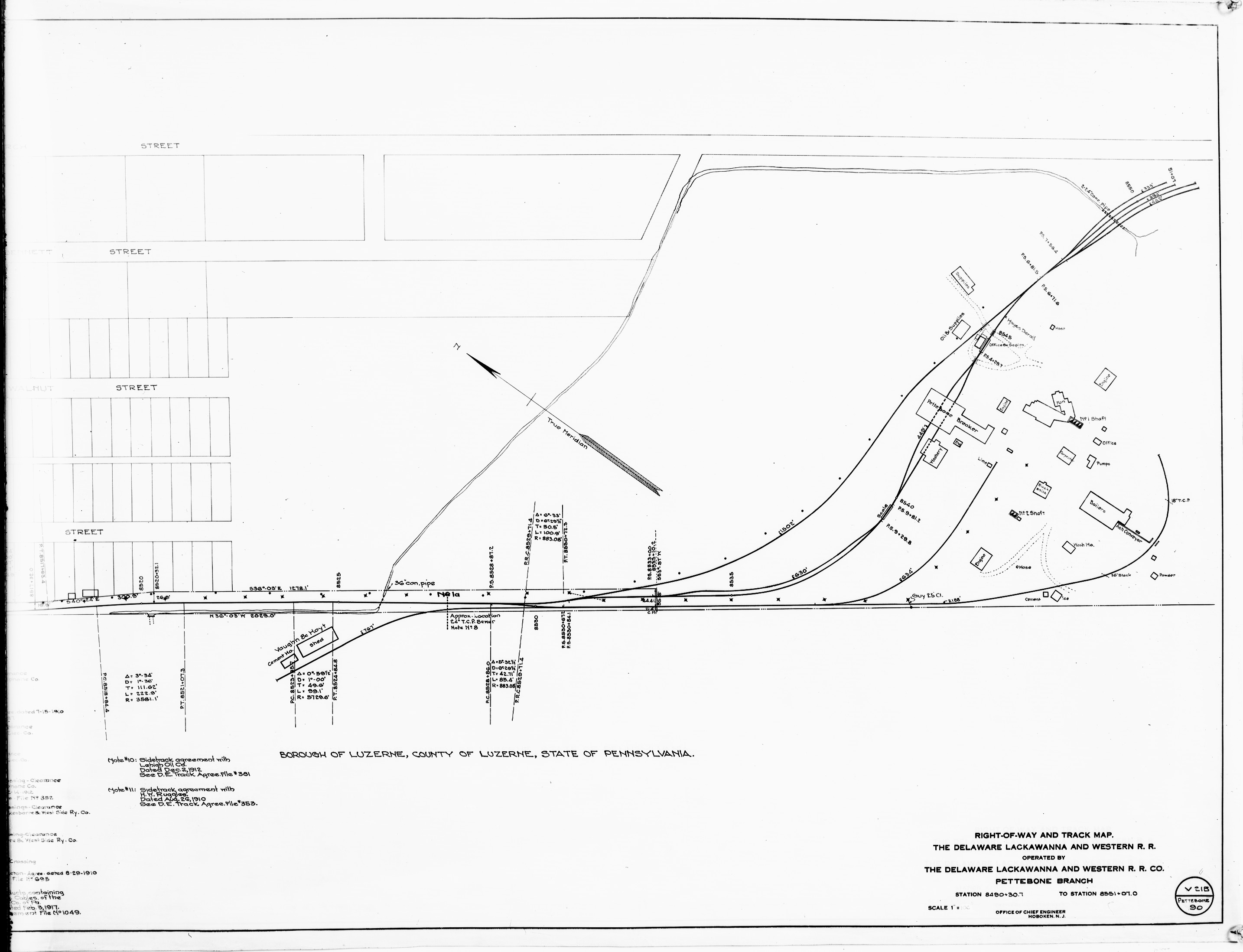
1918 DLW v21b m90 Steamtown NHS-B2672
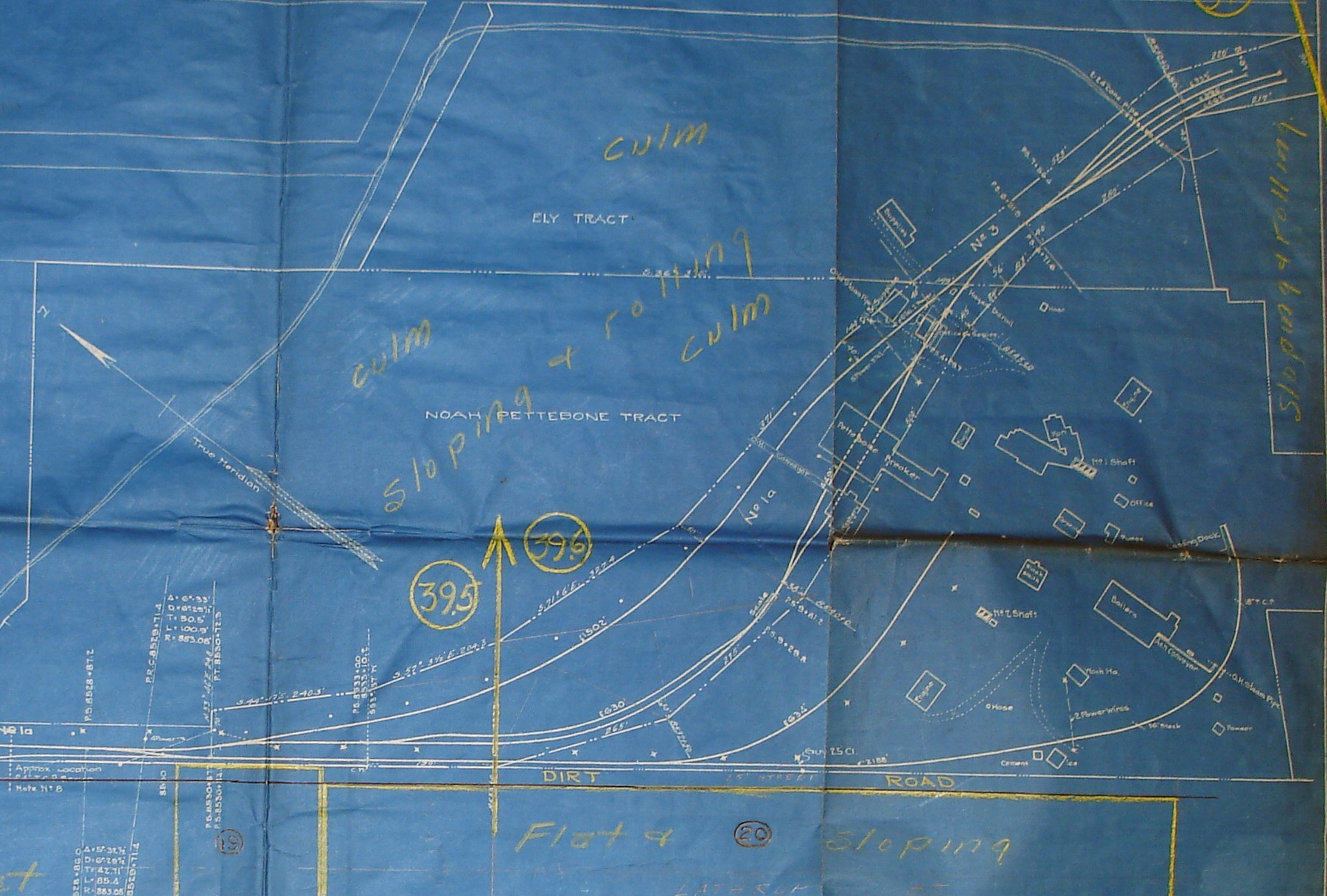
1918 DLW v21b m90
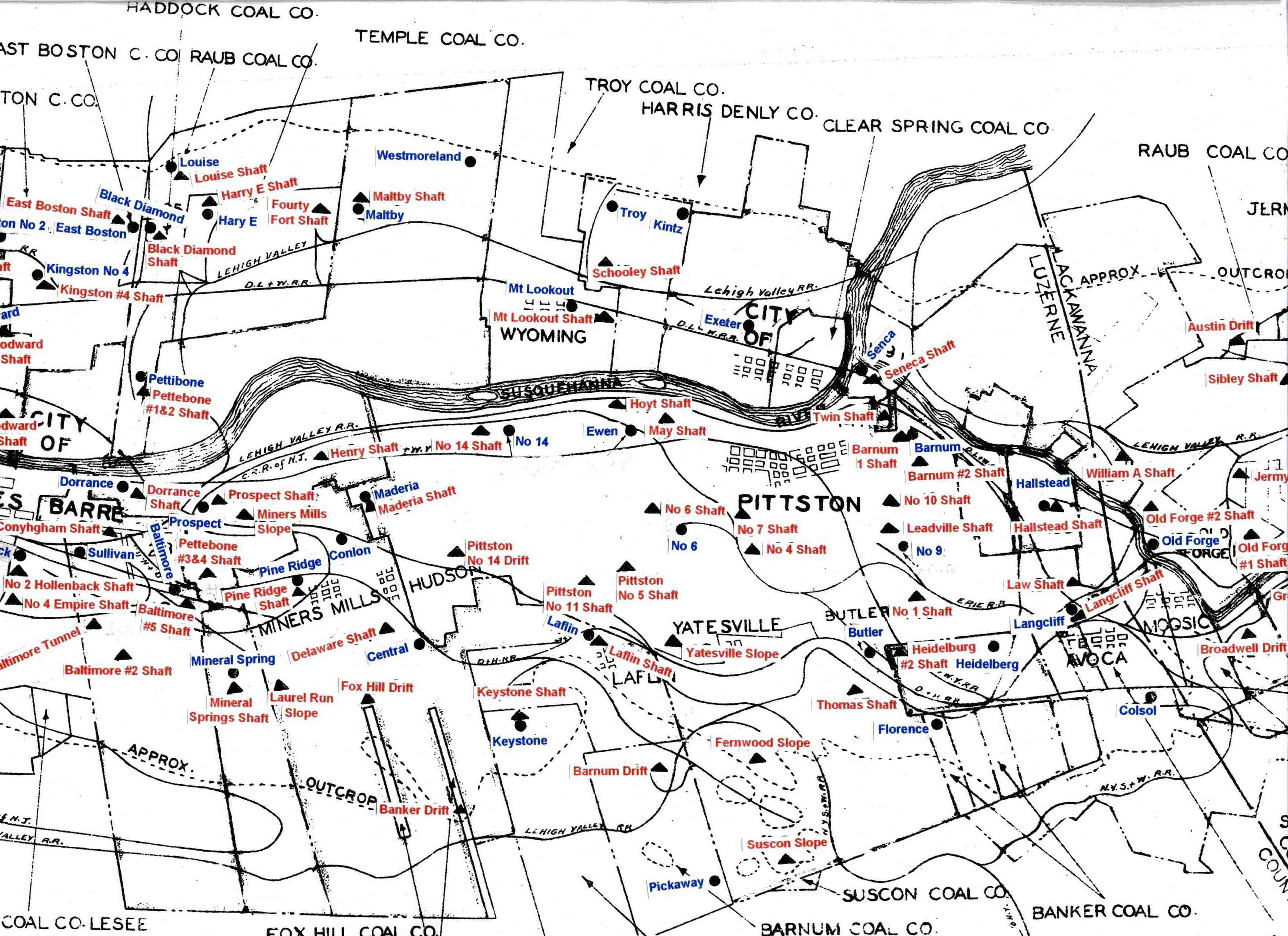
1930 Pittston Co Map Part 2
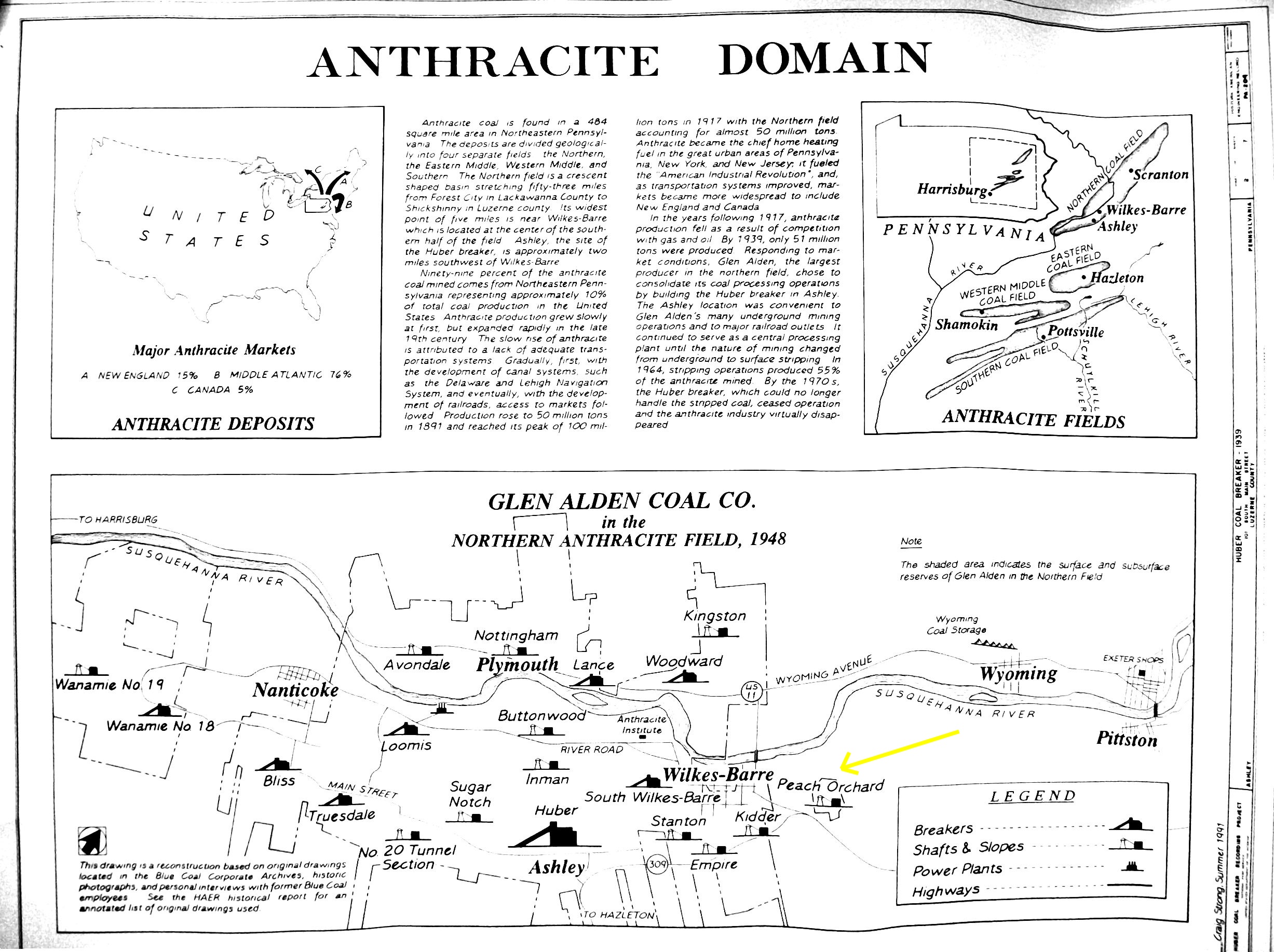
1948 Glen Alden Map
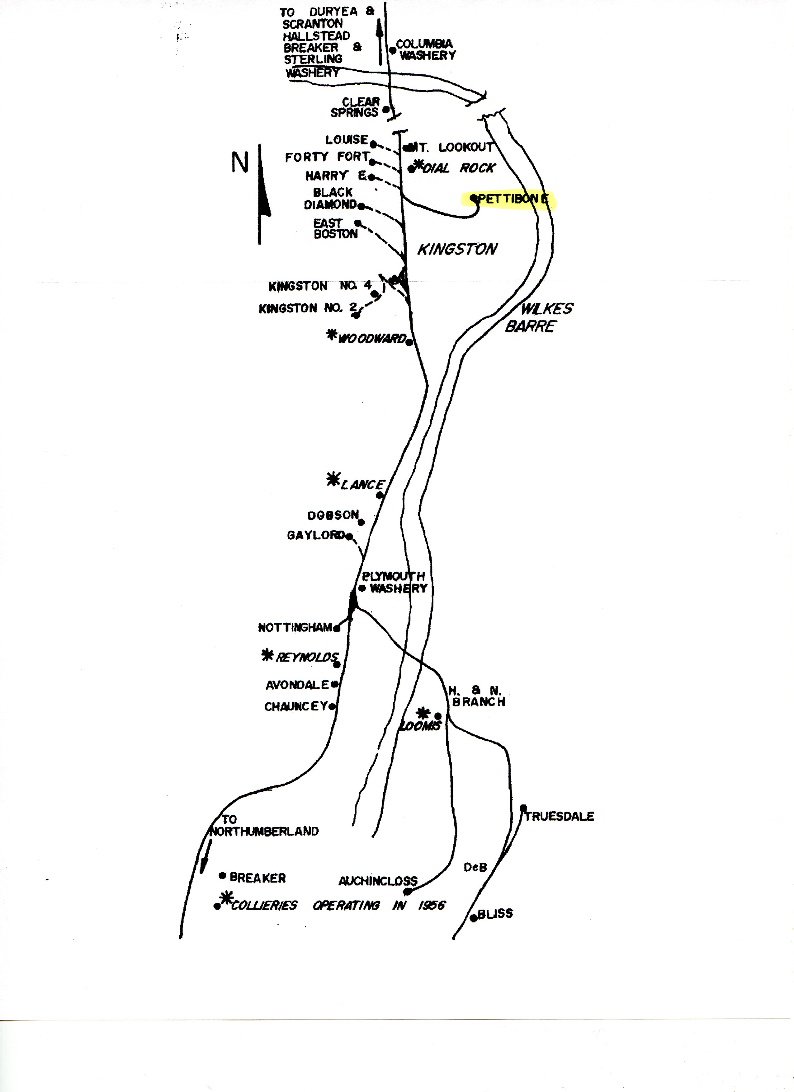
DLW Coal Operations
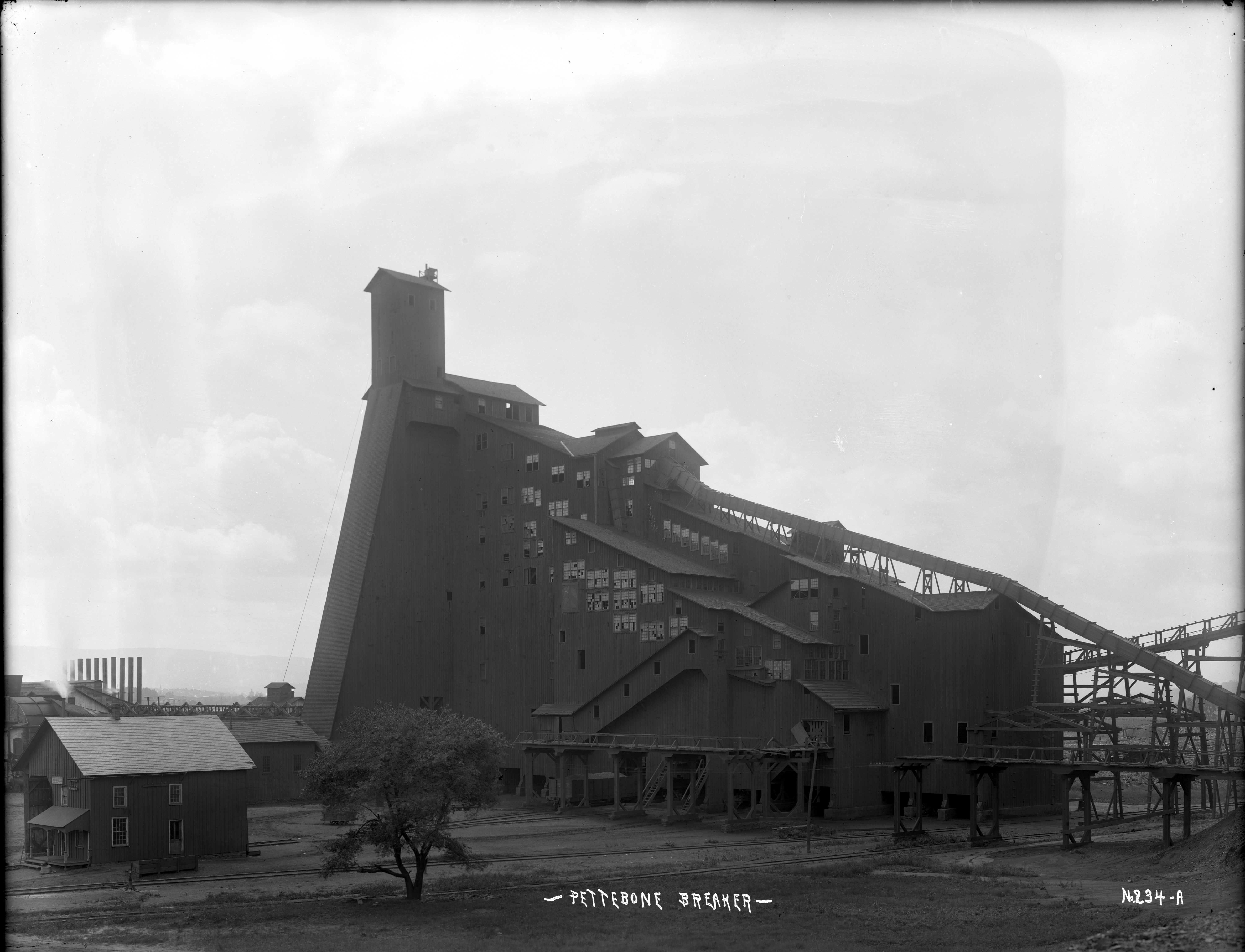
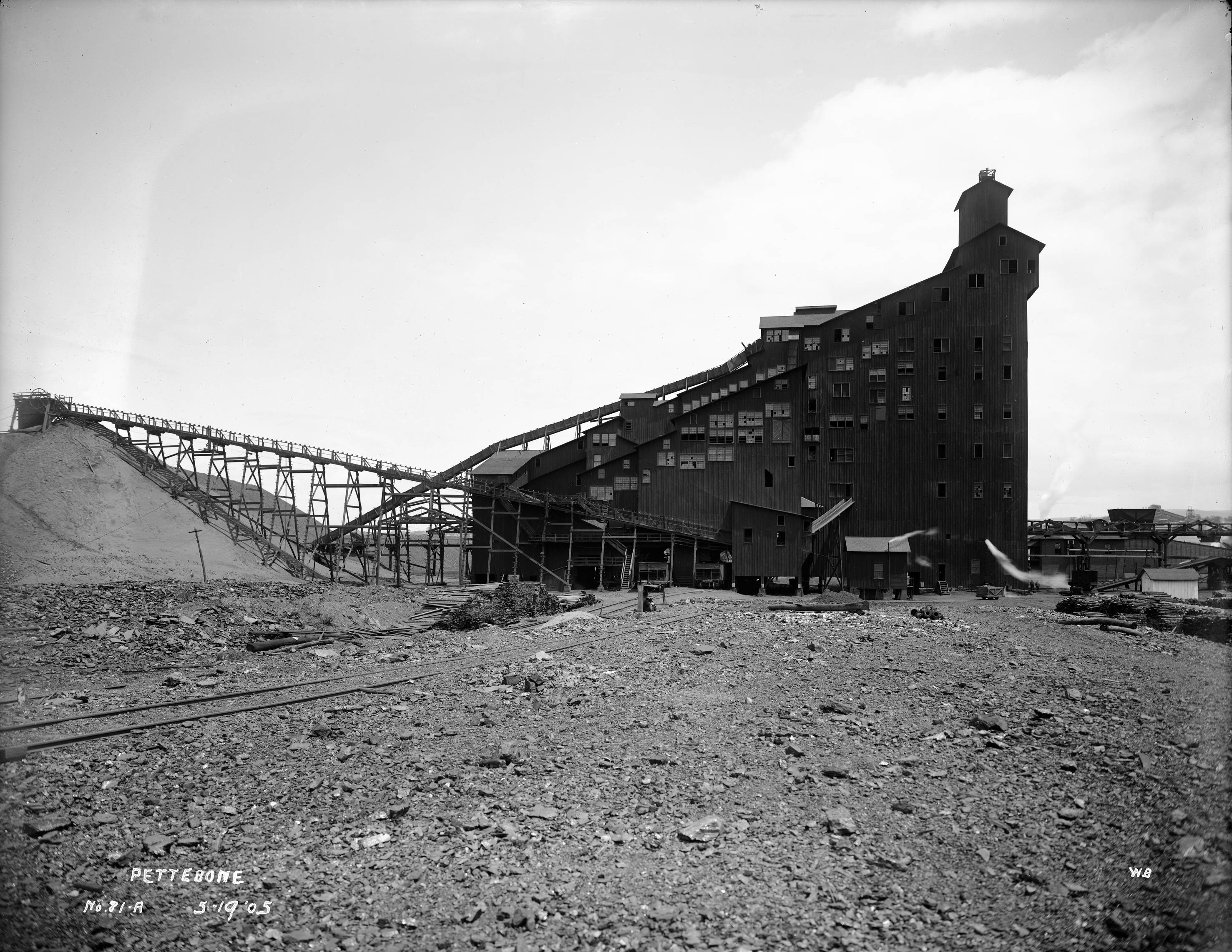
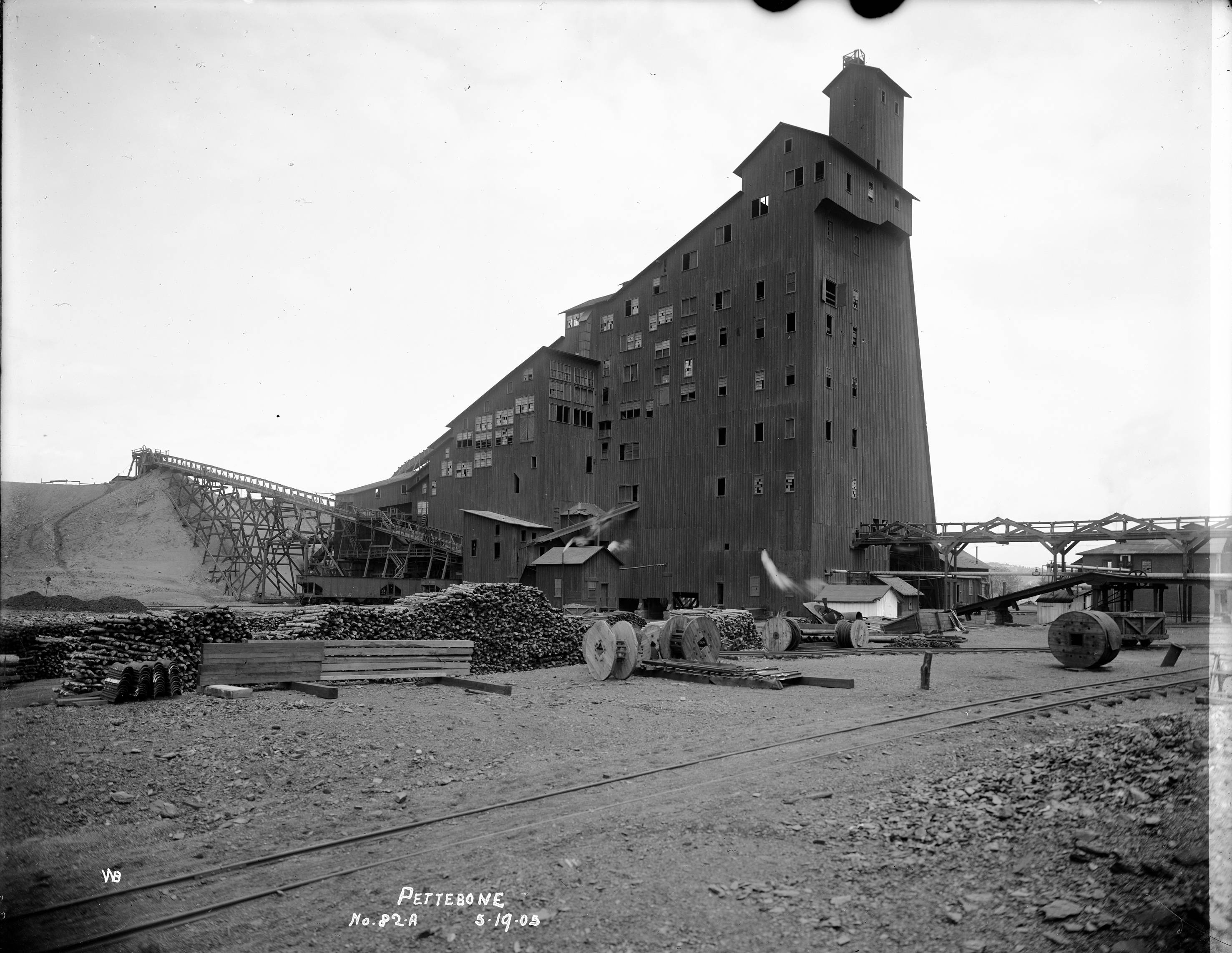
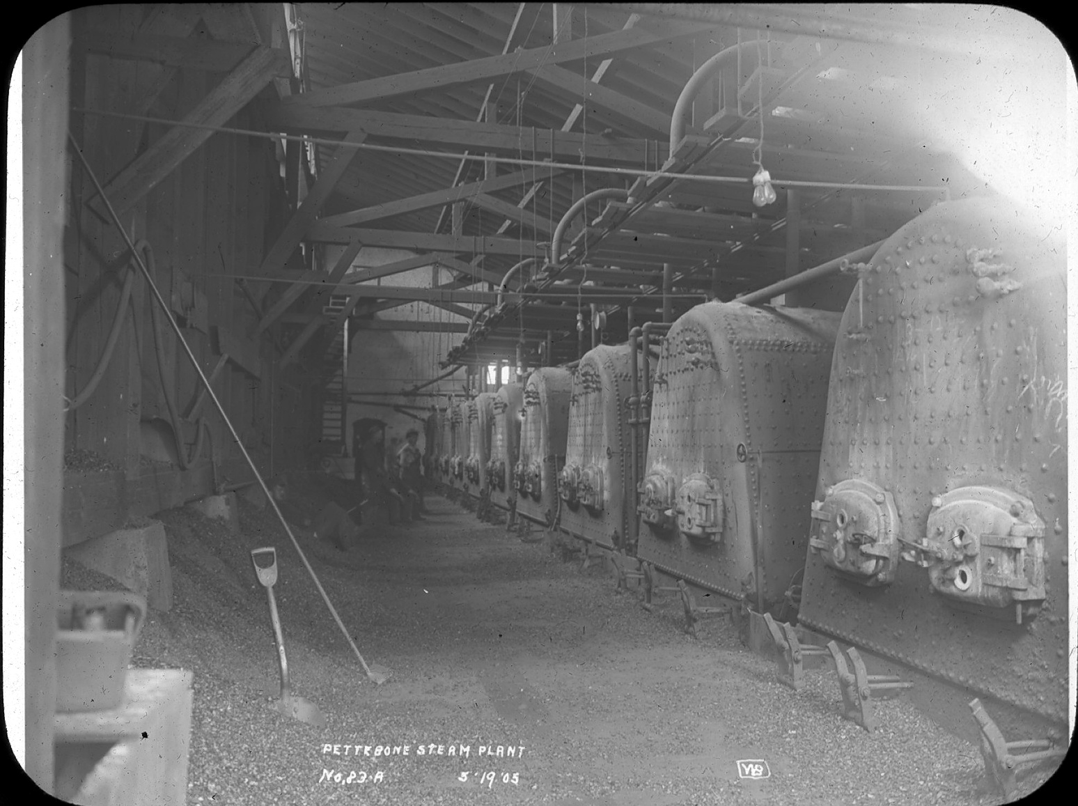
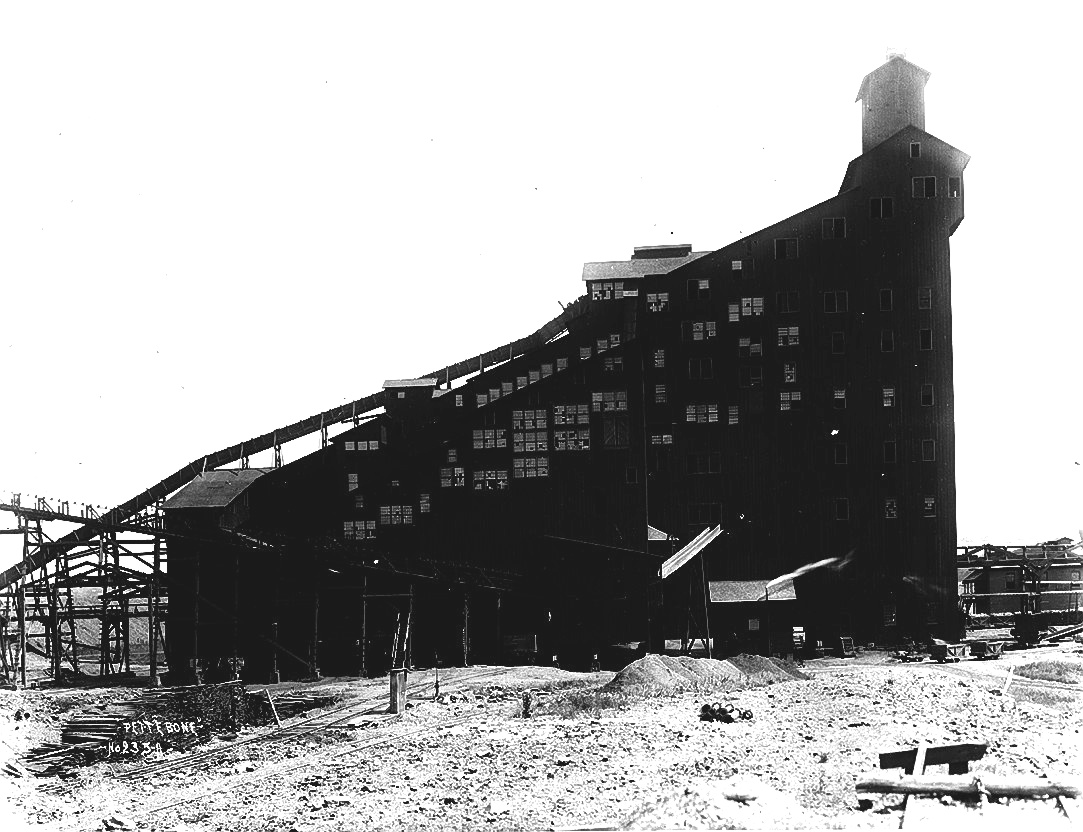
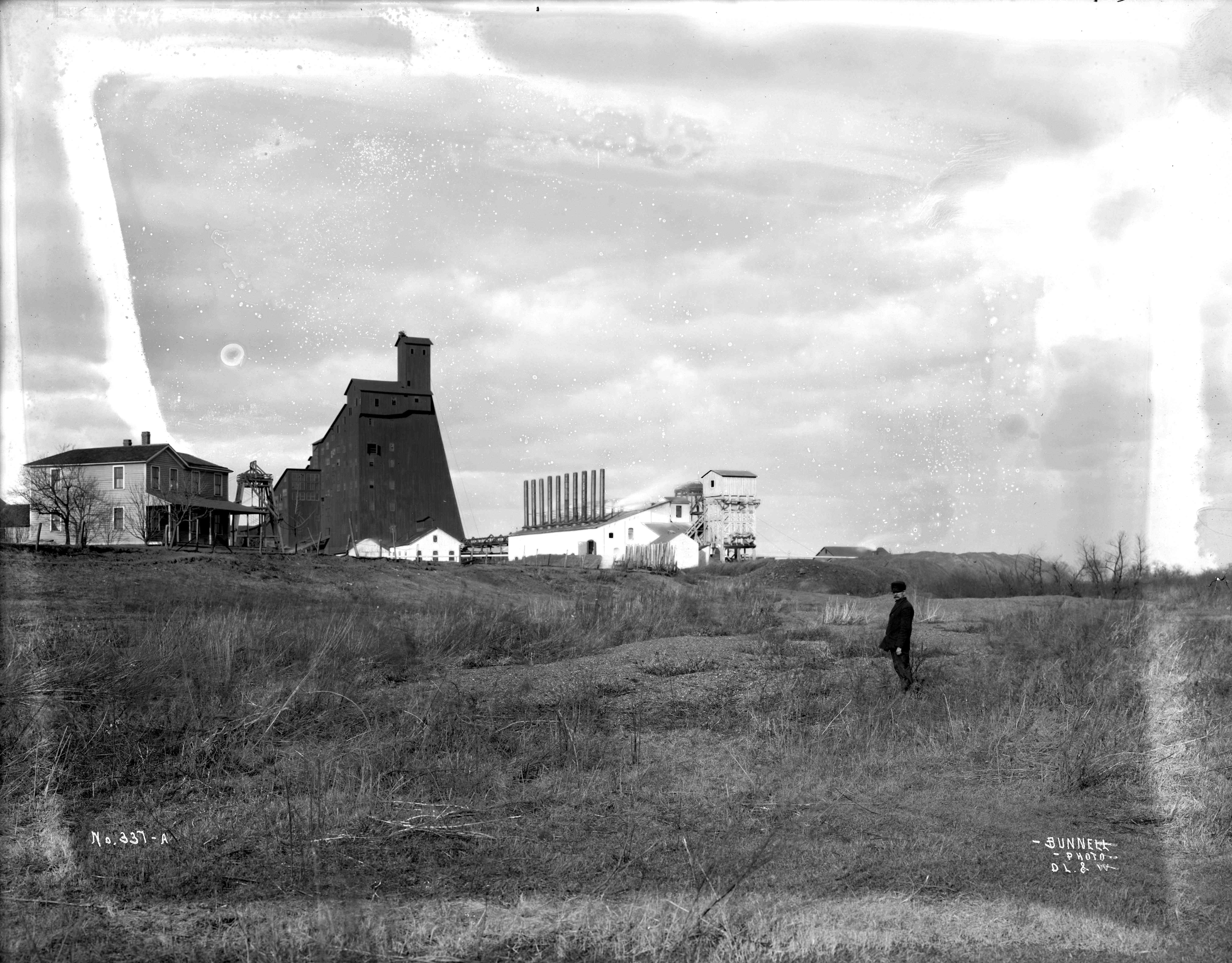
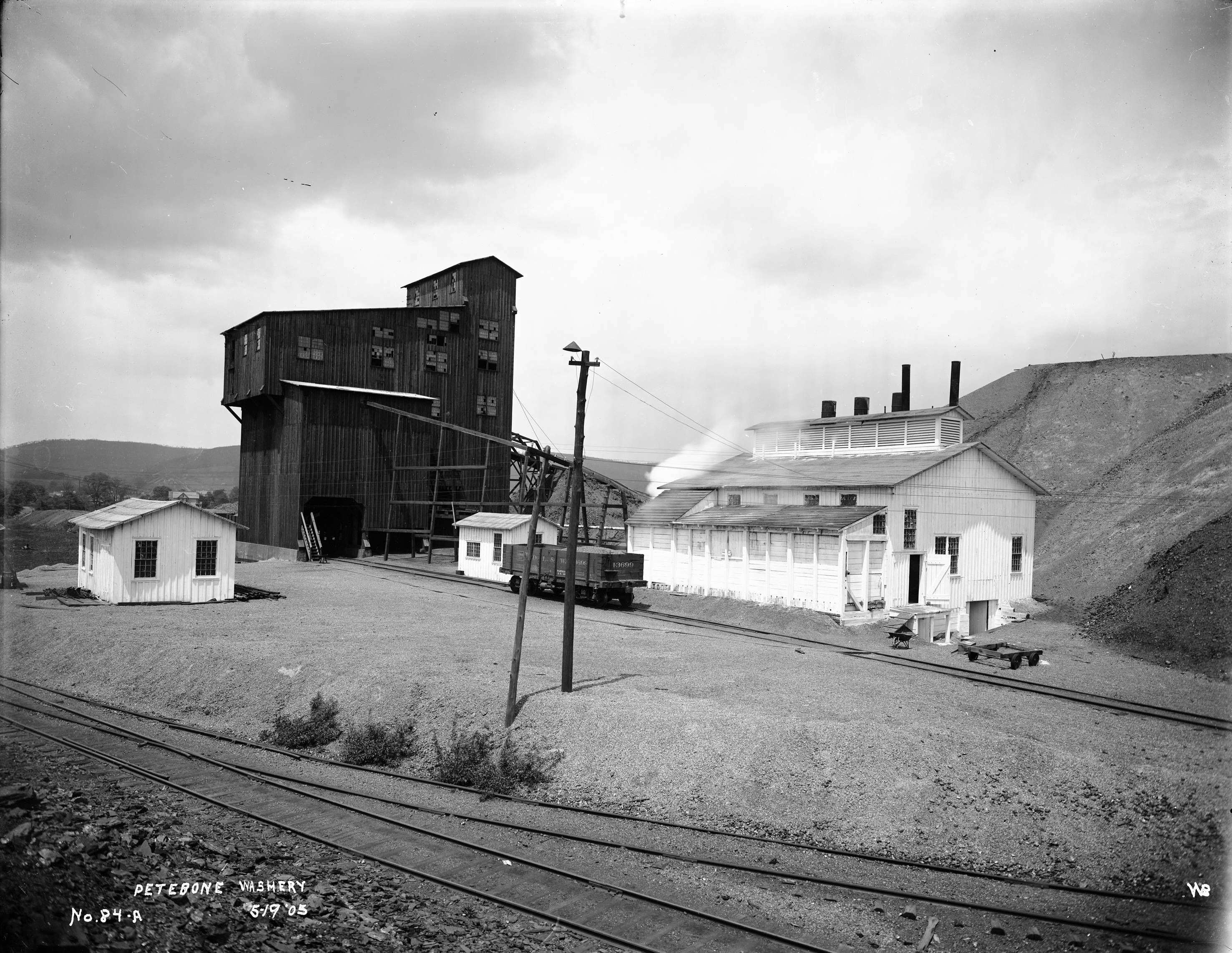
Period Photos
7 photos
7 photos
7 photos
7 photos
7 photos
7 photos
7 photos
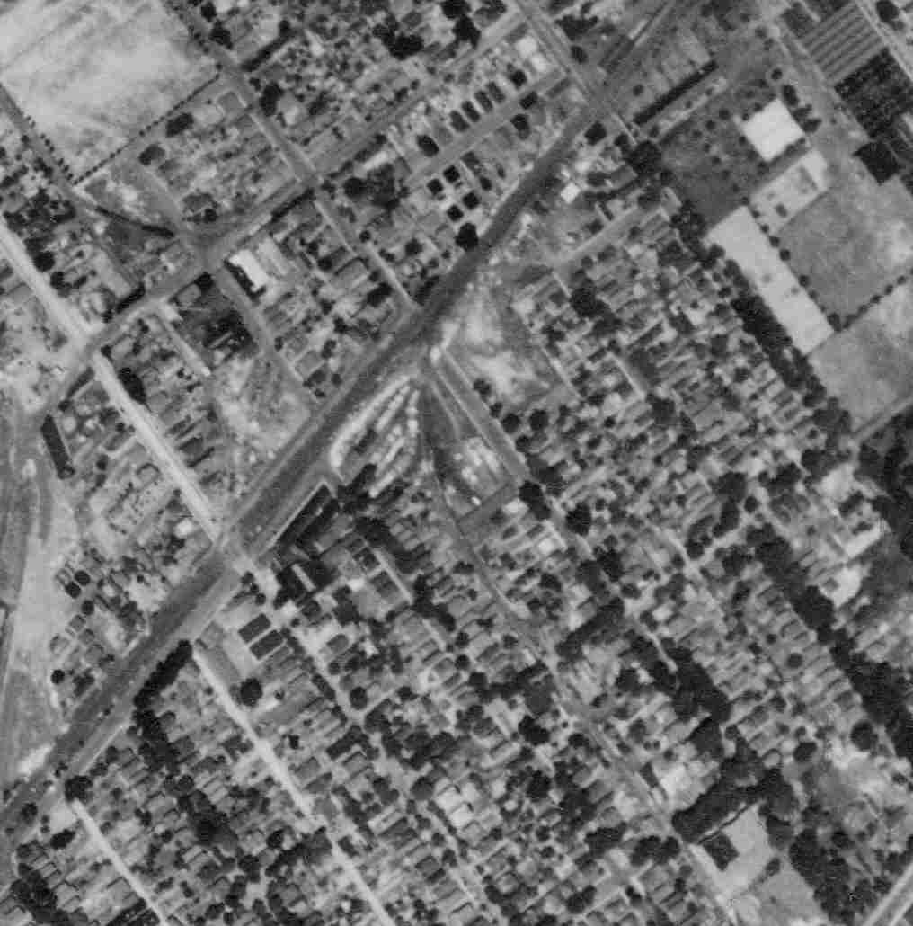
Penn Pilot and Aerial Photos
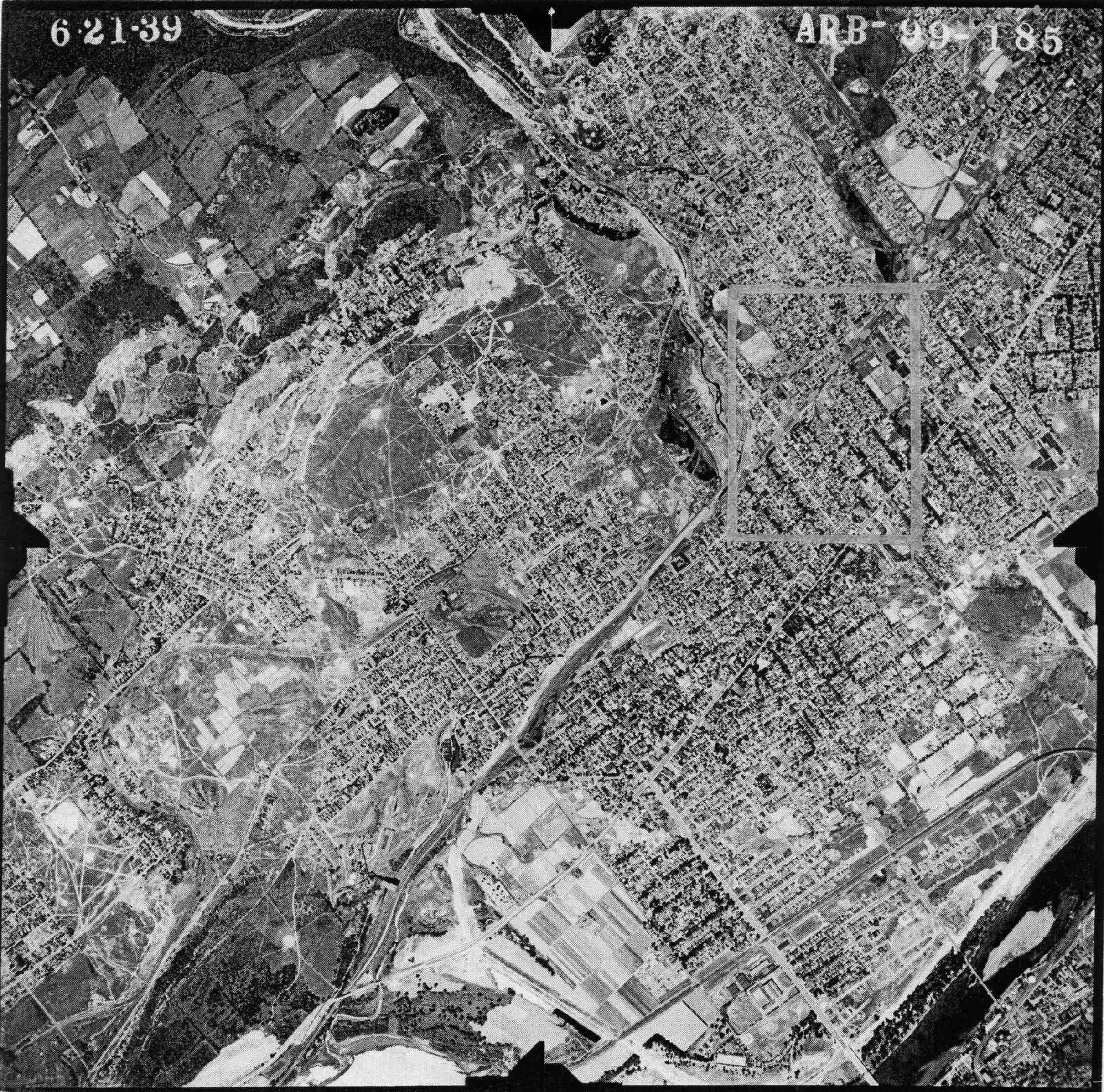
99_185 date 062139 close-up
99_185 date 062139
Mine Inspections
Inspector Narratives
Pettebone No6 aka Peach Orchard Mine
City & Sanborn Maps
1913 Wilkes-Barre Map
Peach Orchard
News, History & Articles
1902-04-07 NYT Miners Continue Strike
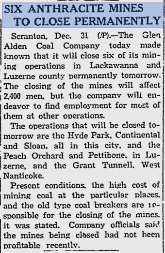
1930-12-31 Pettebone to Close - Reading Eagle
Modern Photos & Google Earth
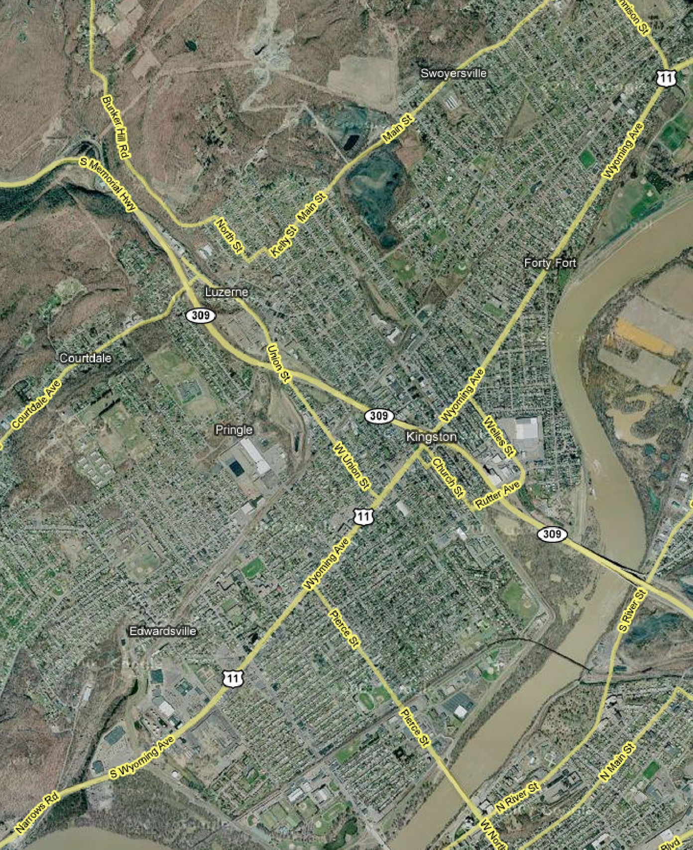
Google Earth
Other Materials
1915 PA Public Service Commission - Bureau of Engineering
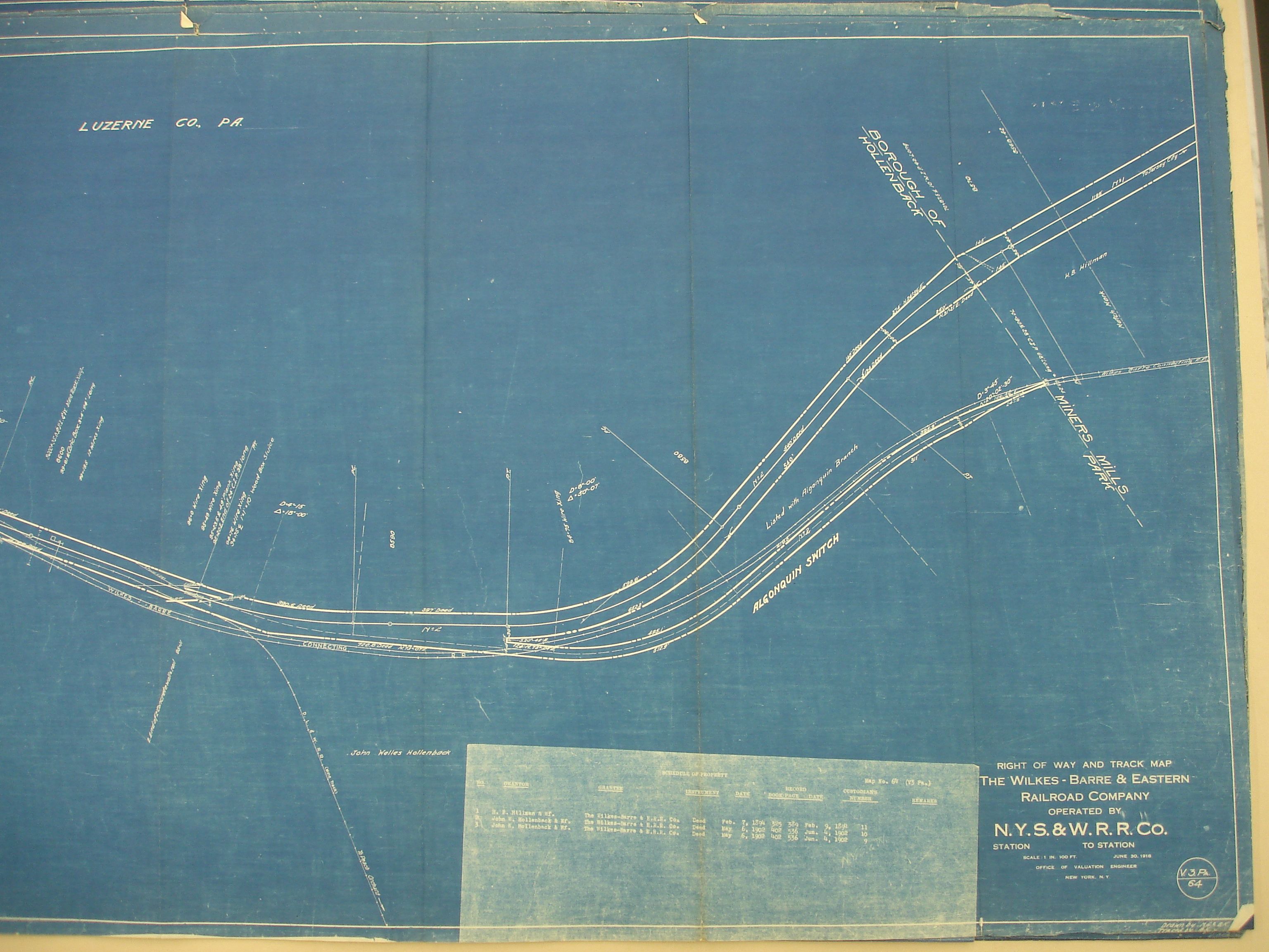
1916 WBE (NYSW) v3 m64 right
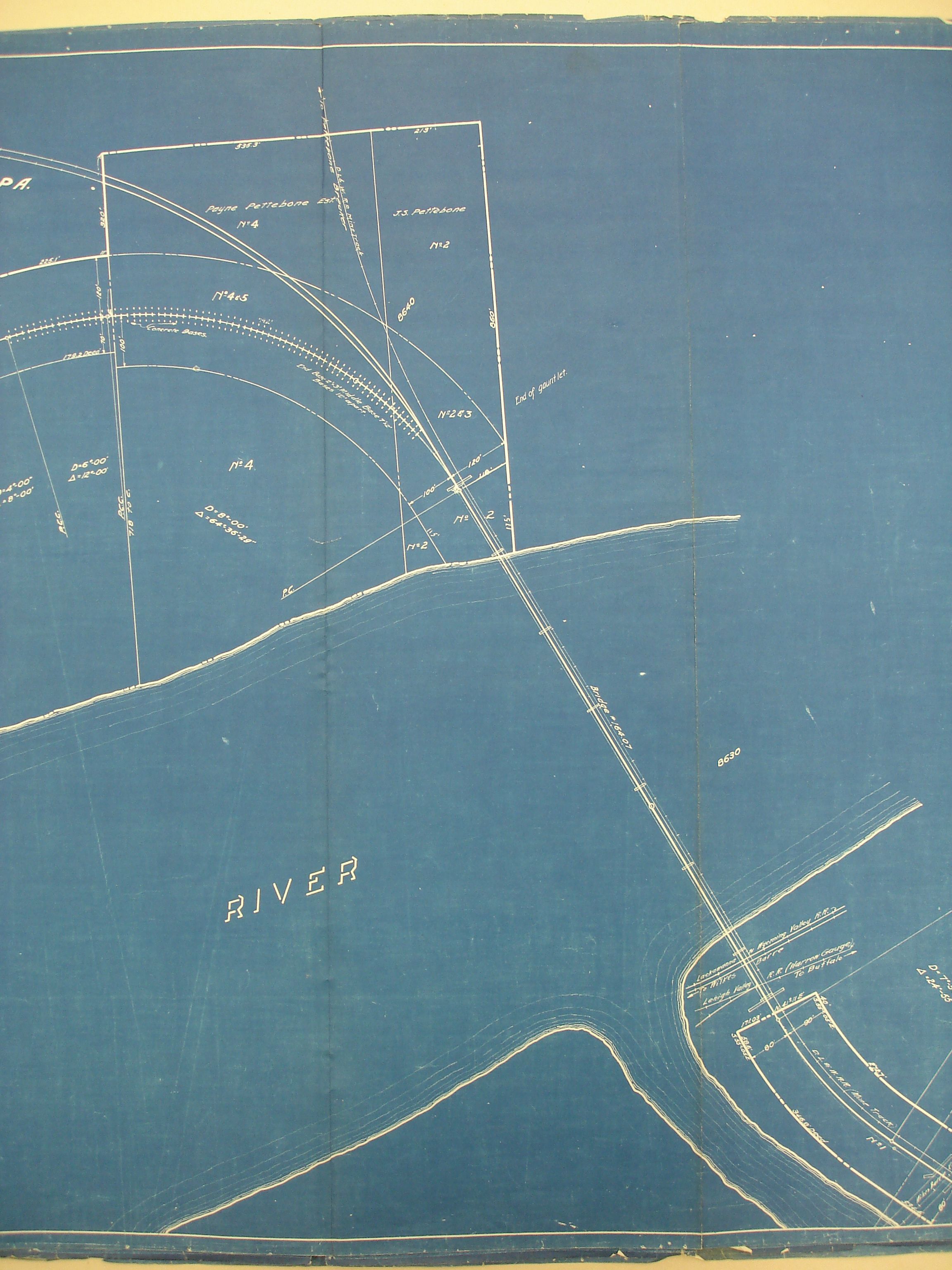
1916 WBE (NYSW) v3 m65 middle
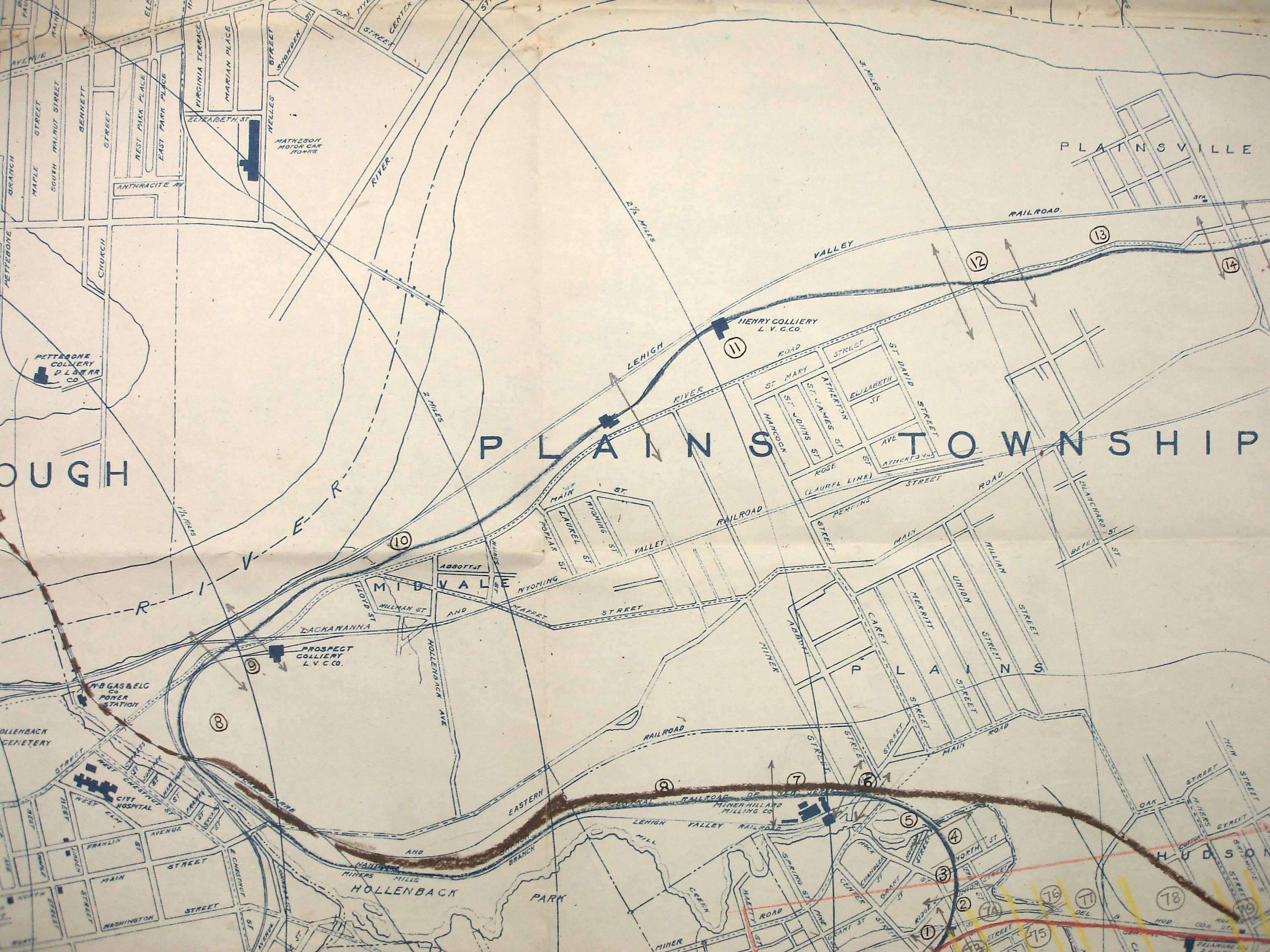
1939 Shepherd Map -connection between Pettebone and Peach Orchard
Comments and Feedback