Back
Baltimore
Area & Railroad Maps
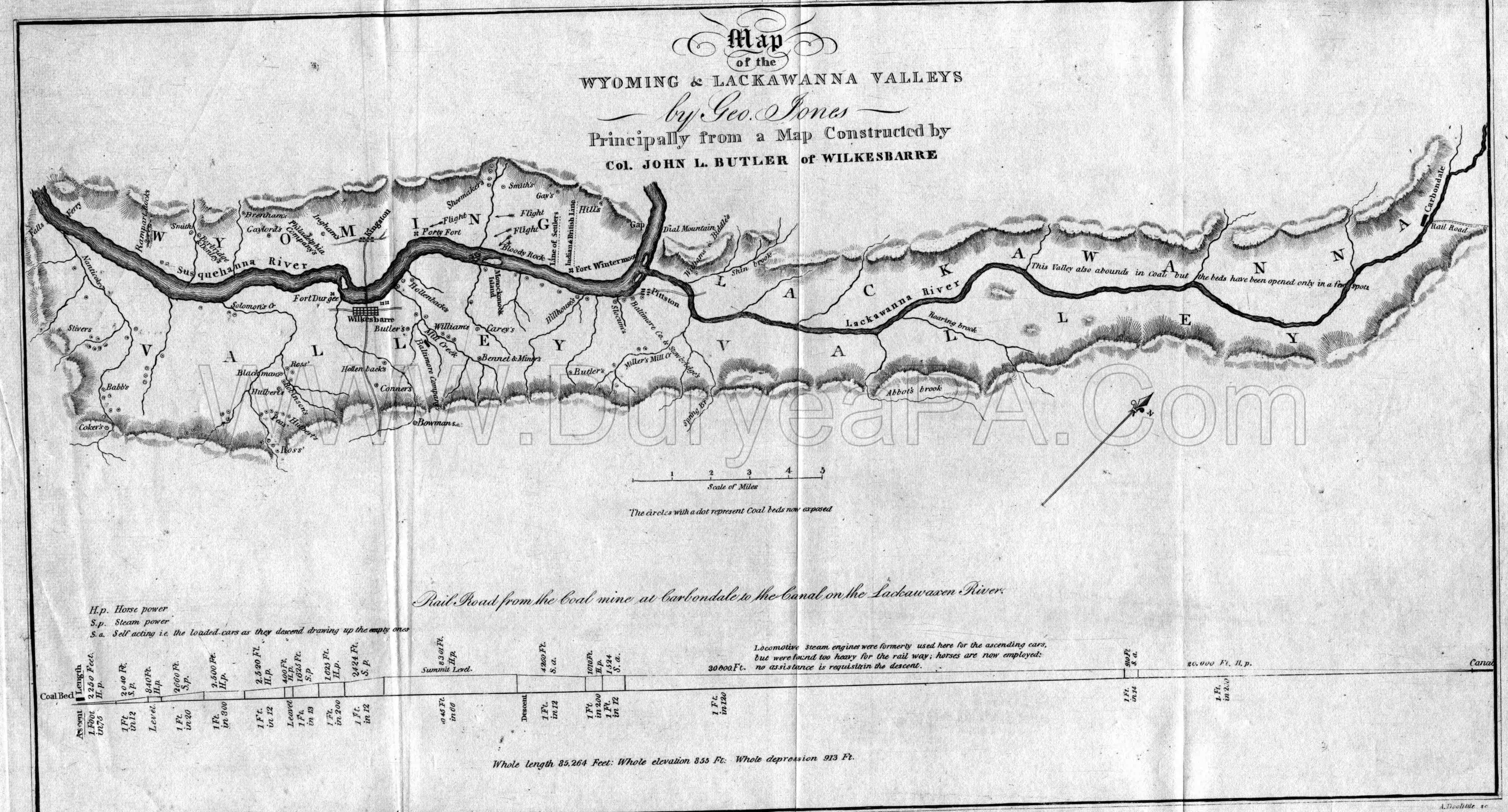
1830 Northern field map
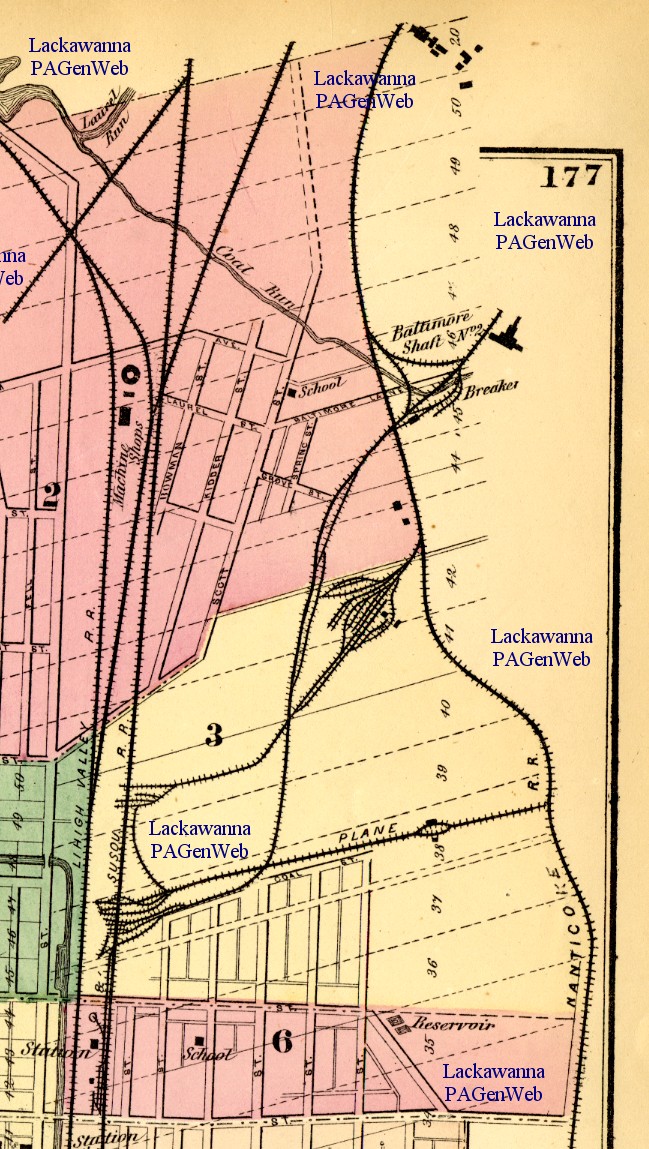
1873 DG Beers
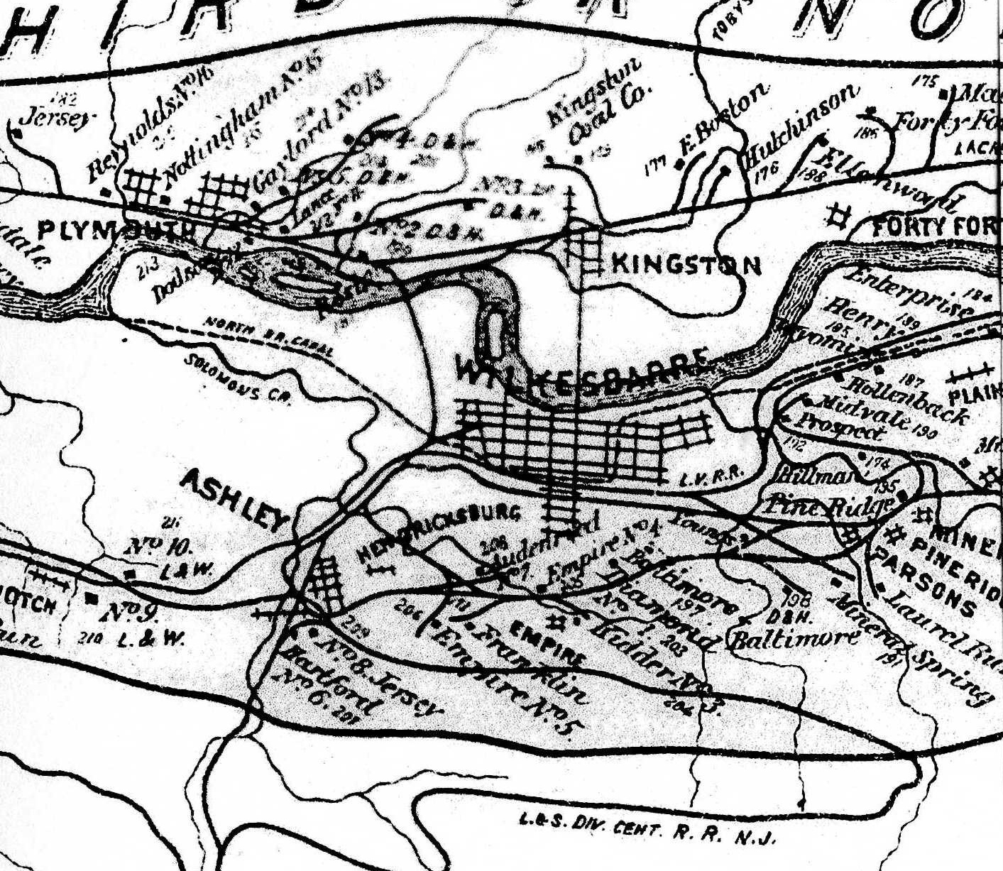
1878 Mine Inspector Map
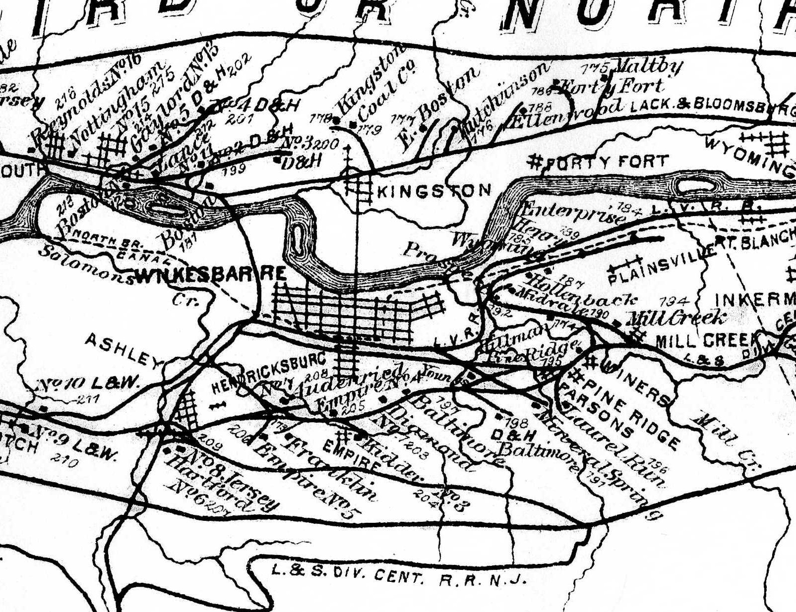
1879 Mine Inspector Map
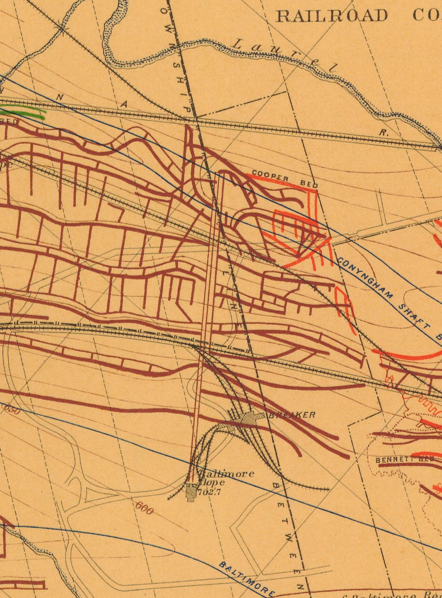
1884 2nd Pa Geo Survey sheet VIII
1890 Baltimore Slope (126) Northern Field PSU
1890 Baltimore Tunnel (127) Northern Field PSU
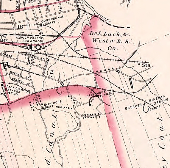
1894 Baist Atlas Wyoming and Lackawanna Valley Plate 3
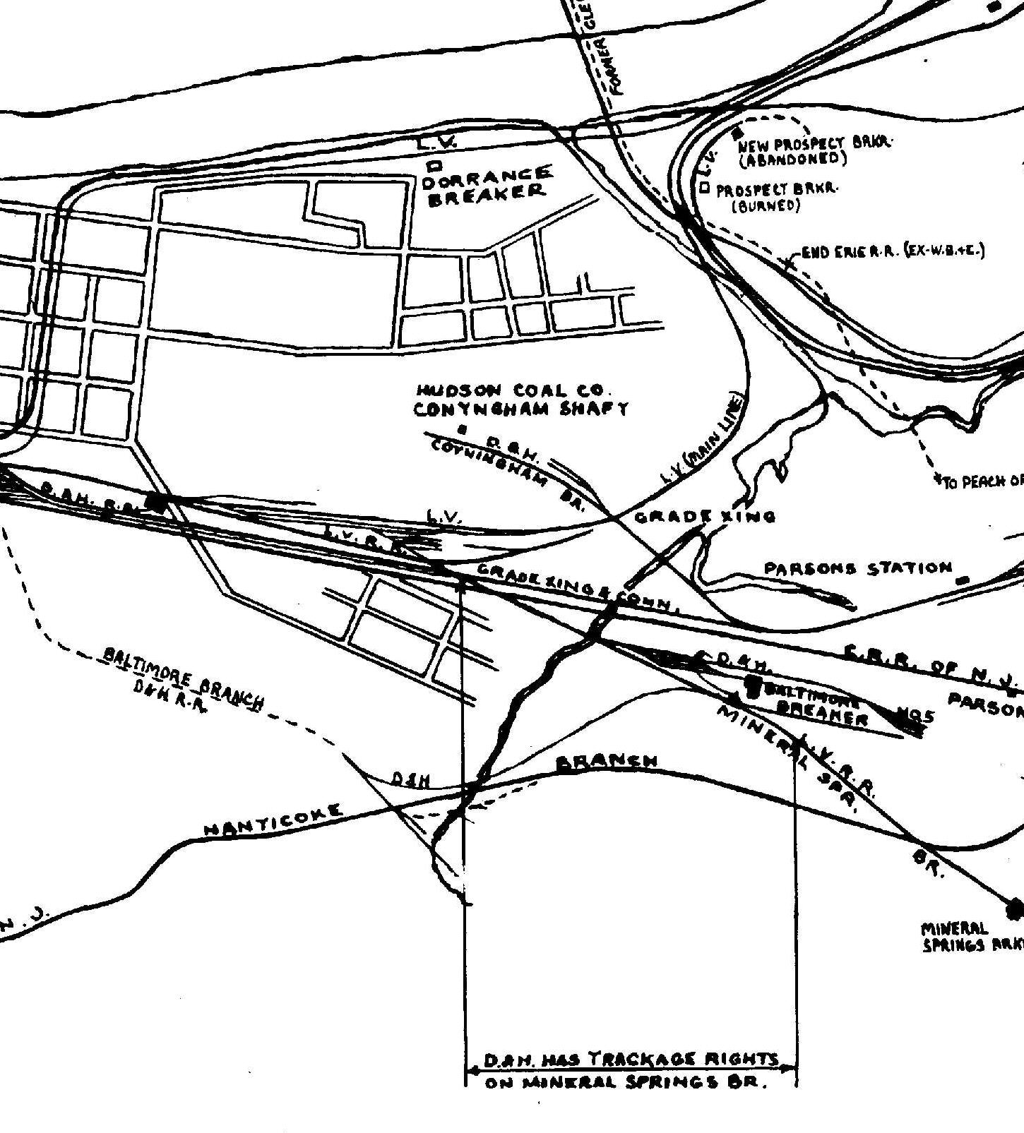
1918 DH v1a m01a Baltimore Tunnel Brkr
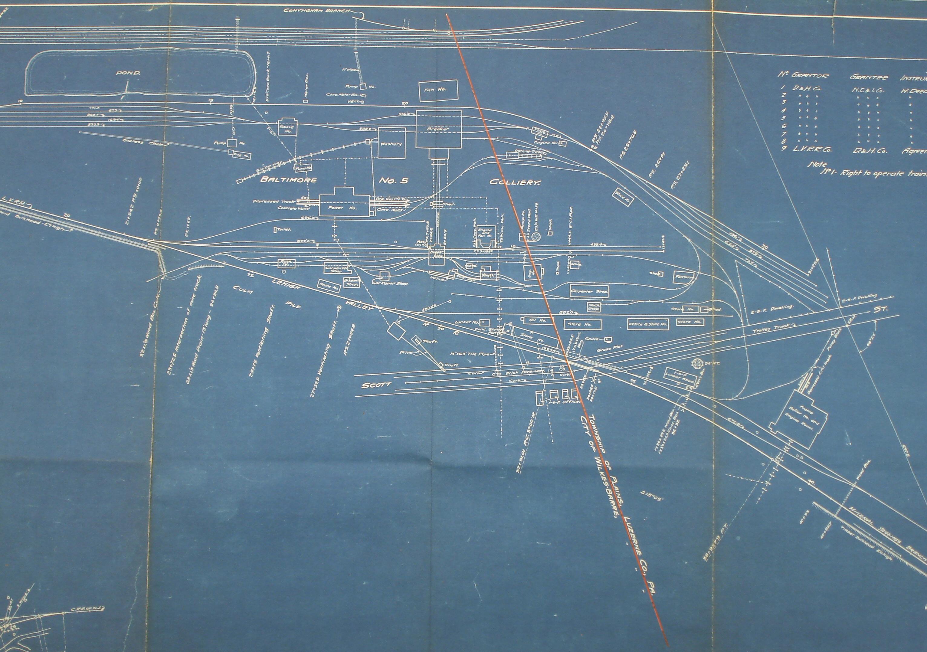
1918 DH v1a m02a Baltimore Brkr
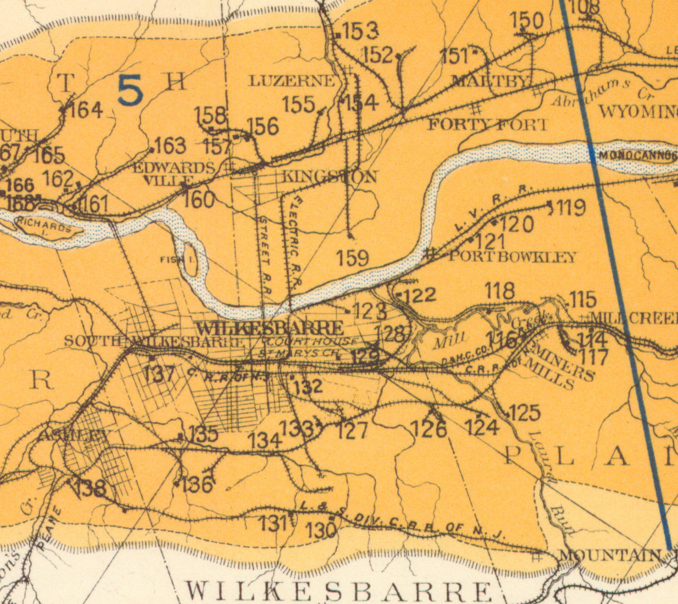
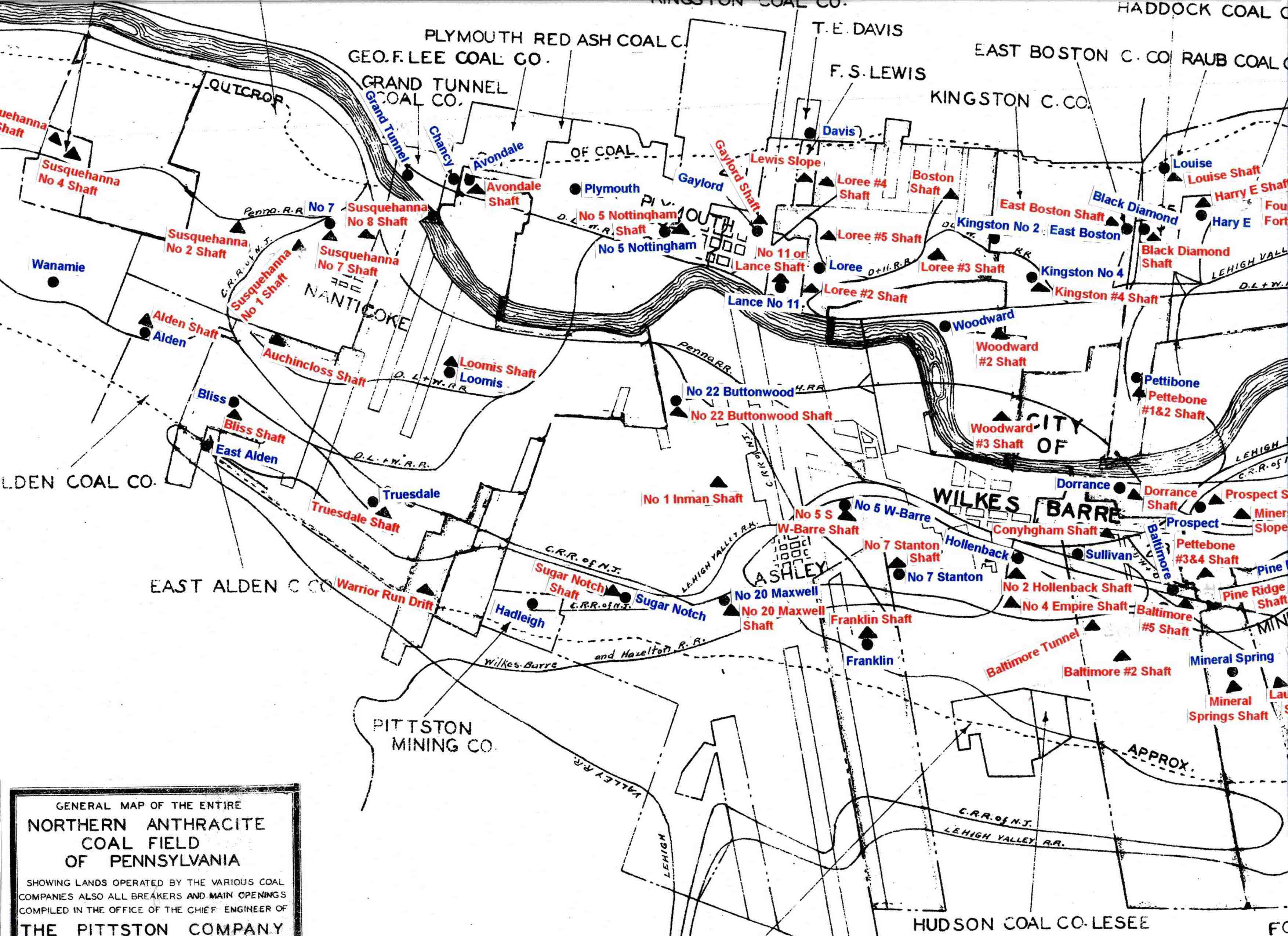
1930 Pittston Co Map
1939 Shepard map
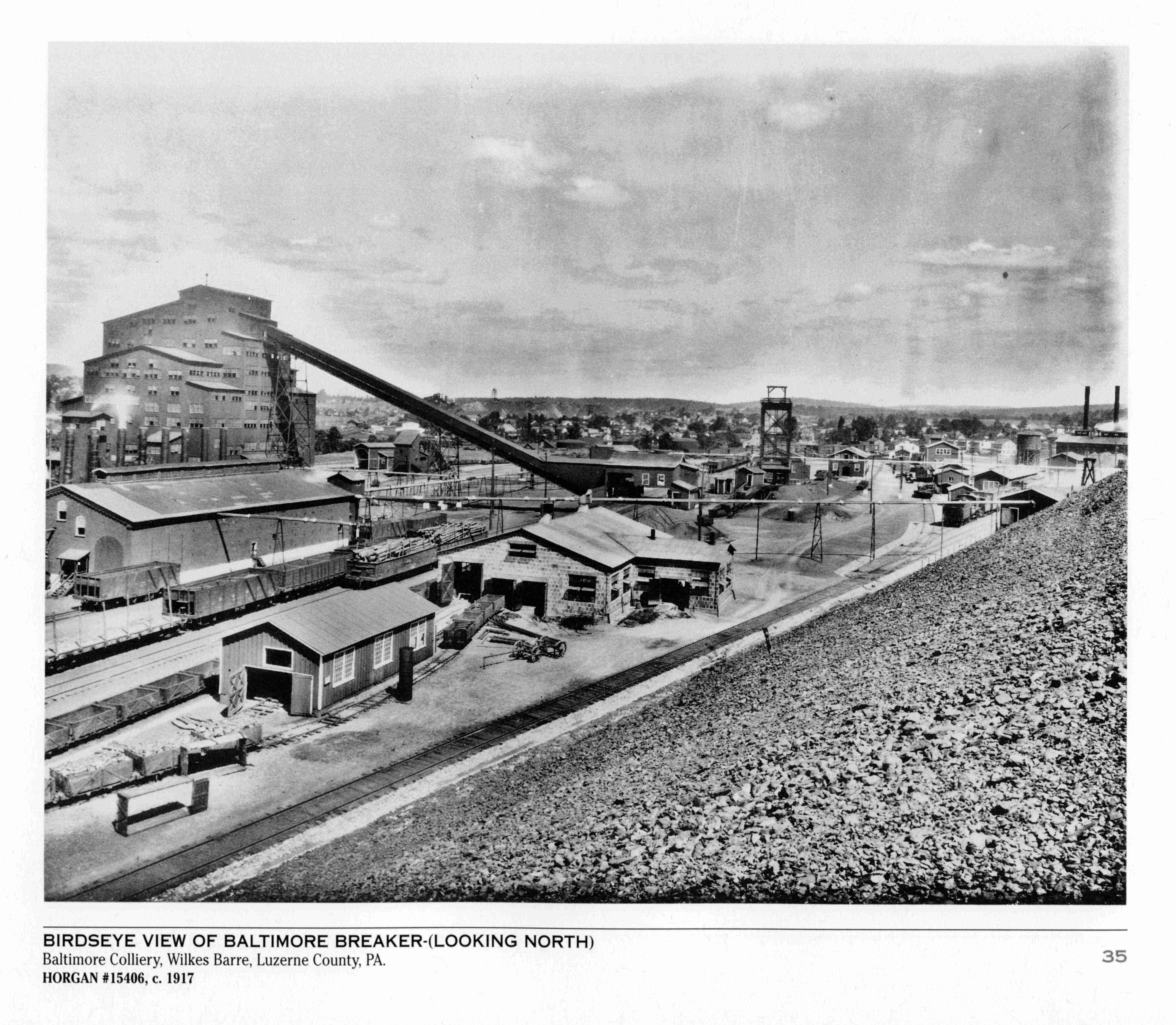
Period Photos
Photo
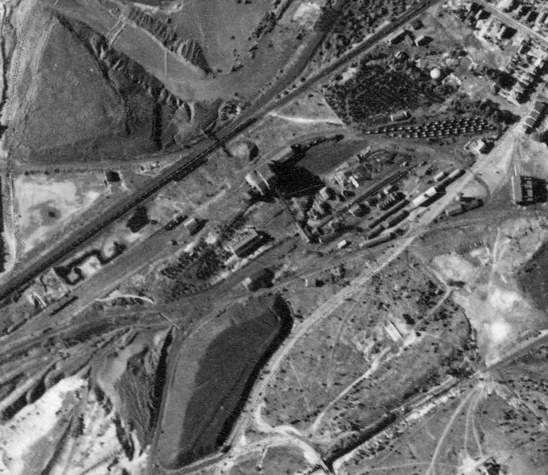
Penn Pilot and Aerial Photos
107_66 date 070239 close-up
107_66 date 070239
Mine Inspections
Inspector Narratives
City & Sanborn Maps
1913 Wilkes-Barre map 09
Wilkes-Barre 1910 vol 1 Sheet 36
Wilkes-Barre 1910 vol 1 Sheet 50
Wilkes-Barre 1910 vol 1 Sheet 68
News, History & Articles
1968-06-02 The Scrantonian
Modern Photos & Google Earth
Google Earth
Other Materials
1930 DH Coal Operations CY
Comments and Feedback