Back
Langcliffe
Area & Railroad Maps
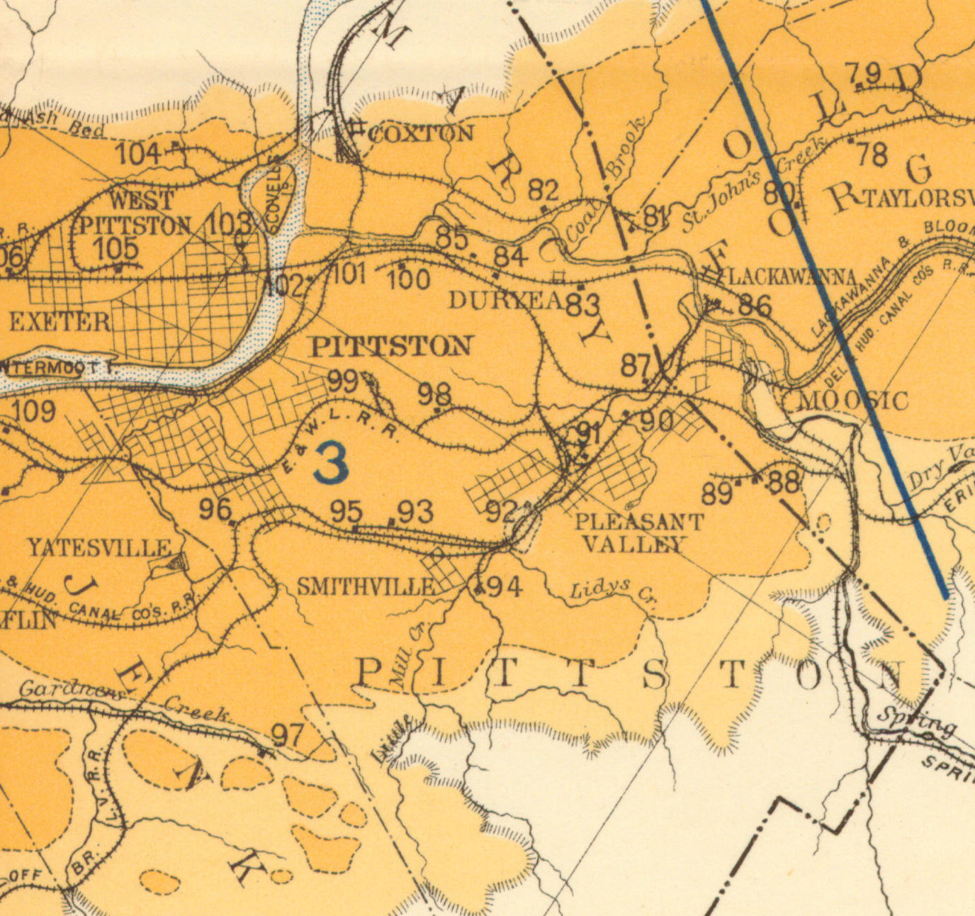
1890 Northern Field (90) PSU
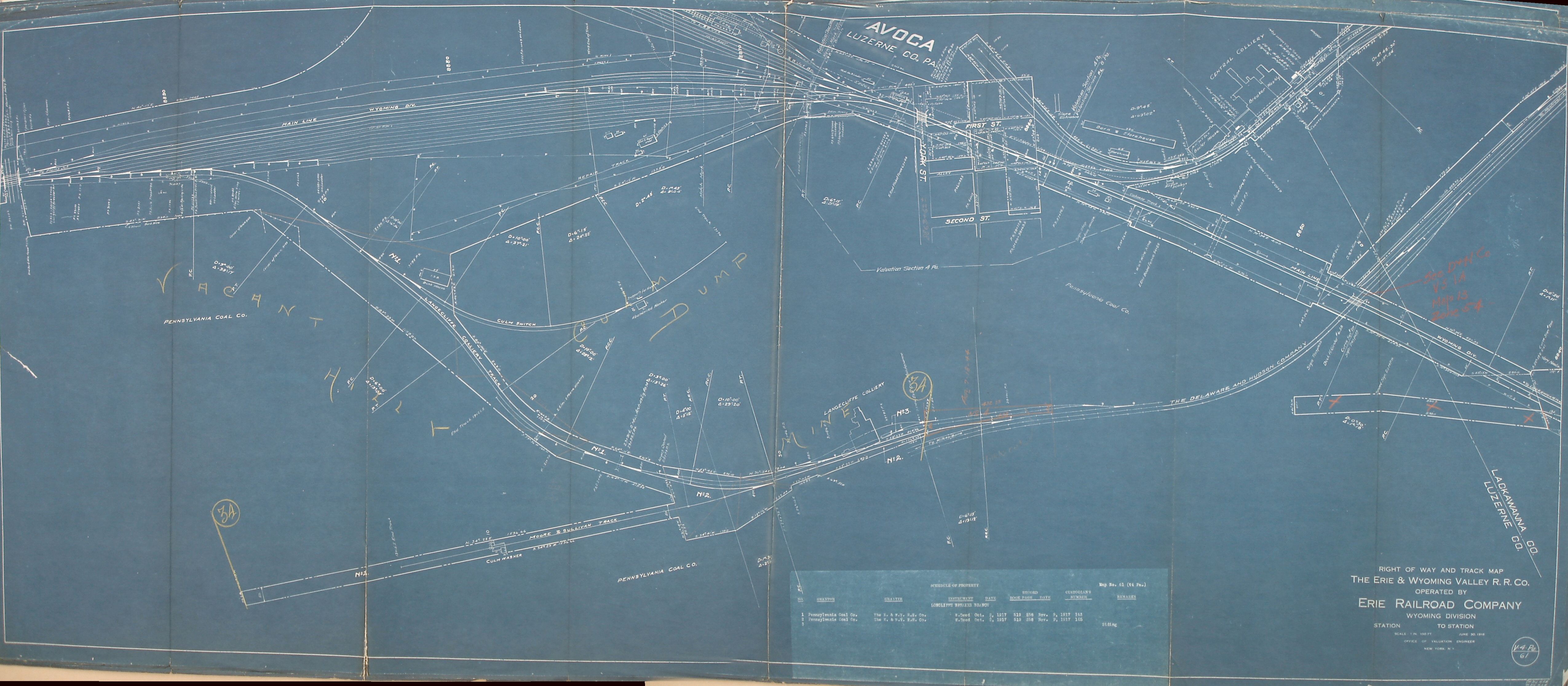
1918 Erie V4 Pa m61
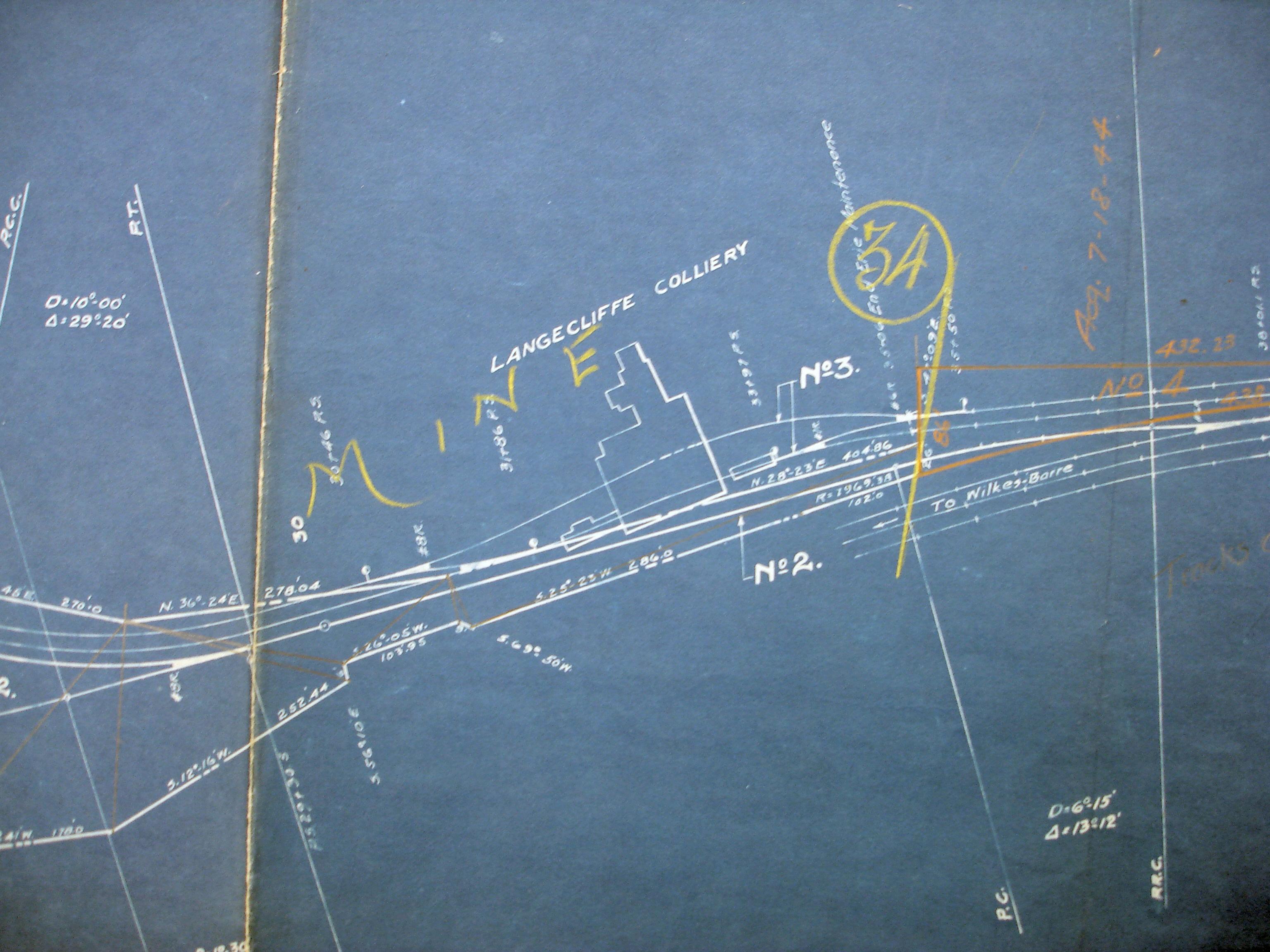
1918 Erie v4 Pa m61 close up
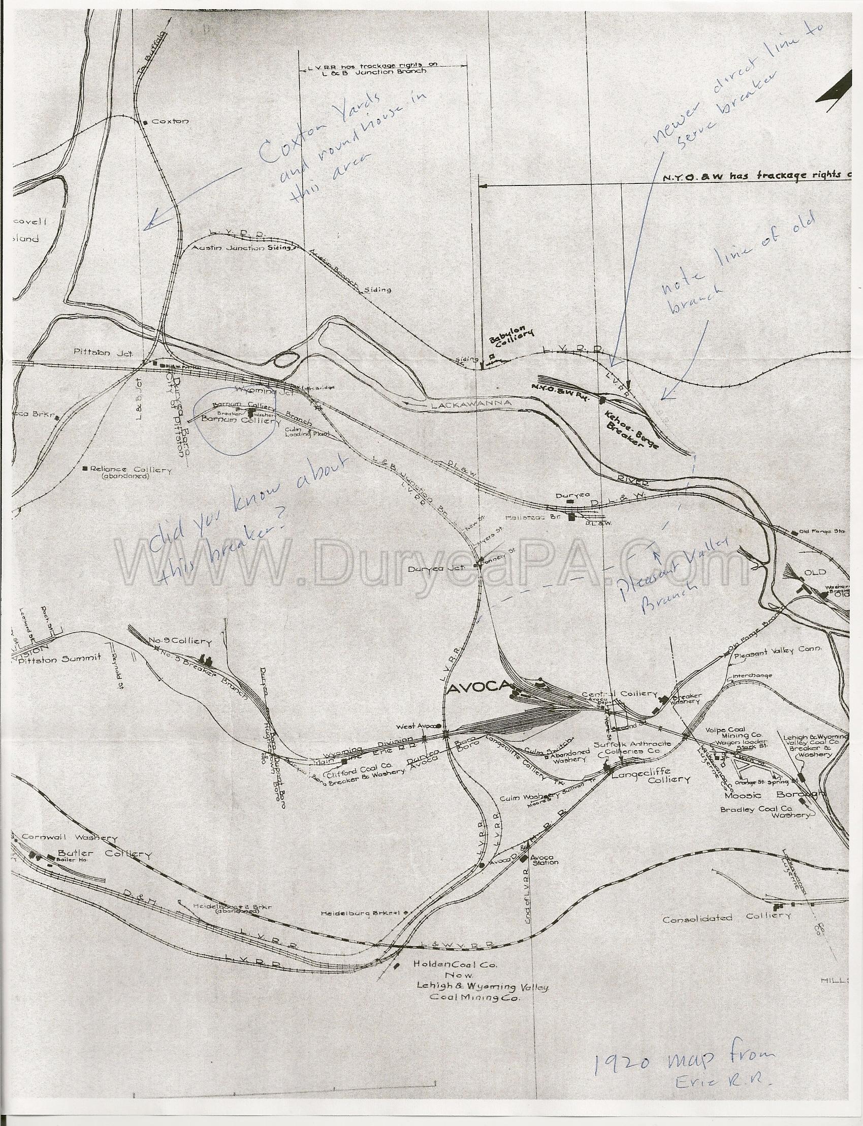
1920 Erie RR map
1930 Pittston Co Map
1932 Erie RR Sketch Avoca and Pittston
1932 Erie RR Sketch WBE territory
1939 Shepherd Map
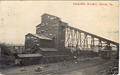
Period Photos
Photo
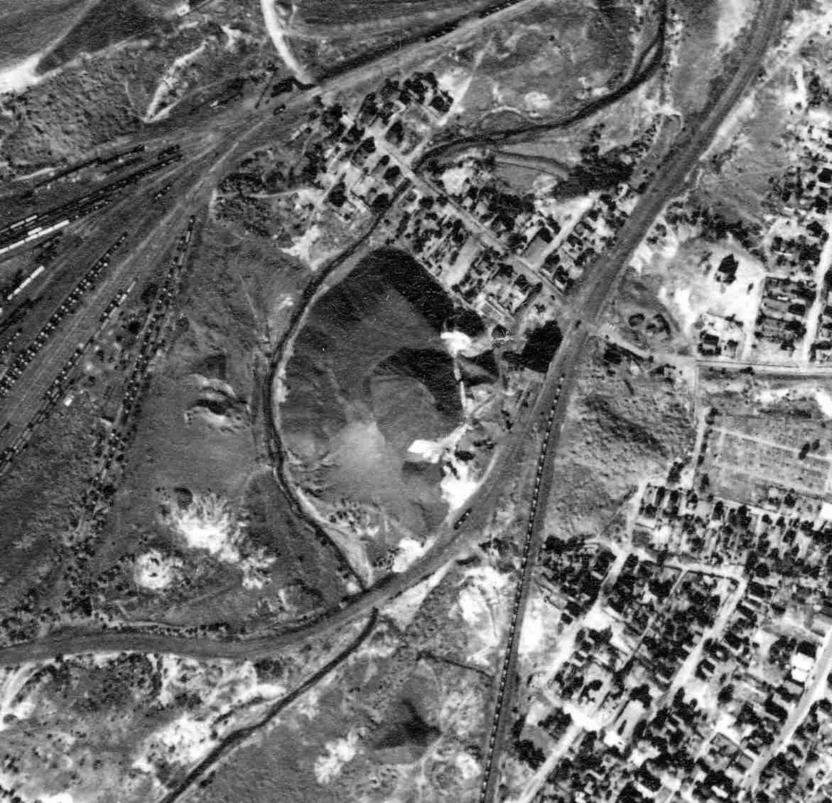
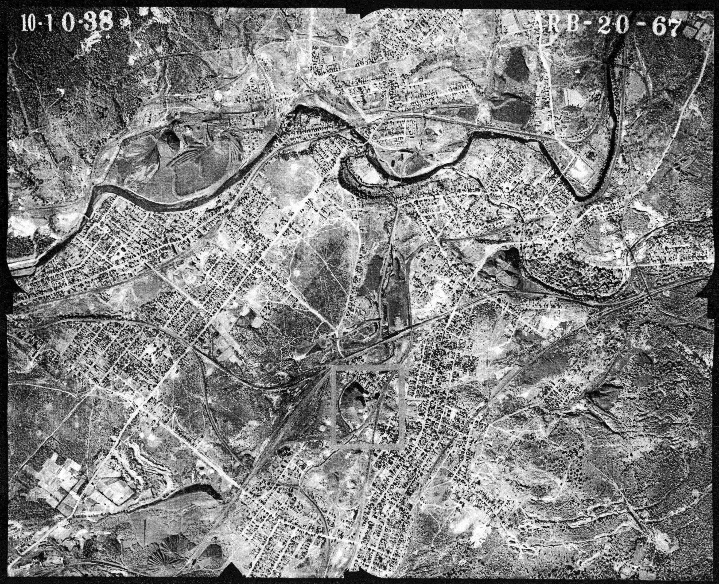
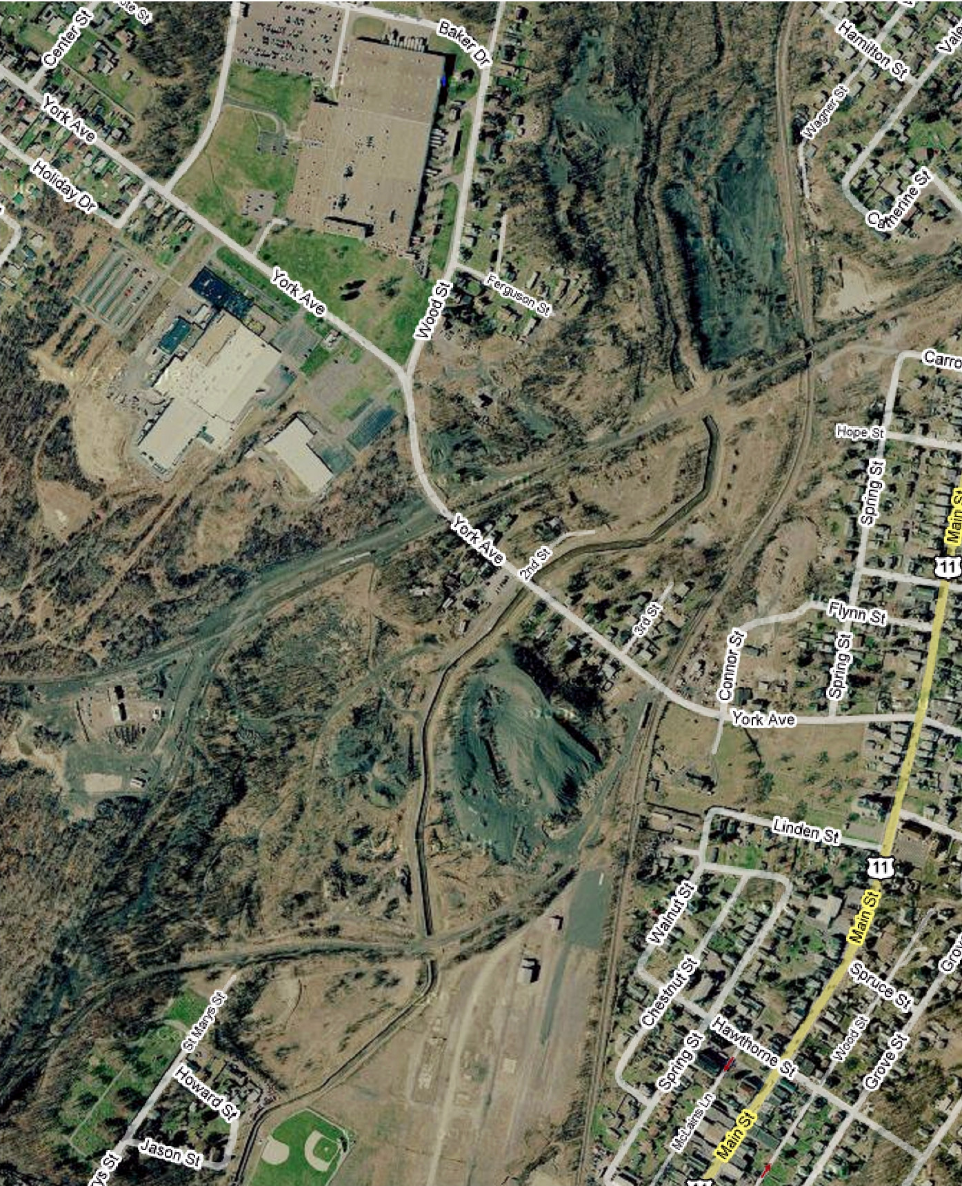
Penn Pilot and Aerial Photos
20_67 date 101038 close-up
20_67 date 101038
Mine Inspections
Inspector Narratives
City & Sanborn Maps
Avoca 1926 Sheet 2
News, History & Articles
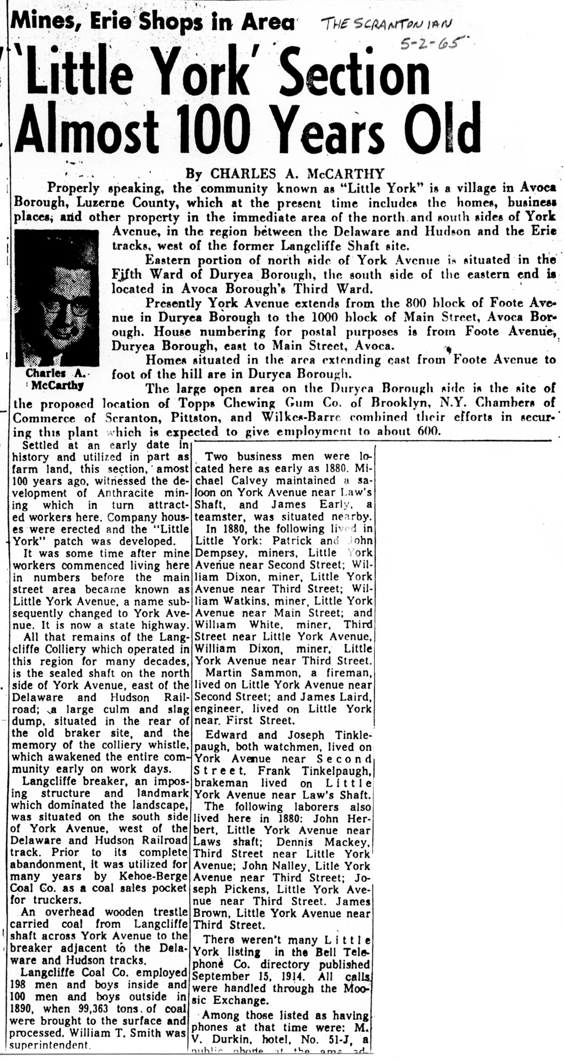
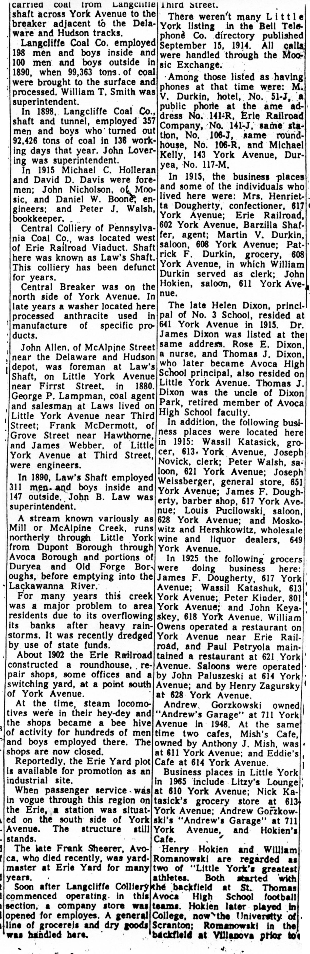
1965-05-02a The Scrantonian
1965-05-02b The Scrantonian
1966-04-24 The Scrantonian
Modern Photos & Google Earth
Langcliffe Google Earth
Other Materials
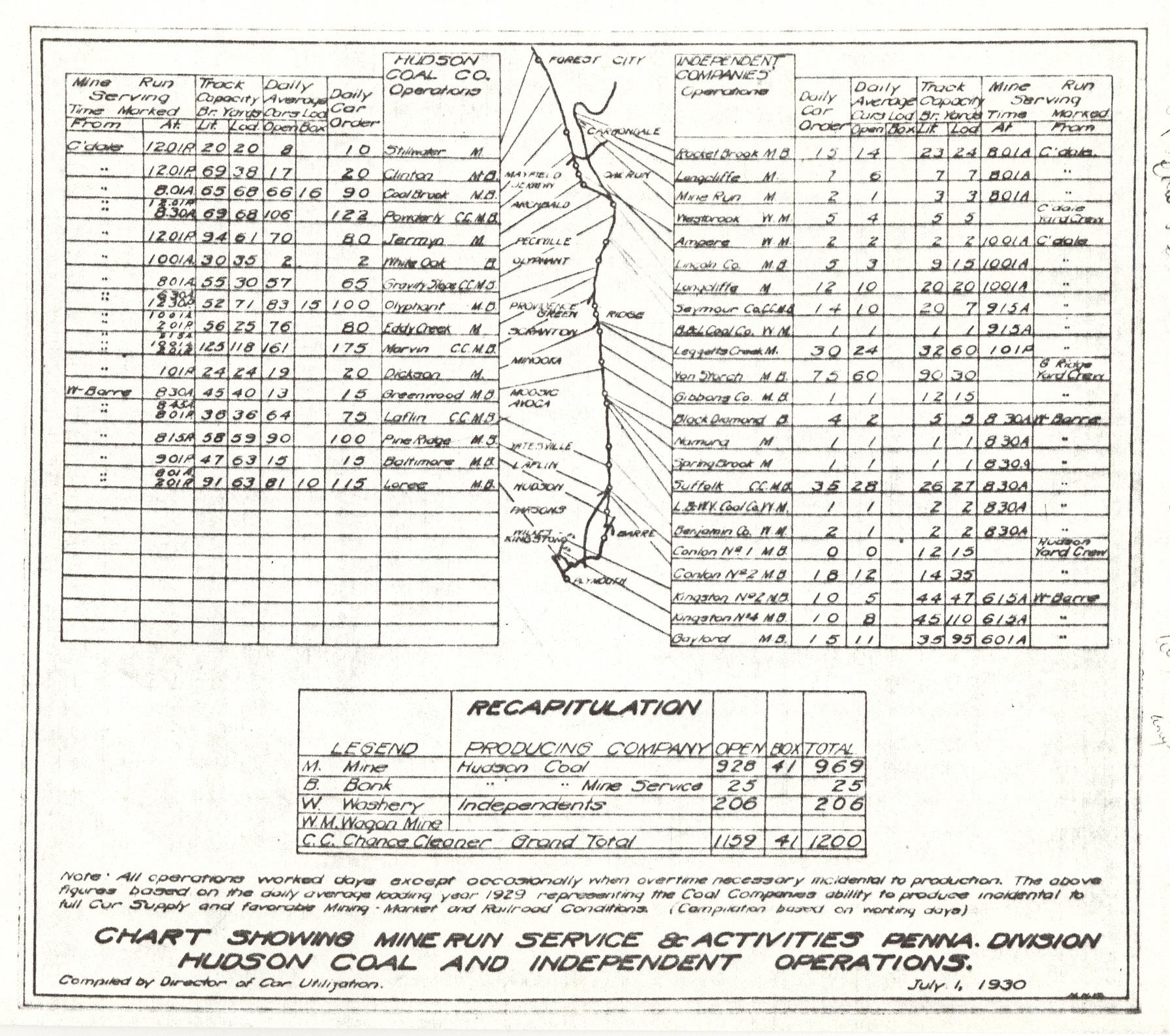
1930 DH Coal Operations CY
Comments and Feedback